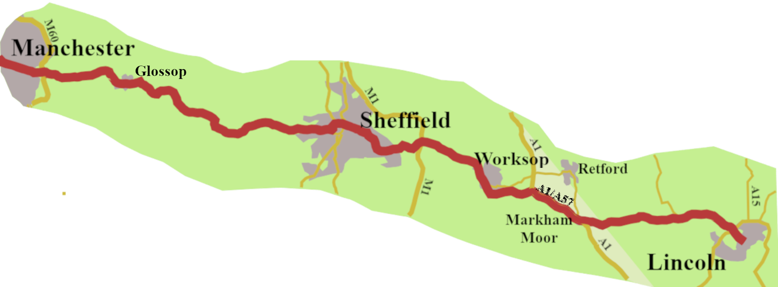
In the previous post, I traced the development of the A57, from Liverpool, to the point where the Hyde Road leaves Manchester. In this one, I will look at the rest of the road, through Glossop, Sheffield, Worksop, and so to Lincoln.
Finding a Road
It is difficult to find evidence for any A57 road between Manchester and Glossop, until the coming of stagecoaches. The Romans had a road (Margary no. 711) running from a fort in Castlefield, a district south-west of Manchester city centre, to another, known as Melandra, between Woolley Bridge and Glossop.1 The latest evidence points to the Roman road running north of the A57, but parallel to it, so going in the right general direction. However, beyond Glossop it went off towards Barnsley and Doncaster.
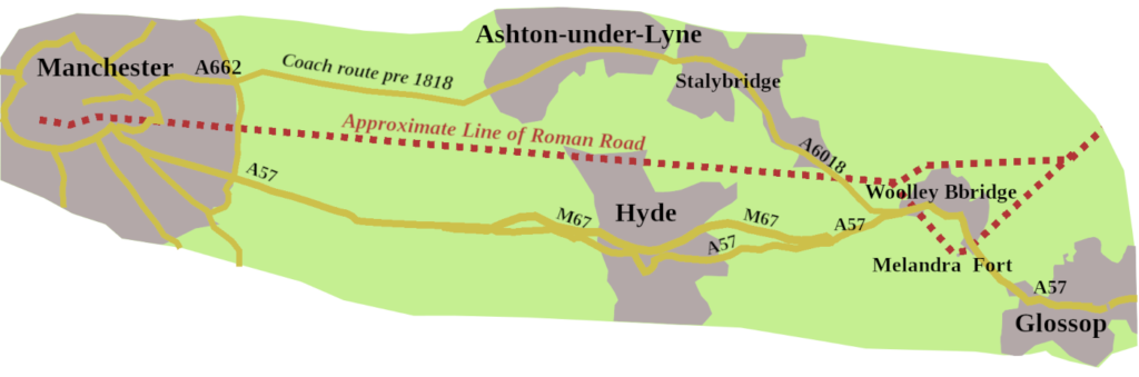
If we jump forward to the end of the eighteenth century, coaches from Manchester to Sheffield were going through Glossop, but via Ashton Underline, more the A6018 than the A57. It could have something to do with Hyde not being there until the early nineteenth century. However, by 1818, the Manchester Hyde and Mottram Turnpike went to Glossop.
Glossop to Sheffield
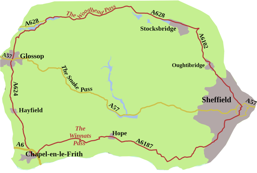
Beyond Glossop, Sheffield bound coaches either took the Woodhead Pass (A 628) or the more southerly route, through Chapel-en-le-Frith, over the Winnats Pass, then along the Hope Valley. Neither of these routes is particularly direct.
e future A57.
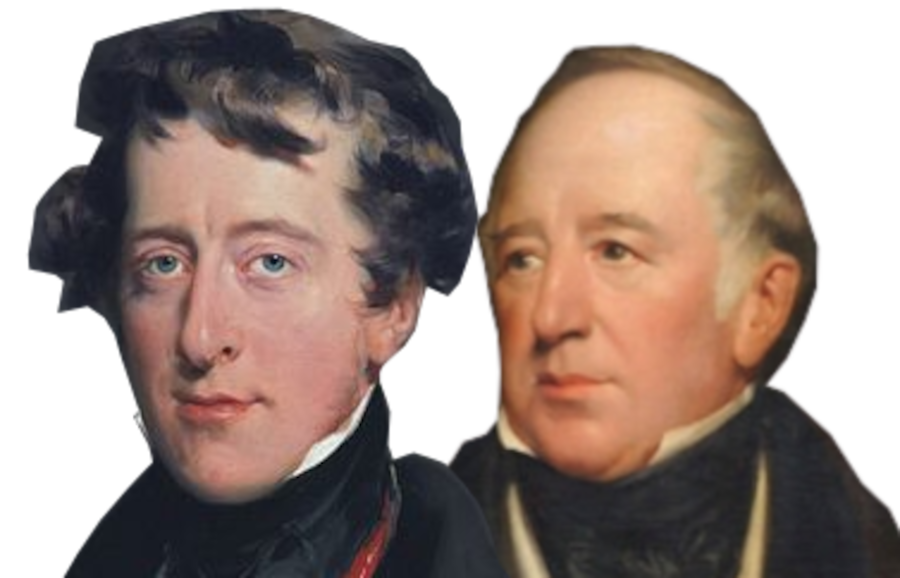
In 1818, the Duke of Norfolk, the Lord of the Manor of both Sheffield and Glossop, got together with the Duke of Devonshire, who owned the land in between. They hatched a notion to build a new road, along the line of a packhorse trail, known as Doctor’s Gate.
It was a rash decision. For a start, building an entirely new road, not just improving an existing one, was rare. In addition, the terrain was unforgiving, making the construction difficult and expensive. A Sheffield surveyor, William Fairbank, was initially given the task, but when he was obviously floundering, John McAdam was brought in to finish the job, at some expense, I’m sure.
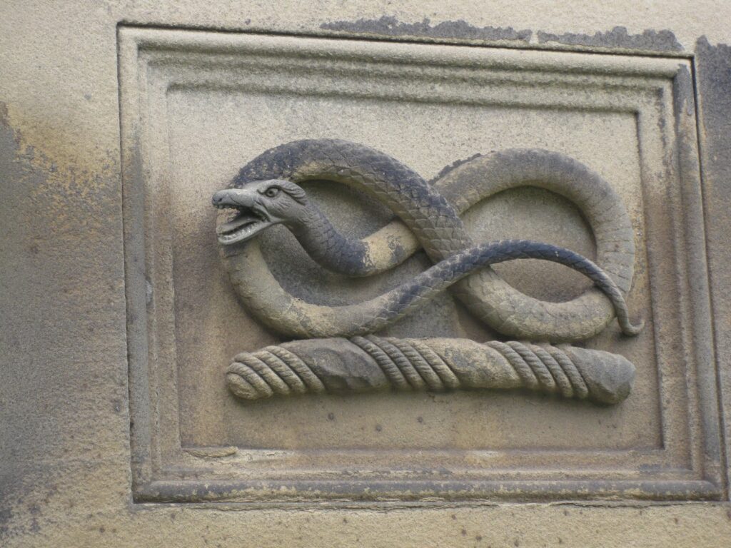
The origin of the name, Snake Pass, might refer to the wiggly nature of the road, but it did not. As part of their Lordships’ plan, an inn was built, about seven miles from Glossop, for coaches to stop. It was originally called The Ladyclough Inn, but the Duke of Devonshire, William Cavendish, put his family crest, a knotted serpent, over the front door. It was not long before one-and-all called the place the Snake Inn, and the name attached itself to the whole stretch of road.
The 1828 edition of Cary’s New Itinerary, gives the Royal Mail, from Sheffield to Manchester, going on the new Line of Road through Glossop,2 which we can suppose was the A57, Snake Pass route.
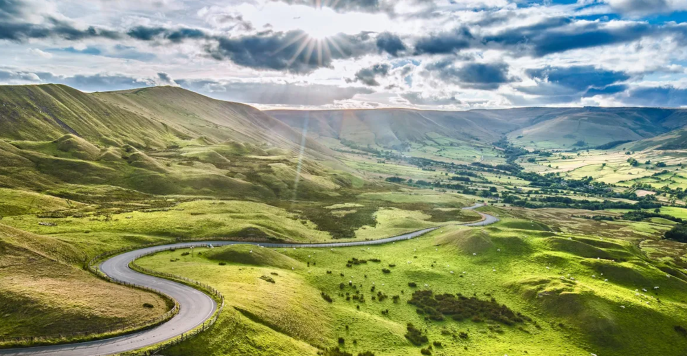
It’s doubtful that their Lordships ever got their money back, because twenty-three years later, the Manchester to Sheffield railway line opened, killing the coaching trade. They did, however, give us the Snake Pass, a gem of a drive. From Glossop, it takes you over the high ground between the moorland plateaux of Kinder Scout and Bleaklow to the Ladybower Reservoir. Its highest point, one thousand six-hundred and eighty feet, is where it crosses the Pennine Way.
The opening of this Snake Pass route meant there was a direct road between Glossop and Sheffield, now called the A57.
Through Sheffield
Before the 1960s Inner Ring Road was built, the A57 came into Sheffield along Glossop Road, which is now the B6547. It then went straight through the centre of Sheffield, past the cathedral and along some of the city’s oldest streets such as Haymarket, Waingate and Wicker.
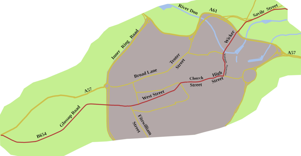
One-way systems, and redevelopment, mean, today, you can’t drive the 1923 route, over Lady’s Bridge, and out of the city along Staniforth Road, now the B6200. Quite sensibly, the modern route keeps cars away from the centre, directing traffic north of the city, via the A61, to pick up the A 57 as the Sheffield Parkway.
Steel Town
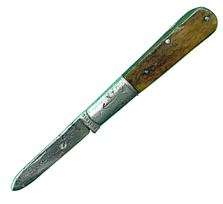
The ancient street names are a clue to how long metal has been worked in the city. Robertus le Coteler, one of Sheffield’s early little mesters, paid Hearth Tax in 1297 for the workshops he owned, which produced knives, swords, and other bladed tools.3
In The Canterbury Tales, the Reeve says of a miller:
‘Ther was no man, for peril, dorste hym touche.
A Sheffeld thwitel baar he in his hose.‘
For ‘thwitel’, read ‘knife‘, which gives us the modern word whittle. So, even at the end of the fourteenth century, it was noted that the knife was made in Sheffield. By 1379, twenty-five percent of the population of Sheffield were listed as metal-workers.
It was the beginning of ‘Steel Town’ Sheffield becoming the world-renown producer of fine cutlery. Not knives and forks alone, though, but steel for armaments and railways. Ingenuity and quality have always been the stamp of Sheffield, and though the industry was filleted during the 1980s, firms producing high quality steel hang on, drawing on centuries of skill and nous.
A Castle and a Queen
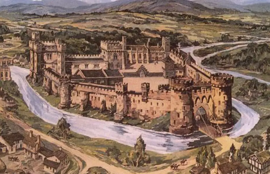
A castle once stood east of Waingate. The original motte and bailey structure burnt down in 1266, as did much of the town, during Henry III’s struggle with Simon de Montfort. It was rebuilt in stone in the 1270s.
In November 1570, Mary Queen of Scots, then aged 27, arrived there, having travelled from Chatsworth. Little did she think she would stay in Sheffield, on and off, for fourteen years.
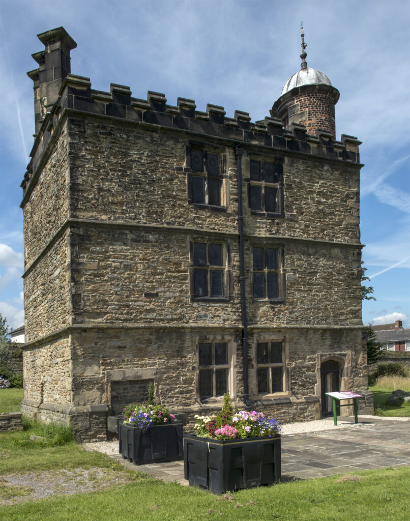
To begin with, Mary was kept in the castle, but later, more comfortably, at Manor Lodge, which still stands.
The castle, though, did not survive the Civil war. Seized by Royalists in 1643, it was battered by Parliamentary artillery in 1644.4 Three years later, the House of Commons ordered its demolition. The Earl of Arundel did, at one time, have a scheme to restore it, but the damage was too extensive, and finally, the remains were levelled.
On to Worksop
There is little, or no, record of a road from Sheffield to Worksop in the Middle Ages, or the early modern period. Worksop is probably of Saxon origin, for it is in Domesday. There was a minor, Wars of the Roses, skirmish there, in December 1460.
During Henry VIII’s reign, Leland visited the town, but tells us nothing of a road to Sheffield, as he came from Doncaster, and went on to Mansfield.
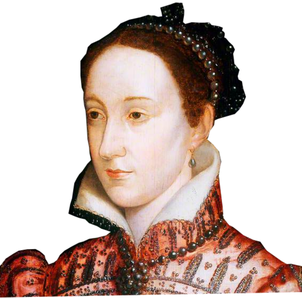
There must have been some sort of highway, because, in the summer of 1583, during her imprisonment at Sheffield, Mary Queen of Scots was taken to Worksop Manor for a time. The house burnt down in 1761. An eighteenth century mansion was built on the site, albeit only one wing of what was planned.
The Worksop to Attercliffe turnpike, was in place from 1764, and by 1798, Cary outlines a road between Sheffield and Worksop, which looks very like the A57 of 1923.5 Coming out of Sheffield it goes along the B6200 as far as Swallownest, which was the line of the A57 until the 1970s. After that, it is pretty much the A57 into Worksop.
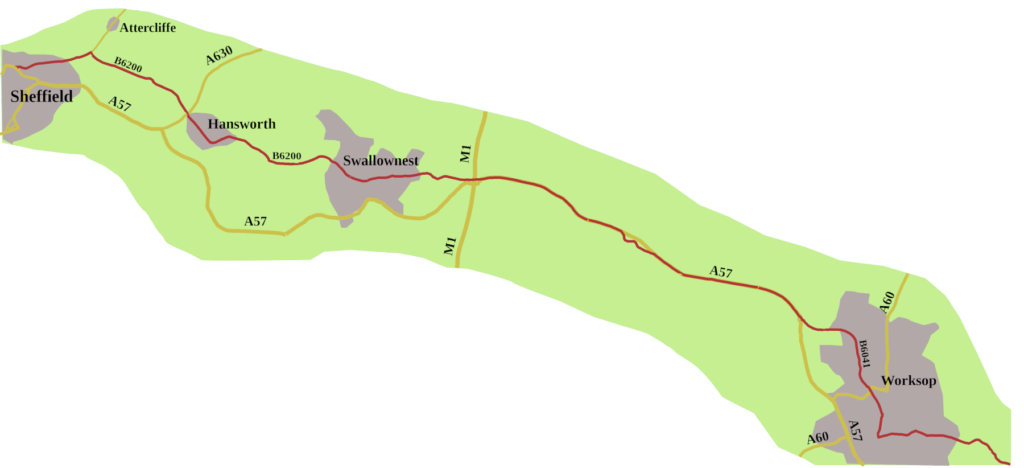
Of course, nowadays, you can’t drive the original route of the A57 through Worksop. Where the modern road swings almost due south at a roundabout three-quarters of a mile outside the town, you follow the signs for Kilton, Tickhill and Blyth. The B6041, Gateford Road is the way the A57 once ran. Because Bridge Street is pedestrianised, you have to go around the houses, then along the B6040 Retford Road to pick up the A57. The A60 remains the one ‘A’ road through Worksop, coming up from Loughbough and heading for Doncaster.
The Coming of Coal
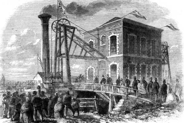
A little to the north-west of the A57, the Duke of Newcastle began sinking the first shafts of the Shireoaks Colliery. It was the catalyst that changed Worksop from a market town, where they grew liquorice, made hats, and Windsor chairs, to a coal producing, industrial centre.
Though Worksop is in Nottinghamshire, its four pits, Shireoaks, Steetley, Manton, and Firbeck have always been regarded as South Yorkshire collieries. Over the years, the Worksop miners played their part in national mining disputes, culminating in the strike of 1984/5. Despite a majority in Nottinghamshire voting to continue working, men from Shireoaks and Manton supported the struggle.
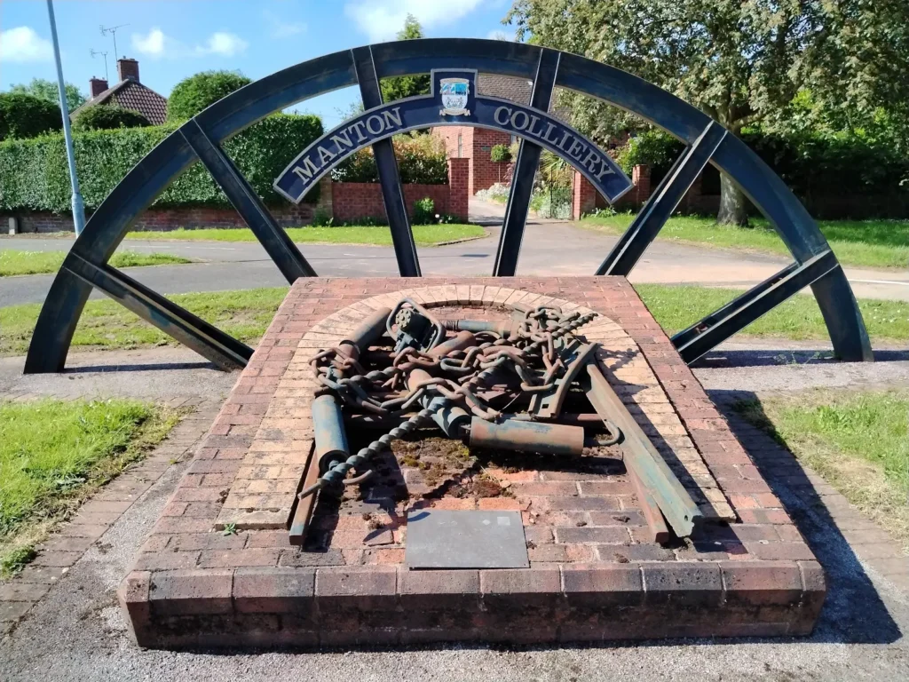
The Shireoaks pit hung on until 1990. The last Workshop pit, Manton, closed in 1994, bringing an end to a hundred and fifty years of winning coal in the area.
A Road to Lincoln
The real fun starts the far side of Worksop.
There was never a direct turnpike road between Worksop and Markham Moor. However, from 1822 there was a turnpike running east from Worksop to Retford, (then known as East Retford). At Retford you could pick up the Bawtry and East Markham Common Turnpike, opened in 1766, which ran south down part of the Great North Road. That turnpike took you to East Markham, from where the Dunham Road Trust, opened in 1765, ran to Dunham Ferry, where it connected with the earlier Lincoln Northwest District Turnpike, from Dunham Ferry to Lincoln.
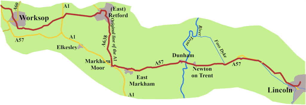
By the end of the nineteenth century maps give a road running north-west from Markham Moor, which, beyond Elkesley, is marked Worksop Road. This must be the road which was the basis of the route the ministry men chose for the A57, though it was never a turnpike.
Elkesley and the A1 Changes
Elkesley was a victim of the wanderings of the A1.
In 1923, the A57 ran through Elkesley and West Drayton, crossing the A1 at Markham Moor. As I covered in a previous post, in 1961, the Doncaster bypass arrived. As a result, The A1, which originally went from Markham Moor to Retford, to reach Blyth, was rerouted to go through Elkesley and Upper Morton, that is, along a stretch of A57. When the A1 was duelled in 1967, Elkesley found itself stranded, with only one way to join, or leave, the high-speed road. A bridge and new junctions were finally constructed in 2015. A second result is that the A57 temporally abandons its identity between Upper Markham and Markham Moor, and the A1.
On to Lincoln
Once the road reaches Markham Moor, and becomes the A57 again, the road follows a well-trodden path.
East of Dunham, you have to cross the Trent to leave Nottinghamshire and enter Lincolnshire. Until 1832, that meant taking the chain ferry, which had been there for centuries. Eventually, a group of businessmen had a bridge built, with a toll paid to cross. It was not replaced until the end of the 1970s, and even then, the original piers were kept. The tolls, 50p a car, are to pay for their replacement when the time comes.
Once over the river, you skirt Newton on Trent, continuing to the charmingly named Drinsey Nook Junction, where you turn right for Lincoln.
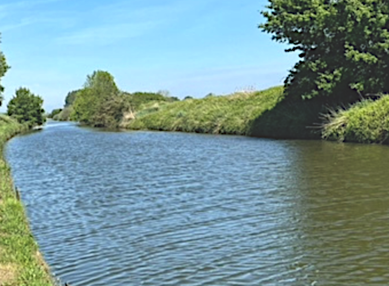
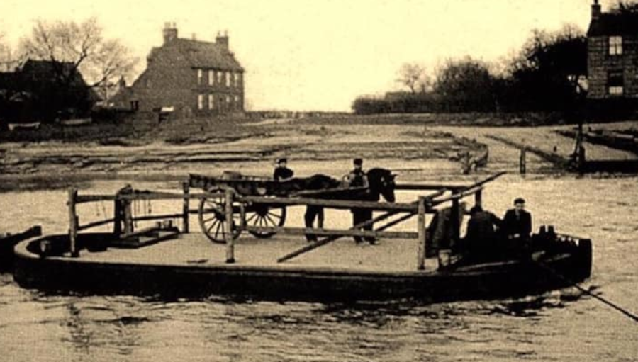
For a while, the road runs beside the Foss Dyke. We are not sure who built this ancient waterway, but it is likely the Romans had a hand in it. It joins the Trent, at Torksey Lock, where a small bronze statue of the Roman God Mars was found in the eighteenth century.
If the Romans built that end, did they take it all the way to Brayford Pool in Lincoln, where they already had an inland port? The documentary evidence suggests Henry I may have been involved in part of its construction, or perhaps its reclamation.6 The canal certainly has a ‘straight’ Roman feel about it.
As you come into Lincoln, you pick up the Carholm Road. Since 2017, the A57 was routed, via a right turn at the end of Carholm Road, onto Brayford Way, which was built in the 1990s. It takes you back over the Foss Dyke, catching a glimpse of Brayford Pool. From there the road runs along a series of streets, Rope Walk, St Mark’s Street, Tentercroft Street, and the East West Link Road. It then goes under a flyover, round a long, right-hand loop, to the junction with the A1434, where today’s A57 ends.
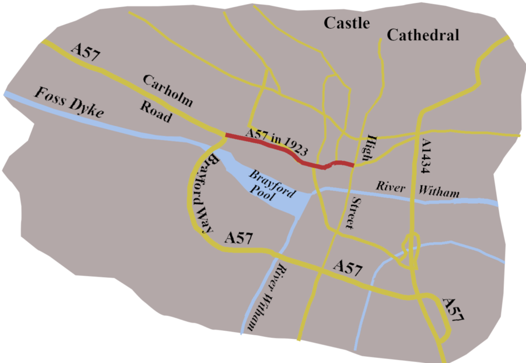
Of course, that was not how the road originally went. Until the High Street was pedestrianised, from the end of Carholm Road, the A57 kept, more or less straight, going along Newland. It then seemed to have then gone along Mint Street, to join the A15 on the High Street, just by the Stonebow, once the entrance to the city’s Guildhall. Even by 1923 theA15 no longer followed the line of the Roman road along the High Street.
The A57 is a curious road, in many respects, but so are many of our roads. Lincoln to Liverpool, Liverpool to Lincoln, it seems unlikely, but there it is, weaving a route from the industrial North-west to an ancient city, founded by the Romans. As we saw at the beginning of the previous post, it links the lost pool in Liverpool to the ancient Brayford Pool. A road between two pools.
- Margary, Ivan, D., 1973 Roman Roads in Britain: Written by Edition, (3rd Revised edition), J. Baker ↩︎
- Cary, John, 1828, Cary’s New Itinerary, Printed for John Cary, No. 181 Strand ↩︎
- Unwin, Margaret, Joan, 2002 The Hallamshire Cutlery Trades in the late 17th century: a study of the Hearth Tax returns and the records of the Cutlers’ Company, Faculty of Social Sciences, University of Sheffield ↩︎
- Civil War and the Fall of Sheffield Castle, 2020, Libraries Sheffield Blog, https://shefflibraries.blogspot.com/2020/04/civil-war-and-fall-of-sheffield-castle.html ↩︎
- Cary, John, 1798, Cary’s Itinerary Printed for John Cary, No. 181 Strand ↩︎
- Fossdyke Navigation, Canal and River Trust Website, https://canalrivertrust.org.uk/canals-and-rivers/fossdyke-navigation ↩︎
Leave a Reply