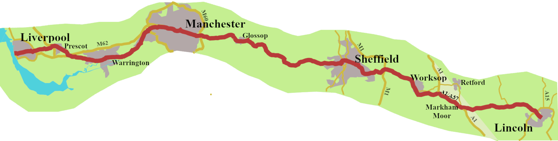
The A57 is too long, interesting and varied, to be crammed into one post, so this is the first of two.
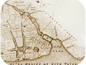
Why two pools? No problem with Liverpool, it is in the name, and there was a pool. More of an inlet from the Mersey, really, but it offered protection from the westerlies and raiders. So, when King John was on the lookout for a base from which to continue his attempt to conquer Ireland, ‘The Pool’ looked just the job.
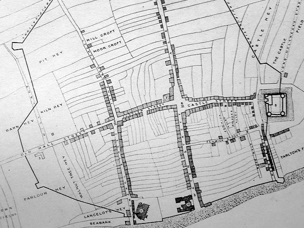
He gave the, then, town its first charter, and laid out the orignal seven streets.
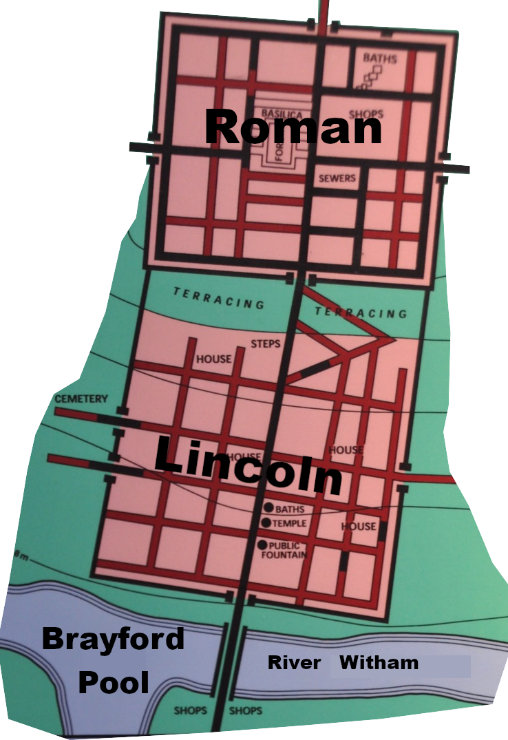
Lincoln though, what about the pool there?
Well, there is one; always was one. We knew it as the Brayford Pool.
When the Romans arrived, it was already an established site, possibly of some ritual significance, with archaeological evidence of offerings and Iron Age activity. It may have been called Lindon, from Lin, or Lindo, meaning a pool in the British (Bythonic) dialect spoken around there.
For the Romans, it was an ideal site. They could bring ships along the River Witham from the Wash, to develop The Pool as the country’s first inland port. Immediately to the north, was a hill, which simply cried out to be a fort, so they built one. Pretty quickly, the place became a major administrative centre. By about 90 CA, it achieved the status of Colonia, a top-ranking town where retired legionnaires could live. They kept the Lin connection, and called their town, Lindum Colonia, ‘Pool Town’.1 So, you see, there is, indeed, a pool at each end of the A57.
Setting Off
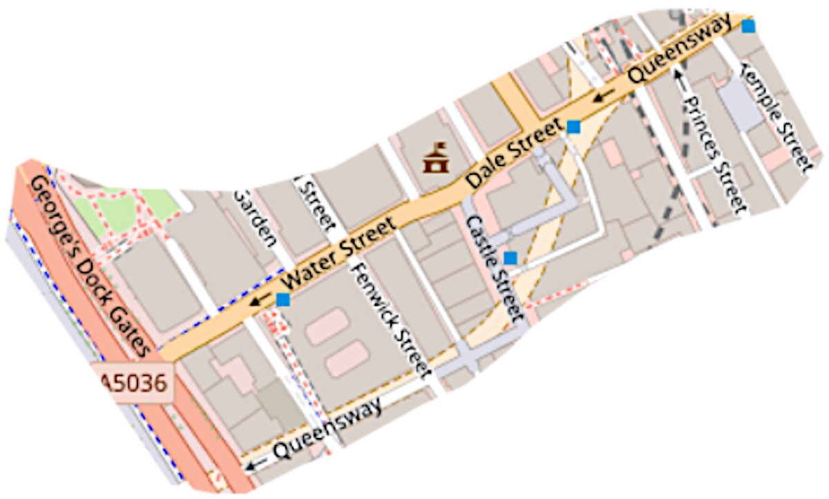
Back to Liverpool’s first seven streets. Water Street (known as Bank Street until the 1520s) is one of them. It runs east, from behind The Royal Liver and the Cunard Buildings, two of the Pierhead’s iconic ‘Three Graces’. The 1923 Ministry of Transport map had the A57 begin there. It carried on down Dale Street, another of King John’s original seven, then out towards Prescot, Warrington and onto Salford and Manchester.
Water Street was the scene of a horrific event, on August Bank Holiday Monday, 2025. A man drove his car into a crowd of Liverpool supporters celebrating their team winning the Premier League. Seventy-nine people, including children, were injured, some seriously. It was a dreadfully, modern phenomenon unfolding in one of the city’s oldest streets.
Nowadays, if you are coming from Manchester, or much less likely, Lincoln, the A57 ends at the top of Water Street. Trying to start from there, however, is a different matter, because it’s all one way.
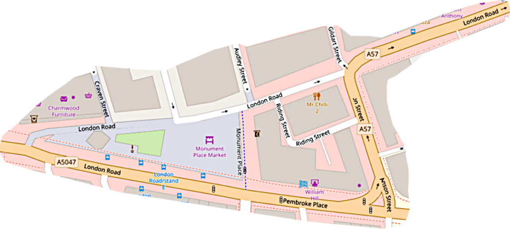
Even looking at the map later, I’m not sure how I got to the A57, London Road, at all. At one point it appears to go along a ‘Pedestrian Zone’. I think I followed the A5047, also called London road. It took me left and right, and presto, I was on the A57 for real.
From then on the road dutifully took me on through Prescott. (Avoid the M57 – it’s a false friend.) Now comes about five miles of pleasant, country road, with glimpses of wheat and barley behind hedges, as you head for Warrington. Leaving Warrington, the A57 becomes the Manchester Road, as it probably has been for centuries
A Curious Road
At first glance, the A57 looks to be two distinct roads which share a number. Liverpool, through Manchester and on to Sheffield, yes, you can see how they go together. But Sheffield to Lincoln? You have to ask what the civil servants in the Ministry of Transport were thinking in 1923?
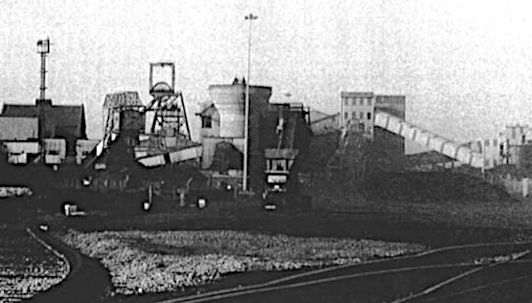
It begins to make more sense when we remember that the Manton Pit opened, at Worksop, in 1907. For the railway minded men from the ministry, their instinct was to follow the rails. Thus, Sheffield to Worksop seemed a natural continuation of the A57. But, Worksop was not on the main-line, and that would never do. Lincoln, however, was something of a railway hub at the time, so they thought they’d send the A57 there.
That is my theory, anyway.
Ageing the A57
The number A57 was attached to an existing road, or, more likely, a series of roads right at the start of the road numbering system. What can we glean about how it got started?
All the major settlements at the western end of the road were there when the Normans came. As we have seen, Liverpool, which must have been arround since Saxon times, came into formal existence, thanks to King John, in 1207. Once places are there, people make tracks to travel between them which leave no record. As a result, we have no evidence of where these early highways were.
© Linda Godden 2019-2026
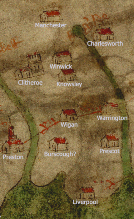
The first hint of there being a road from Liverpool to Manchester comes from the Gough Map, drawn sometime between 1350 and 1410.
Liverpool, Prescot, Warrington, and Manchester are there in the right order, at the right distance apart, strongly suggesting there was some sort of road: a fledgling A57.
Sheffield and Lincoln are also on the map, but none of the settlements along the line of the road, which likely means, there was no highway of any significance.
The next snippet of evidence, for the westerly end of the road, comes from the second quarter of the sixteenth century with the Itineraries of John Leland. Of Liverpool, Leland says:
‘At Lyrpole is smaule custume payid that causith marchantes to resorte. Good marchandis at Lyrpole, and moch Yrisch yarn that Manchester men do by ther.’2

If Manchester men were going to the market at Liverpool in the 1530s or 40s, it suggested there was a well-trodden highway between the two. Leland seems to have followed it as far as Warrington, but then, true to form, he went off to Wigan.
The English Civil Wars
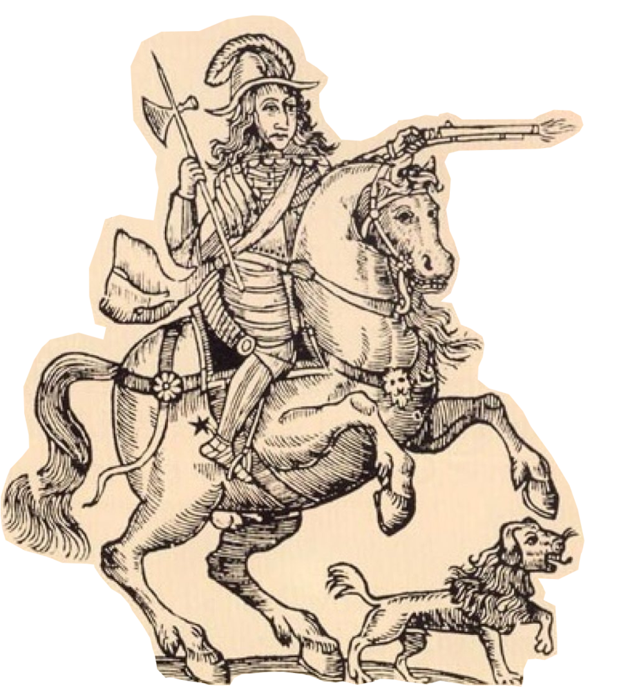
In 1642, just after the start of the First English Civil War, there was a major siege and battle around what is now the Victoria Bridge, in Manchester. At the time it was the Old Salford Bridge, which dated from the fourteenth century. However, that particular struggle is more part of the A6’s story than the A57’s.
A year later, Parliamentary troops marched from Manchester to Liverpool, presumably along the line of the A57, to occupy the city, (then a town). The following year, Prince Rupert took it back, but most of the Parliamentary troops escaped across the Mersey. Later in the year, after a savage three-month siege, Liverpool was retaken for Parliament. And, that is how matters remained for the rest of the war.
John Ogilby, Silvia Fiennes and Daniel Defoe
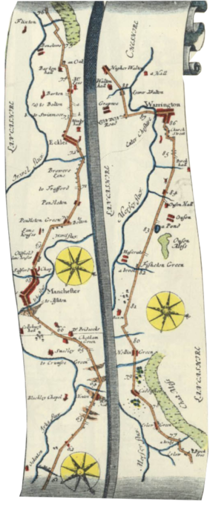
Fifteen years after the restoration of Charles II, John Ogilby produced his beautiful book of road maps, Britannia. It only gives a short section of the A57 as part of the map from York to West Chester [Plate 89]. He shows the road going through Manchester, and Eccles, with a turning to Trafford marked. He continues through Irlam, (Erlam Green), Cadishead (Caddyhed), Hollins Green (Hollin Green), taking him to Warrington.3 All very much the basic route of the A57. Once at Warrington, Ogilby turned south into Cheshire.
Nonetheless, we can imagine, if that piece of our A57 was in place, it would most likely have continued through Prescot to Liverpool.
From the end of the seventeenth comes Celia Fiennes, who chose to ride around the land, observing as she went. She arrived at Liverpool by water, then went ‘7 very long miles, but pretty good way, mostly Lanes,’4 to Prescot, from where, like Leland, she headed off to Wigan.
Celia Fiennes was on her ‘Side Saddle in the Time of William and Mary‘, but in the reign of the first George, Daniel Defoe tells us that ‘the cross-country post route went by West Chester to Liverpool and Warrington, from whence it turns away east, and passes to Manchester.’5 The route, more or less the A57, seemed well established, though the mails were still carried on horseback. There was no mail coach along the road until the 1770s.
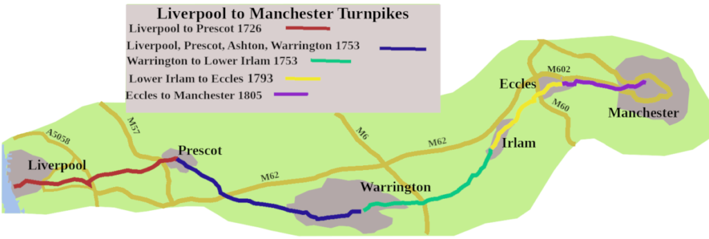
Turnpikes
About the time Defoe’s last volume of A Tour thro’ the Whole Island of Great Britain, was published, turnpike trusts began to be established.
We get a flavour of the state of the road at the time from the submission made by the sponsors of one of the trusts:
‘(‘T)he Road….is very much used in the Carriage of Coals to Liverpoole, and also from Liverpoole (sic.) to…Manchester, and …. in the Carriage of Wool, Cotton, Malt, and all other Merchants Goods; whereby several Parts of the said Road are so very deep, and other Parts so narrow, that Coaches, Waggons, and other Wheel-carriages, cannot pass through.’6
The first turnpike, in 1726, oversaw the road from Liverpool to Prescot. It was extended to Warrington in 1753, to become the Liverpool, Prescot, Ashton, Warrington Trust. The same year, the Warrington to Lower Irlam turnpike pushed the road east. There was then a forty-year lull. The next section, improving the road as far as the middle of Eccles, did not arrive until 1793, with the final stretching to central Manchester not coming until 1805.
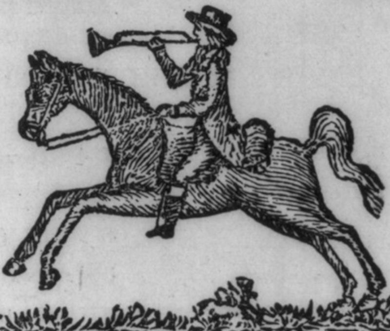
Stagecoaches
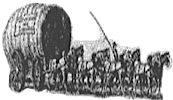
A stagecoach service, between Liverpool and Manchester, began in 1767, running three days a week. Despite some ‘improved’ stretches of turnpike, the journey took all day.
‘The coach was accustomed to start early in the morning from Liverpool; it breakfasted at Prescot, dined at Warrington, and arrived at Manchester usually in time for supper.’7
It is not clear When postboys were finally replaced by coaches, but, from 1798 a coach ran between Liverpool and Hull, along something like the A57 route as far as Manchester.
To my mind, it was a more logical route, connecting Liverpool and Manchester to Leeds, York, and Hull: a bit like today’s M62, and a proper coast-to-coast route. But, it was not how the A57 was destined to go.
That coach, though, was still running in 1828.8
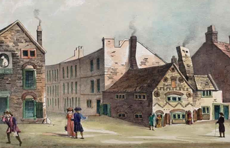
At the height of the coaching boom, coaches from Liverpool,
‘rattled out (of Dale Street) from the Saracen’s Head or The Angel. Besides these inns there were in the street The Golden Lion, The Angel and Crown, The Bull and Punch Bowl, The Wool Pack, The Fleece, and others.‘9
Manchester coaches left from The Sun Inn, on Deansgate, and The Mosley Arms, on the Market Place, The Royal Hotel and New Bridgewater Arms, at the corner of Mosley Street, Piccadilly.
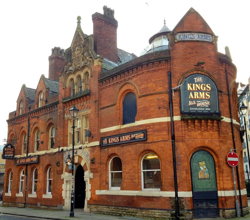
In Salford, The King’s Arms still stands on Bloom street, though on the opposite side of the road from where it started in 1807. In its time, it was a thriving coaching inn with four coaches a day, the Enterprise, Dispatch, Express and Perseverance, setting out for Liverpool. Today it’s pub, but more than that, with a theatre upstairs and a Monday evening sewing bee.
The King’s Arms coaches did not need to cross the Irwell, though there had been a bridge between Salford and Manchester since at least 1386. The Old Bridge, or Old Salford Bridge was dismantled in 1837, to rise again, in 1839, as the Victoria Bridge, which is still there, taking the A56 over the river.
The Regent Bridge, which carries the A57 today, was not built until 1808. It is unlikely coaches used it. There is a certain conservatism about such things, so drivers probably continued to take their passengers over the Salford Bridge.
The Coming of the Railways and After
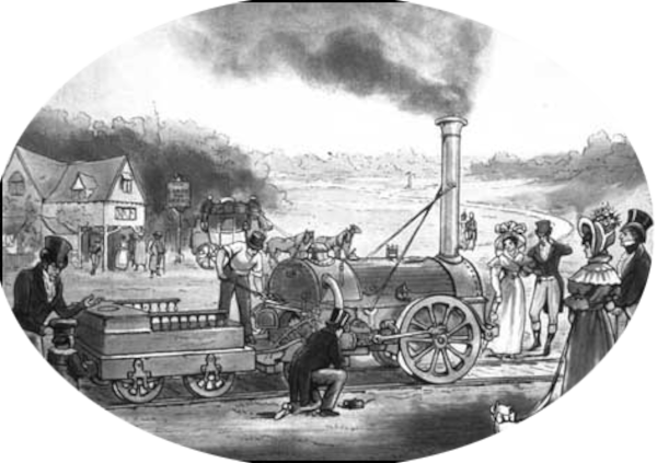
A tagedy marred the razzmatazz of the opening of Liverpool to Manchester railway in 1830. The MP for Liverpool, William Huskisson, a vocal supporter of the railway, was killed by a train coming in the opposite direction.
As the railways took over, the road was left to farm carts, light carriages, and bicycles, which means we lose sight of it until 1923 when the numbering scheme began.
You can just about work out how the A57 crossed Manchester in 1923. Having come over the Irwell by the Regent Bridge, you would have turned left into Water Street (now a right turn, off Trinity Way), then a right onto Liverpool Road. At the far end it was left into Deansgate. Not now, it’s all one-way. Back then, you could go north along Deansgate, with a right turn into Market Street. No chance today. Market Street is pedestrianised, but in 1923, you could drive along it, into Piccadilly, on to the A6 London Road, passing London Road Station, which would not become Manchester Piccadilly until 1960. Downing Street next, which is where today’s A57 and A6 join. A bit further along the A6 was a left turn Hyde road, (now a roundabout) and you were leaving Manchester along the A57.
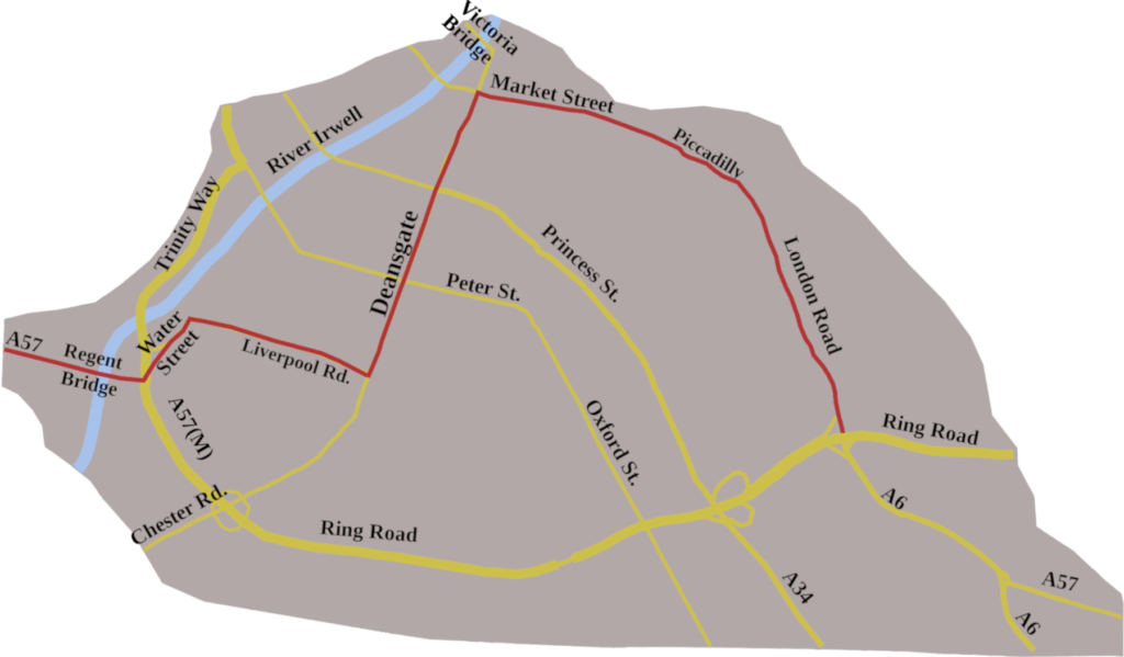
Today, after crossing the Irwell, you are taken onto the A57(M) Ring Road, for about a mile and a half, to a complicated junction to join the A6 at Downing Street. Half a mile further, is the roundabout which takes you onto the A57, Hyde Road, and so, out of Manchester.
What happens then will be the subject of the next post. For now, we have looked at two pools, and seen a road between Liverpool and Manchester develop from the Middle Ages to today. Since the 1970s, the option has been to use the M62, and I’m sure many do. But the A57 Liverpool/Manchester road is still there, stamped with its complicated print of history.
- Jones, Michael, J., Stocker, David, and Vince, Alan, 2003, The City by the Pool: Assessing the Archaeology of the City of Lincoln, Oxbow Books ↩︎
- Hearne, Thomas, (ed,), 1744–45. The Itinerary of John Leland the Antiquary (2nd ed.) ↩︎
- Ogilby, John, 1939, Britannia, Alexander Duckhams & Co. Ltd ↩︎
- Fiennes, Celia, 1888, Through England on a Side Saddle, Field & Tuer, The Leadenhall Press, E.C ↩︎
- Defoe, Daniel, 1927, A Tour thro’ the Whole Island of Great Britain, Divided into Circuits or Journies, JM Dent and Co ↩︎
- Baily, F., A., 1936, The Minutes of the Trustees of the Turnpike Roads from Liverpool, Prescot, St Helens, Warrington, and Ashton in Makerfield, 1726 – 89, The Historic Society of Lancashire and Cheshire Website ↩︎
- Smiles, Samuel, 1864, James Brindley and the Early Engineers, John Murray, Albemarle Street, London, https://minorvictorianwriters.org.uk/smiles/c_brindley_3.htm ↩︎
- Cary, John, 1828, Cary’s New Itinerary, G & J Cary, 86, St James Street, London ↩︎
- Young, Henry, S., and Young Harold, E., 1913, Bygone Liverpool, Henry Young and Sons, Liverpool ↩︎