
Some of the most frequent and useful sources found across the site.
SABRE
Anyone already interested in British roads will be familiar with the SABRE website. (SABRE: The Society for All British and Irish Road Enthusiasts.)
For those who are not, it has a Wiki, with information on virtually any road, as well as a discussion forum and other pages. Even more usefully, it has a splendid maps section, where you can find the original 1923 Ministry of Transport map, with the first road number. In addition, there is a range of historical road maps.
The National Library of Scotland (NLS)
The National Library of Scotland’s website Map Collection provides access to the British Isles Ordnance Survey six-inch maps from the 1820s to the 1960s.
The site provides a host of other historical maps including George Taylor and Andrew Skinner’s Survey and maps of the roads of North Britain or Scotland, 1776. This collection of strip maps are a valuable source for where Scottish roads ran in the eighteenth century
The Roman Roads
We have good evidence for where Roman roads ran, for as well as road builders they were administrators and record keepers.
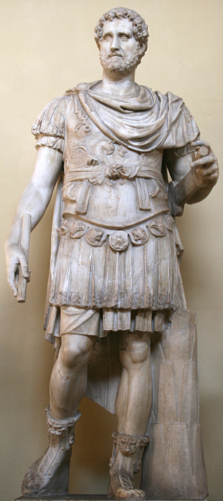
The Itinerarium Provinciarum Antonini Augusti, usually referred to as the Antonine Itinerary, is a list of important viae across the empire. Though compiled over at least two hundred years it has become associated with Antoninus Pius, the emperor who came after, the better known Hadrian, and ruled from 138 to 161 CE. The Itinerary gives the Roman names for, and distances between, the stopping-off places along the routes. Each iter has acquired a number, not present in the Roman text, but now so ingrained they are taken for granted.
In 1955 Ivan Margary (1896–1976) published his seminal work, Roman Roads in Britain. Not only did he bring together all the Roman roads known at the time, but devised a numbering system we still use.1
Luckily, we can access both the details of the Antonine Itinerary and Margary’s work through the Roman Road Research Association website. The association, chaired by Mike Haken, is a splendid source of up-to-date scholarship on Roman Roads.
There are two other excellent sources for Roman roads in Britain. One is the Anglo Saxon History website. Though the author Simon M mainly concentrates on the Anglo Saxon period, there is a good deal of well researched information about Roman roads.
Another site to which I regularly return, when I want to find where Roman roads ran, is Keith Briggs’s Maps of Roman Roads in England. Not only does he show all of Ivan Margary’s roads, he also offers maps updated by more recent discoveries.
Saxon Roads
Mappa Mondi
There’s a big gap, though the Anglo Saxon History website goes some way to fill it. In the end, the Saxons left us little information about their highways, except to name the principle Roman roads that they found, and used. Names such as Watling Street and Ermine Street are Saxon, not Roman.
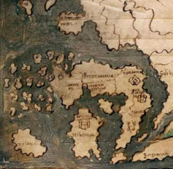
It is true that by the eleventh century people were beginning to draw maps, such as the Mappa Mundi, made somewhere between 1025 and 1050, probably at Canterbury. It does give a reasonable idea of the shape of Britain, but it doesn’t show roads
The Gough Map
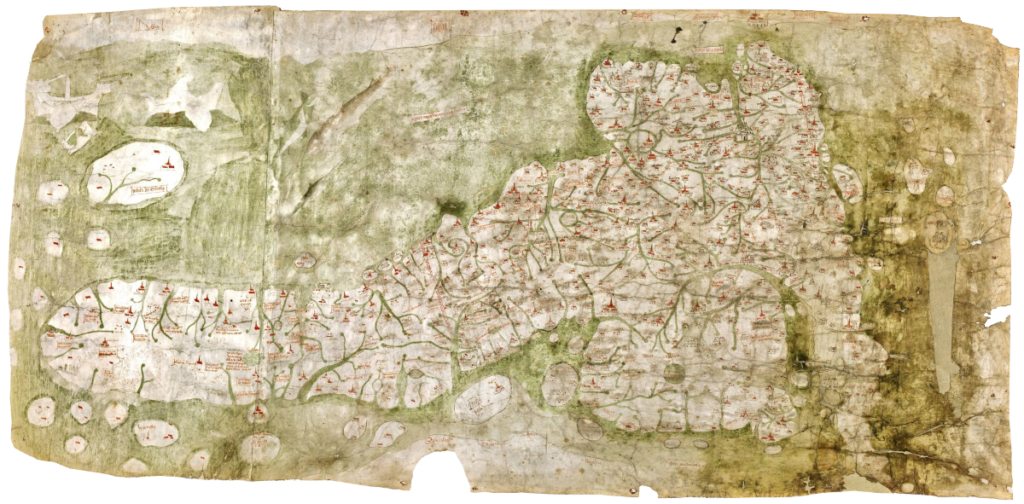
We have to wait for around the fifteenth century for the Gough Map, which includes nearly three thousand miles of road across England. Do not be misled into thinking the map was created by a craftsman called Gough, for we have no idea who made it. It gets its name from Richard Gough, who bequeathed it to the Bodleian Library in 1809, though when it was made is disputed. It probably dates from somewhere around 1400 or perhaps a little after, though some claim it may be older.
The map looks peculiar to modern eyes because the convention that north should be at the top had not taken hold, so we find east is at the top and north to the left. Rivers are shown more predominately than roads, which are merely thin black lines between towns. It is uncertain if they represent the details of the highways, just that a road existed. Some important ones are missing, such as what will be our A2 from London to Dover. Even so, all the towns en route appear in their proper places. The Gough map is truly a masterly piece of work, and it shows us that by the fifteenth century there was a network of roads running throughout Britain.
The Itineraries of the Premonstratensian Canons of Titchfield Abbey
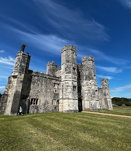
Early evidence for some roads comes from the itineraries of the Premonstratensian Canons of Titchfield Abbey,2 near Fareham in Hampshire. The Premonstratensian were an austere religious order, founded in France in the twelfth century. As Premonstratensian is something of a mouthful, they were commonly known as the White Cannons, because of the colour of their habits. Titchfield was one of their smaller abbeys, but it left us records of thirty journeys made during the first decade of the fifteenth century. The manuscript lists the names of the stopping-off places, the distance between them, and the total mileage. Because they provide, perhaps, the earliest record of particular roads, their trips crop up in various posts, as evidence for a particular road being there in the early 1400s.
John Leland
In 1533, during Henry VIII’s reign, John Leland was tasked with visiting monasteries throughout the kingdom, to make an inventory of the documents they held. It took some time, but in 1546 he reported to the King that:
“there is neyther…. cyties, burgs, castrls, pryncypall manor places, monasterys, and colleges, but I have seen them.”3
He kept a journal of his travels, though, because he tended to go where his interest took him, he mostly doesn’t provide coherent evidence for the lie of a particular road. Nonetheless, John Leland does help to give us clues about some of the roads in Tudor England.
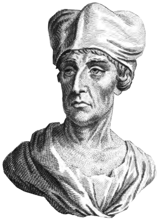
Holinshed

From the reign of Elizabeth I comes Raphael Holinshed. He is best known as the source for Shakespeare’s history plays as well as King Lear and Macbeth.
In addition, he wrote “Chronicles of England, Scotland and Ireland” which covered a range of topics, with headings such as:
“Whether it be likelie that any giants were, and whether they inhabited in this Ile or not.”4
The 1587 edition has a section headed “Of Innes and Thorowfaires” which includes thirteen routes across England, all of which relate to some of today’s roads. He crops up in posts from time to time, where he gives the route of a road we are following, though his mileages are a little suspect.
John Ogilby’s Britannia
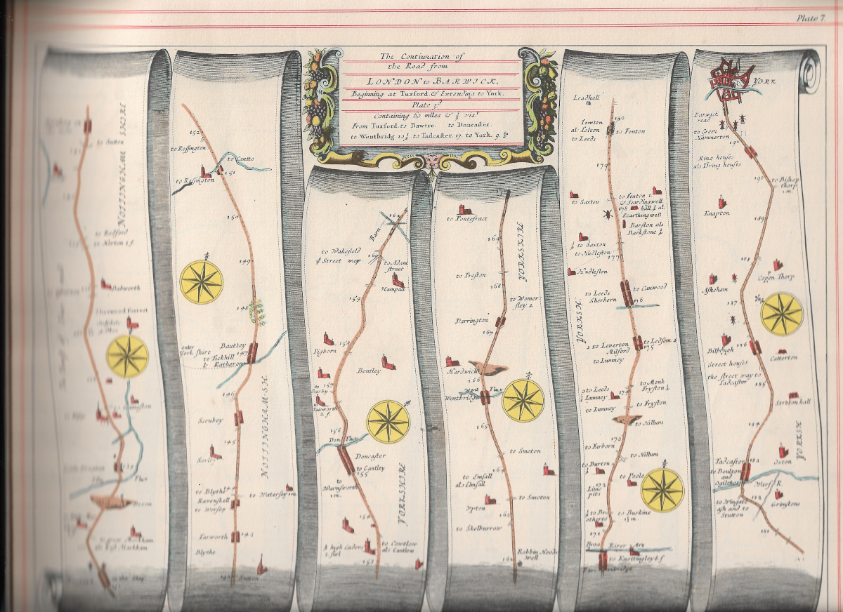
In 1675 John Ogilby, and his step-grandson, William Morgan, published Britannia a collection of strip maps of what he called the ‘Principal Roads of England and Wales’. As well as being beautiful, they are the first accurate road maps we have. They mark each mile, offer an indication of the inclines, give bridges, fords and ferries, and show junctions, with a note of where the turnings might take you. All this accuracy was achieved by Ogilby sending out teams pushing or towing a wheel for measuring distances precisely, which he called a “waywiser”. He also standardised the mile to 1760 yards. Up until then, miles were variable, with different regions and even counties sticking to their own length. We still hold on to the shadow of this notion in the phrase ‘a county mile.’
Many of the roads remain significant today, though a few seem obscure, which has given rise to theories about Ogilby’s involvement in sinister plots. What we also find is, three hundred and fifty years later, some portions of his maps are difficult to tie onto modern routes. I have my own, pre-war edition, but you can see all the maps on Chris Mullen’s website Fulltable.com.
In 1699, William Morgan published a spin-off to Britannia, called The Traveller’s Guide, or A Most Exact Description of the Roads of England.5 The author was given as John Ogilby, but he’d been dead for twenty-three years by then. The text must be based on the notes made by the teams who measured the roads. From my perspective, they provide a useful commentary on what is in the maps, and I quote passages from time to time.
Surveys of the Posts
Two surveys of the Posts were carried out in the reign of Charles II, one in 1677 and the other in 1682.6 They give us six roads in England, going from London to Edinburgh, Yarmouth, Dover, Plymouth, Bristol and Holyhead, with a further four routes in Ireland. The surveys lay out the route the post took, the distance between posts, and the names of the Post Master along the way. Though they cover a limited number of roads, what is in the surveys provides support for how some significant roads developed.
Celia Fiennes: Through England on a Side Saddle
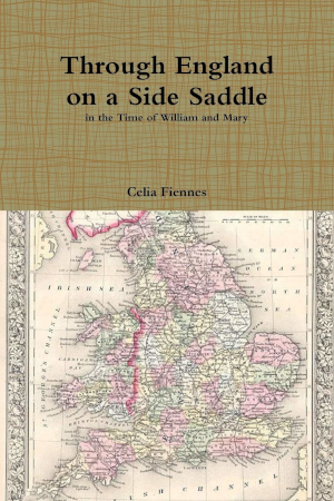
Celia Fiennes was from a well-connected family and sufficiently comfortably off to be independent. Beginning in the mid-1680s she set out on a series of journeys around England, making notes and observations as she went. She often travelled on horseback with only one or two servants, which was unusual for a woman of her class. She seems to have kept at it into the early 1700s. The book describing her journeys ‘Through England On a Side Saddle in The Time of William And Mary’ didn’t appear in her lifetime, but had to wait for one of her descendants, Emily Griffiths, to edit and publish it in 1888.i A bit like Leland, Miss Fiennes was too interested in everything to follow direct routes, but though she pops off and on roads, it is usually still possible to glean its basic route. She also gives very personal and particular descriptions of the state of the roads and the places she visits.
Daniel Defoe: A Tour Thro’ the Whole Island of Great Britain

Daniel Defoe is best known for Robinson Crusoe, but his three volumes of A Tour Thro’ the Whole Island of Great Britain,7 published between 1724and 1727 was equally popular and financially successful at the time. Just as with Leland and Fiennes, Defoe feels no obligation to follow the route of our modern roads from start to finish. He does though, very much supply a particular view of the places he visits, and sometimes, the roads he uses to get to there
Turnpikes
Through the eighteenth and on into the nineteenth century information about more and more roads becomes available, as Turnpike Trusts were formed. The trusts were legal entities, crated by a private Act of Parliament, so there is reliable information about where each stretch of turnpike ran. My introduction to the whole world of turnpikes was William Albert’s The Turnpike System In England 1663-1840, which tough published way back in 1972, is still a reliable starting point for anyone wanting to know more about how the turnpikes worked.
However, for me, the real treasure trove is Alan Rosevear’s website, Turnpike Roads in England and Wales. As well as maps of the turnpikes in each county, he gives an exhaustive county by county list of trusts, with an indication of the modern roads to which they relate. He also includes a list of turnpike gates and tollhouses, together with links to articles about different aspects of the turnpike system. It is a site of superb scholarship, to which I return again and again.
Stagecoaches
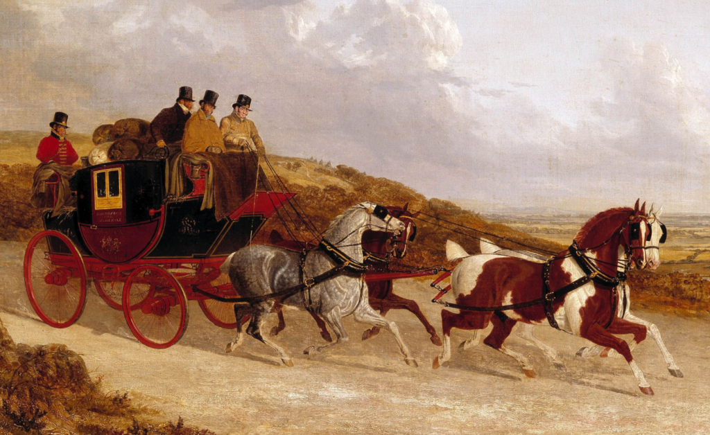
We get further evidence for where roads ran from the routes stagecoaches took. The sources I have most consistently used are the three editions of Cary’s New Itineraries. Cary, trained as an engraver, opened a printing and publishing business on the Strand, London in the 1780s. He specialised in maps, and in 1787 he published The New and Correct English Atlas, which become the standard atlas for the country. In the 1790s, The Post Master General commissioned Cary to produce a survey of English roads. The result was the 1798 edition of Cary’s New Itineraries. It gives the routes and mileages of all the major roads from London, and the towns through which they passed. Another section dealt with what he called Cross Country Routes.
Subsequent editions, (I also have the 1815 and 1828 ones) include a deal of information about where to catch a coach, inns along the roads, and places of interest on the journey. I find the three Itineraries invaluable source of information about the development of roads, and how they were used in practice.
Bicycles, Cars, and Today’s Roads
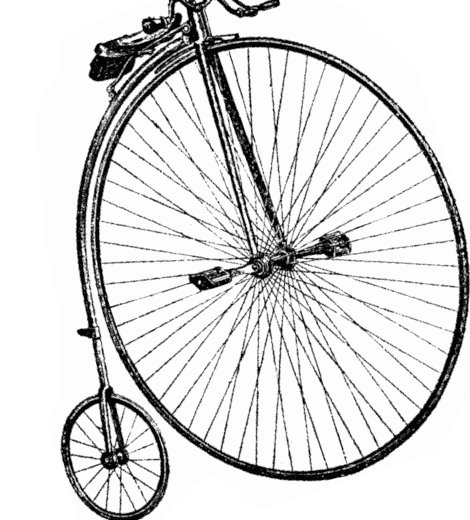
Once the railways arrived, and the stagecoach business collapsed, roads were rarely used for long-distance trips, except by cyclists. The best book about this era is Roads Were Not Built for Cars: How Cyclists Were the First to Push for Good Roads & Became the Pioneers of Motoring, by Carlton Reid, published by Island Press. Reid makes the case that it was the bike enthusiasts who kept the roads alive, demanded road maps, and often became the people who built the early cars.
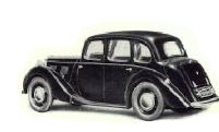
As the internal combustion engine takes over, the available sources become too various, and too particular to feature in a lot of different posts.
When tracking down information on early car, lorry and motorbike enterprises, I often find Grace’s Guide to British Industrial History is my first stop.
Of course, there is much more. I have a top shelf full of, sometimes, random books related to roads and their history. Also, because I visit their sites, I know there is a host of knowledgeable, and enthusiastic road people, who have so much information about particular aspects of our roads and how they developed. I am very grateful for what I have learnt from them, and will continue to, for research never ends.
AJ
- Magry,Ivan, D, 1973. Roman roads in Britain, J Baker ↩︎
- Dickens, B, 1938, Premonstrattensian Itinerarises from a Titchfield Manuscript, at Welbeck, Proceedings of the Leeds Philosophical and Literacy Society, Literary and Historical Sevtion, Volume 4, PP ↩︎
- Schwyzer, Philip, 2009. John Leleand and his Heirs: The Topography of England, in Pincombe, Mike, and, Shrank, Cathy, 2009. The Oxford Handbook of Tudor Literature: 1485-1603, Oxford University Press. ↩︎
- Holinshed, Raphael, 1587. The Chronicles of England, Scotland and Ireland, London: Printed by Henry Denham, at the expences of Iohn Harison, George Bishop, Ralf Nebury, Henrie Denham, and Thomas Woodcoke, Horace Howard Furness Memorail (Shakespeare) Library, Folio DA130. H7 1787 ↩︎
- Ogilby, John, 2010, The Trsveller’s Guide, or a Most Exact Description of the Roads of England, Gale Ecco ↩︎
- Bond, Foster, W., 1985. A General Survey of the Post Office 1677-1682 by Thomas Gardener, The Postal History Society. ↩︎
- Defoe, Daniel, 1978, A Tour Through the Whole Island of Great Brtain, Penguin Classics. ↩︎
Leave a Reply