Tag: British Road History

  • A57 History Part 2: Manchester to Lincoln

    A57 History Part 2: Manchester to Lincoln

    A57 History Part 2: Manchester to Lincoln

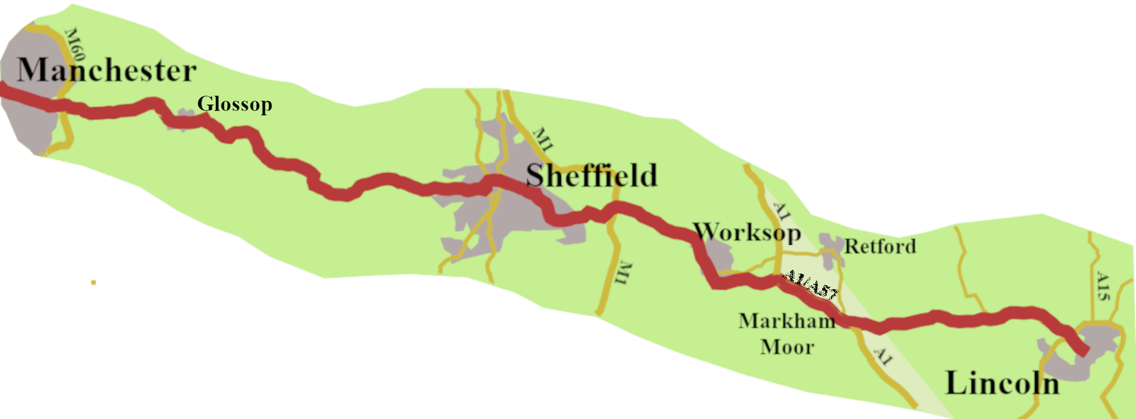
    In the previous post, I traced the development of the A57, from Liverpool, to the point where the Hyde Road leaves Manchester. In this one, I will look at the rest of the road, through Glossop, Sheffield, Worksop, and so to Lincoln.

    Finding a Road

    It is difficult to find evidence for any A57 road between Manchester and Glossop, until the coming of stagecoaches. The Romans had a road (Margary no. 711) running from a fort in Castlefield, a district south-west of Manchester city centre, to another, known as Melandra, between Woolley Bridge and Glossop.1 The latest evidence points to the Roman road running north of the A57, but parallel to it, so going in the right general direction. However, beyond Glossop it went off towards Barnsley and Doncaster.
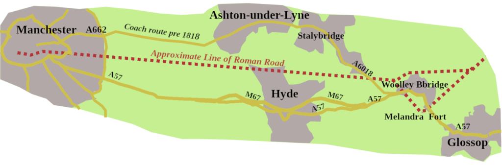
    If we jump forward to the end of the eighteenth century, coaches from Manchester to Sheffield were going through Glossop, but via Ashton Underline, more the A6018 than the A57. It could have something to do with Hyde not being there until the early nineteenth century. However, by 1818, the Manchester Hyde and Mottram Turnpike went to Glossop.

    Glossop to Sheffield
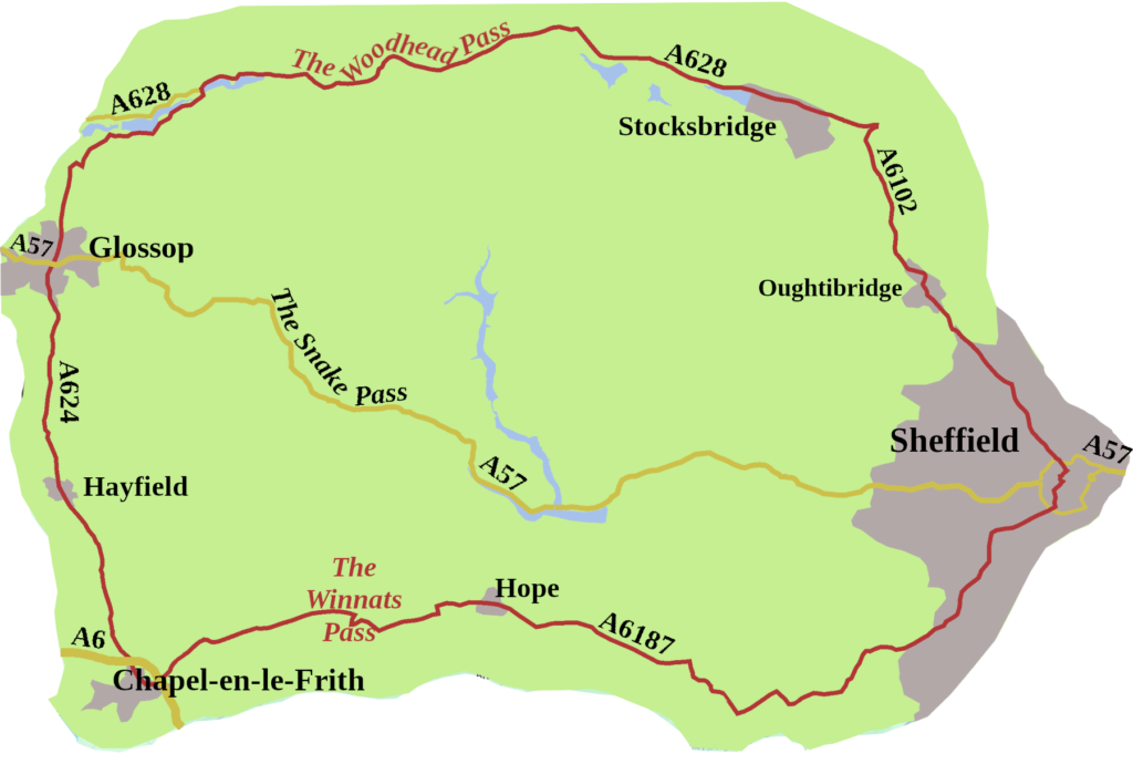
    Beyond Glossop, Sheffield bound coaches either took the Woodhead Pass (A 628) or the more southerly route, through Chapel-en-le-Frith, over the Winnats Pass, then along the Hope Valley. Neither of these routes is particularly direct.
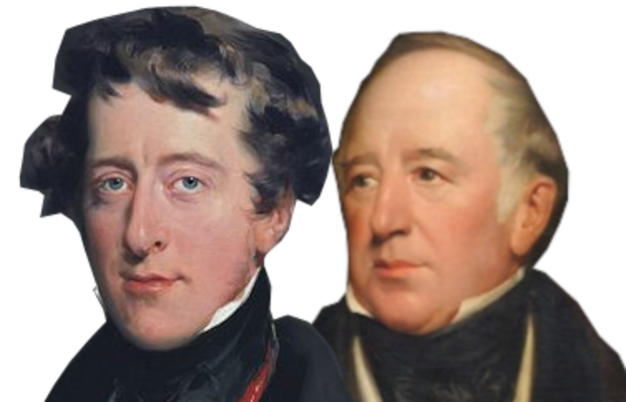
    In 1818, the Duke of Norfolk, the Lord of the Manor of both Sheffield and Glossop, got together with the Duke of Devonshire, who owned the land in between. They hatched a notion to build a new road, along the line of a packhorse trail, known as Doctor’s Gate.
    It was a rash decision. For a start, building an entirely new road, not just improving an existing one, was rare. In addition, the terrain was unforgiving, making the construction difficult and expensive. A Sheffield surveyor, William Fairbank, was initially given the task, but when he was obviously floundering, John McAdam was brought in to finish the job, at some expense, I’m sure.
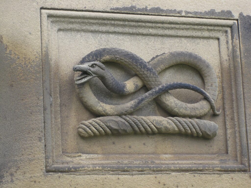
    The origin of the name, Snake Pass, might refer to the wiggly nature of the road, but it did not. As part of their Lordships’ plan, an inn was built, about seven miles from Glossop, for coaches to stop. It was originally called The Ladyclough Inn, but the Duke of Devonshire, William Cavendish, put his family crest, a knotted serpent, over the front door. It was not long before one-and-all called the place the Snake Inn, and the name attached itself to the whole stretch of road.
    The 1828 edition of Cary’s New Itinerary, gives the Royal Mail, from Sheffield to Manchester, going on the new Line of Road through Glossop,2 which we can suppose was the A57, Snake Pass route.
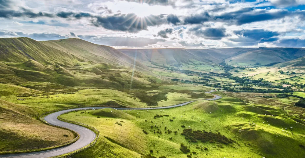
    It’s doubtful that their Lordships ever got their money back, because twenty-three years later, the Manchester to Sheffield railway line opened, killing the coaching trade. They did, however, give us the Snake Pass, a gem of a drive. From Glossop, it takes you over the high ground between the moorland plateaux of Kinder Scout and Bleaklow to the Ladybower Reservoir. Its highest point, one thousand six-hundred and eighty feet, is where it crosses the Pennine Way.
    The opening of this Snake Pass route meant there was a direct road between Glossop and Sheffield, now called the A57.

    Through Sheffield

    Before the 1960s Inner Ring Road was built, the A57 came into Sheffield along Glossop Road, which is now the B6547. It then went straight through the centre of Sheffield, past the cathedral and along some of the city’s oldest streets such as Haymarket, Waingate and Wicker.
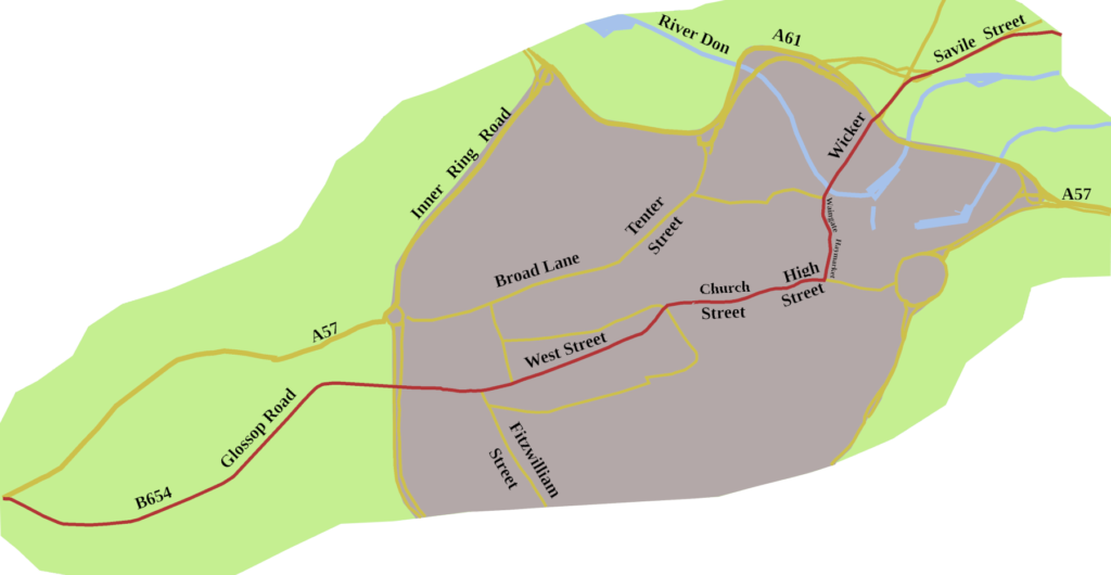
    One-way systems, and redevelopment, mean, today, you can’t drive the 1923 route, over Lady’s Bridge, and out of the city along Staniforth Road, now the B6200. Quite sensibly, the modern route keeps cars away from the centre, directing traffic north of the city, via the A61, to pick up the A 57 as the Sheffield Parkway.

    Steel Town
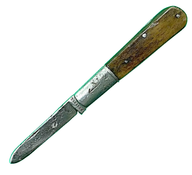
    The ancient street names are a clue to how long metal has been worked in the city. Robertus le Coteler, one of Sheffield’s early little mesters, paid Hearth Tax in 1297 for the workshops he owned, which produced knives, swords, and other bladed tools.3
    In The Canterbury Tales, the Reeve says of a miller:
    ‘Ther was no man, for peril, dorste hym touche.
    A Sheffeld thwitel baar he in his hose.
    ‘
    For ‘thwitel’, read ‘knife‘, which gives us the modern word whittle. So, even at the end of the fourteenth century, it was noted that the knife was made in Sheffield. By 1379, twenty-five percent of the population of Sheffield were listed as metal-workers.
    It was the beginning of ‘Steel Town’ Sheffield becoming the world-renown producer of fine cutlery. Not knives and forks alone, though, but steel for armaments and railways. Ingenuity and quality have always been the stamp of Sheffield, and though the industry was filleted during the 1980s, firms producing high quality steel hang on, drawing on centuries of skill and nous.

    A Castle and a Queen
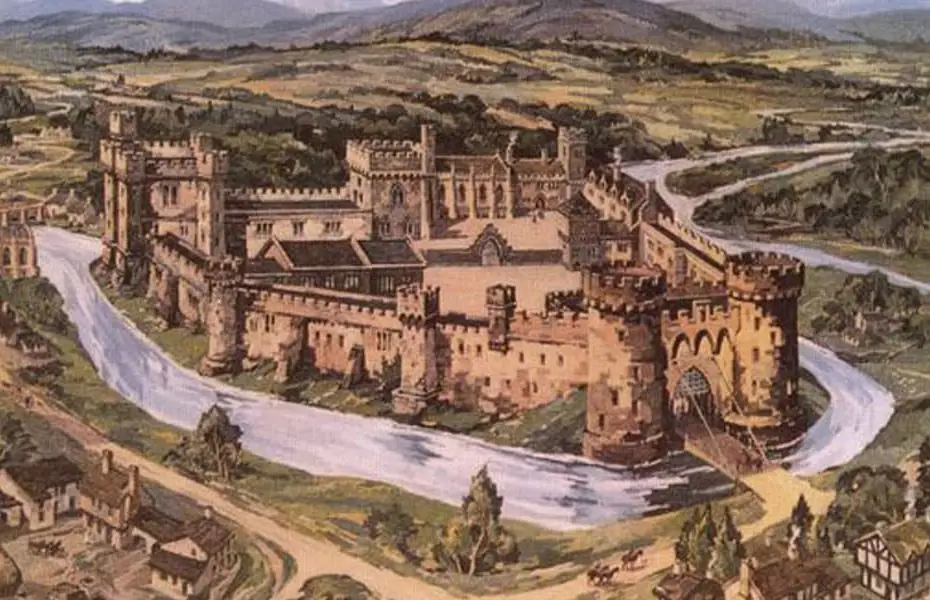
    A castle once stood east of Waingate. The original motte and bailey structure burnt down in 1266, as did much of the town, during Henry III’s struggle with Simon de Montfort. It was rebuilt in stone in the 1270s.
    In November 1570, Mary Queen of Scots, then aged 27, arrived there, having travelled from Chatsworth. Little did she think she would stay in Sheffield, on and off, for fourteen years.
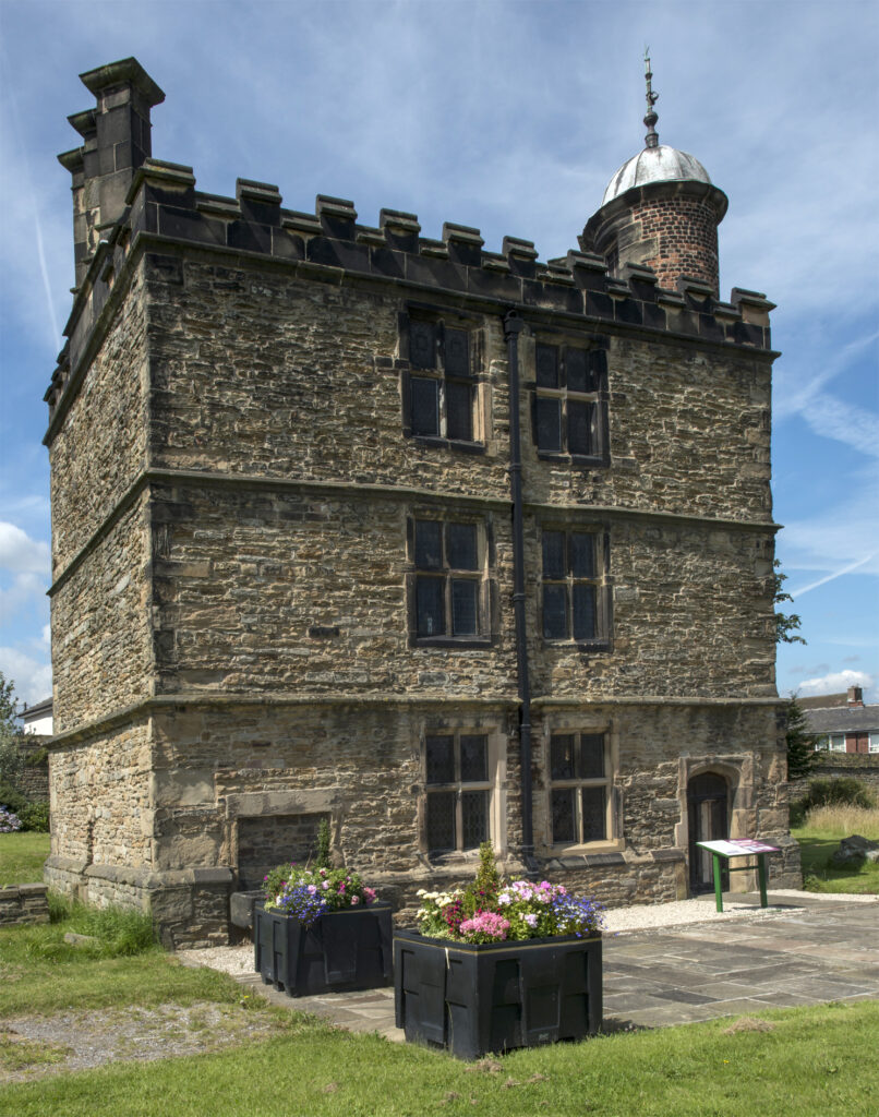
    To begin with, Mary was kept in the castle, but later, more comfortably, at Manor Lodge, which still stands.
    The castle, though, did not survive the Civil war. Seized by Royalists in 1643, it was battered by Parliamentary artillery in 1644.4 Three years later, the House of Commons ordered its demolition. The Earl of Arundel did, at one time, have a scheme to restore it, but the damage was too extensive, and finally, the remains were levelled.

    On to Worksop

    There is little, or no, record of a road from Sheffield to Worksop in the Middle Ages, or the early modern period. Worksop is probably of Saxon origin, for it is in Domesday. There was a minor, Wars of the Roses, skirmish there, in December 1460.
    During Henry VIII’s reign, Leland visited the town, but tells us nothing of a road to Sheffield, as he came from Doncaster, and went on to Mansfield.
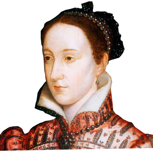
    There must have been some sort of highway, because, in the summer of 1583, during her imprisonment at Sheffield, Mary Queen of Scots was taken to Worksop Manor for a time. The house burnt down in 1761. An eighteenth century mansion was built on the site, albeit only one wing of what was planned.

    The Worksop to Attercliffe turnpike, was in place from 1764, and by 1798, Cary outlines a road between Sheffield and Worksop, which looks very like the A57 of 1923.5 Coming out of Sheffield it goes along the B6200 as far as Swallownest, which was the line of the A57 until the 1970s. After that, it is pretty much the A57 into Worksop.
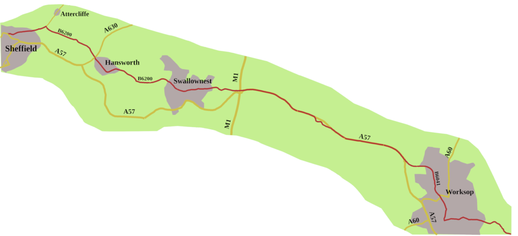
    Of course, nowadays, you can’t drive the original route of the A57 through Worksop. Where the modern road swings almost due south at a roundabout three-quarters of a mile outside the town, you follow the signs for Kilton, Tickhill and Blyth. The B6041, Gateford Road is the way the A57 once ran. Because Bridge Street is pedestrianised, you have to go around the houses, then along the B6040 Retford Road to pick up the A57. The A60 remains the one ‘A’ road through Worksop, coming up from Loughbough and heading for Doncaster.

    The Coming of Coal
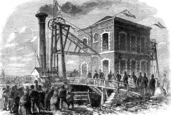
    A little to the north-west of the A57, the Duke of Newcastle began sinking the first shafts of the Shireoaks Colliery. It was the catalyst that changed Worksop from a market town, where they grew liquorice, made hats, and Windsor chairs, to a coal producing, industrial centre.
    Though Worksop is in Nottinghamshire, its four pits, Shireoaks, Steetley, Manton, and Firbeck have always been regarded as South Yorkshire collieries. Over the years, the Worksop miners played their part in national mining disputes, culminating in the strike of 1984/5. Despite a majority in Nottinghamshire voting to continue working, men from Shireoaks and Manton supported the struggle.
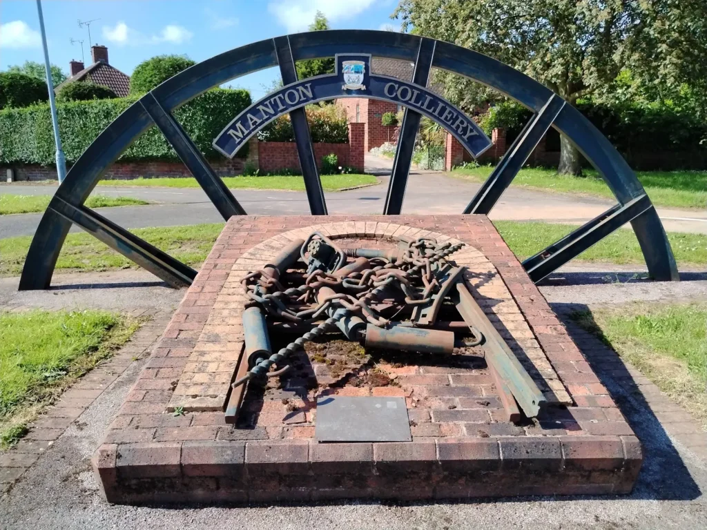
    The Shireoaks pit hung on until 1990. The last Workshop pit, Manton, closed in 1994, bringing an end to a hundred and fifty years of winning coal in the area.

    A Road to Lincoln

    The real fun starts the far side of Worksop.
    There was never a direct turnpike road between Worksop and Markham Moor. However, from 1822 there was a turnpike running east from Worksop to Retford, (then known as East Retford). At Retford you could pick up the Bawtry and East Markham Common Turnpike, opened in 1766, which ran south down part of the Great North Road. That turnpike took you to East Markham, from where the Dunham Road Trust, opened in 1765, ran to Dunham Ferry, where it connected with the earlier Lincoln Northwest District Turnpike, from Dunham Ferry to Lincoln.
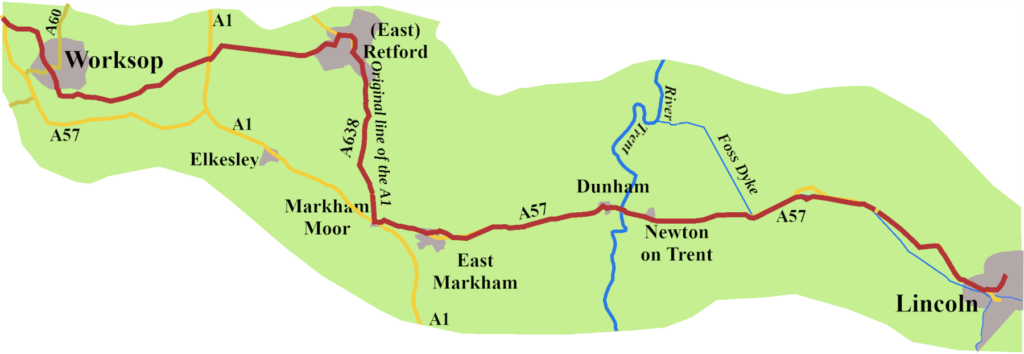
    By the end of the nineteenth century maps give a road running north-west from Markham Moor, which, beyond Elkesley, is marked Worksop Road. This must be the road which was the basis of the route the ministry men chose for the A57, though it was never a turnpike.

    Elkesley and the A1 Changes

    Elkesley was a victim of the wanderings of the A1.
    In 1923, the A57 ran through Elkesley and West Drayton, crossing the A1 at Markham Moor. As I covered in a previous post, in 1961, the Doncaster bypass arrived. As a result, The A1, which originally went from Markham Moor to Retford, to reach Blyth, was rerouted to go through Elkesley and Upper Morton, that is, along a stretch of A57. When the A1 was duelled in 1967, Elkesley found itself stranded, with only one way to join, or leave, the high-speed road. A bridge and new junctions were finally constructed in 2015. A second result is that the A57 temporally abandons its identity between Upper Markham and Markham Moor, and the A1.

    On to Lincoln
    Once the road reaches Markham Moor, and becomes the A57 again, the road follows a well-trodden path.
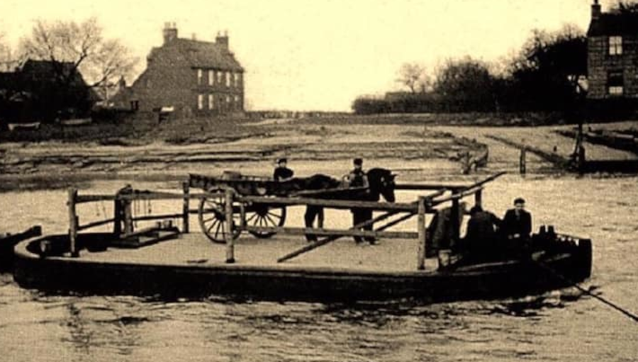
    East of Dunham, you have to cross the Trent to leave Nottinghamshire and enter Lincolnshire. Until 1832, that meant taking the chain ferry, which had been there for centuries. Eventually, a group of businessmen had a bridge built, with a toll paid to cross. It was not replaced until the end of the 1970s, and even then, the original piers were kept. The tolls, 50p a car, are to pay for their replacement when the time comes.
    Once over the river, you skirt Newton on Trent, continuing to the charmingly named Drinsey Nook Junction, where you turn right for Lincoln.
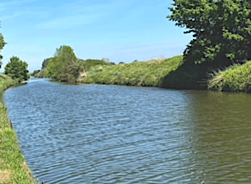
    For a while, the road runs beside the Foss Dyke. We are not sure who built this ancient waterway, but it is likely the Romans had a hand in it. It joins the Trent, at Torksey Lock, where a small bronze statue of the Roman God Mars was found in the eighteenth century.
    If the Romans built that end, did they take it all the way to Brayford Pool in Lincoln, where they already had an inland port? The documentary evidence suggests Henry I may have been involved in part of its construction, or perhaps its reclamation.6 The canal certainly has a ‘straight’ Roman feel about it.
    As you come into Lincoln, you pick up the Carholm Road. Since 2017, the A57 was routed, via a right turn at the end of Carholm Road, onto Brayford Way, which was built in the 1990s. It takes you back over the Foss Dyke, catching a glimpse of Brayford Pool. From there the road runs along a series of streets, Rope Walk, St Mark’s Street, Tentercroft Street, and the East West Link Road. It then goes under a flyover, round a long, right-hand loop, to the junction with the A1434, where today’s A57 ends.
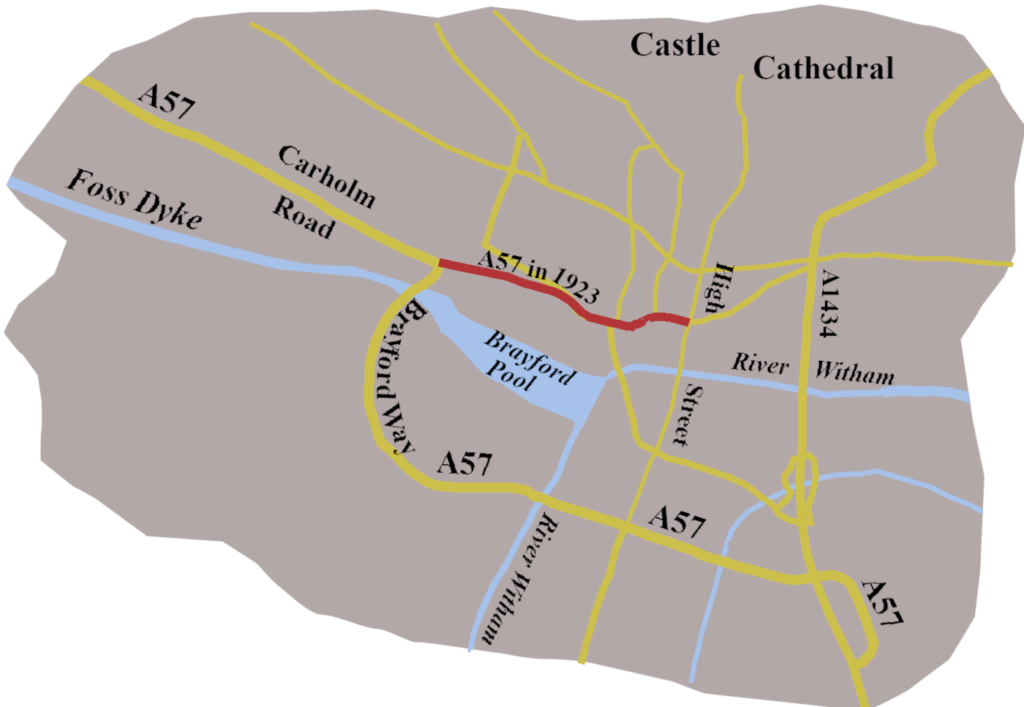
    Of course, that was not how the road originally went. Until the High Street was pedestrianised, from the end of Carholm Road, the A57 kept, more or less straight, going along Newland. It then seemed to have then gone along Mint Street, to join the A15 on the High Street, just by the Stonebow, once the entrance to the city’s Guildhall. Even by 1923 theA15 no longer followed the line of the Roman road along the High Street.

    The A57 is a curious road, in many respects, but so are many of our roads. Lincoln to Liverpool, Liverpool to Lincoln, it seems unlikely, but there it is, weaving a route from the industrial North-west to an ancient city, founded by the Romans. As we saw at the beginning of the previous post, it links the lost pool in Liverpool to the ancient Brayford Pool. A road between two pools.

    1. Margary, Ivan, D., 1973 Roman Roads in Britain: Written by Edition, (3rd Revised edition), J. Baker ↩︎
    2. Cary, John, 1828, Cary’s New Itinerary, Printed for John Cary, No. 181 Strand ↩︎
    3. Unwin, Margaret, Joan, 2002 The Hallamshire Cutlery Trades in the late 17th century: a study of the Hearth Tax returns and the records of the Cutlers’ Company, Faculty of Social Sciences, University of Sheffield ↩︎
    4. Civil War and the Fall of Sheffield Castle, 2020, Libraries Sheffield Blog, https://shefflibraries.blogspot.com/2020/04/civil-war-and-fall-of-sheffield-castle.html ↩︎
    5. Cary, John, 1798, Cary’s Itinerary Printed for John Cary, No. 181 Strand ↩︎
    6. Fossdyke Navigation, Canal and River Trust Website, https://canalrivertrust.org.uk/canals-and-rivers/fossdyke-navigation ↩︎
  • A History of the A5 in Wales

    A History of the A5 in Wales

    The A5 is one of many roads, too long, too old, and too loaded with history, to be contained in a single post. So, this post looks at the A5 through Wales, which has its own, particular history.

    A Beginning

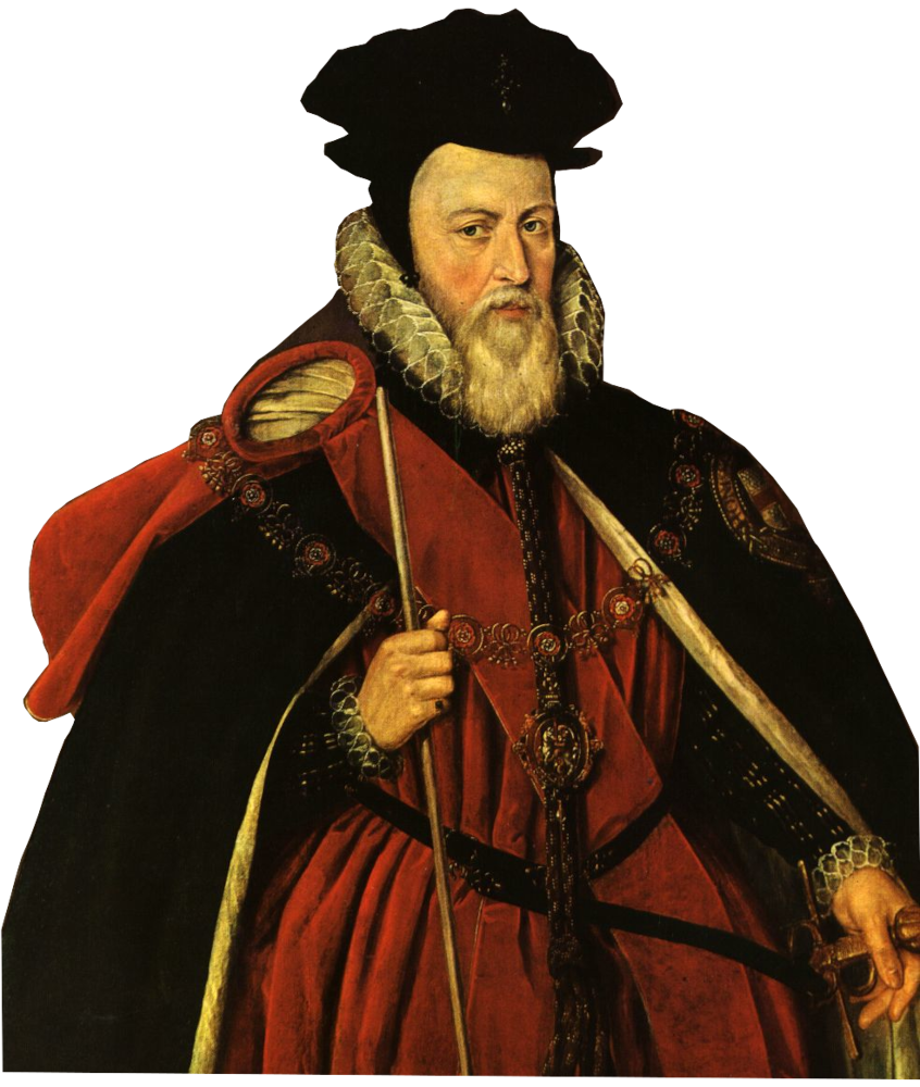
    In 1561, Elizabeth I’s chief minister William Cecil gave orders “for the laying of the Posts”.
    Holinshed tells us, it meant “there should be set Posts appointed between London and Ireland.”1
    Better still, the mail went to Ireland from Holyhead, not by the A5, it’s true, but from Chester.
    So, Holyhead? Yes.
    The Holyhead Road? Not yet.

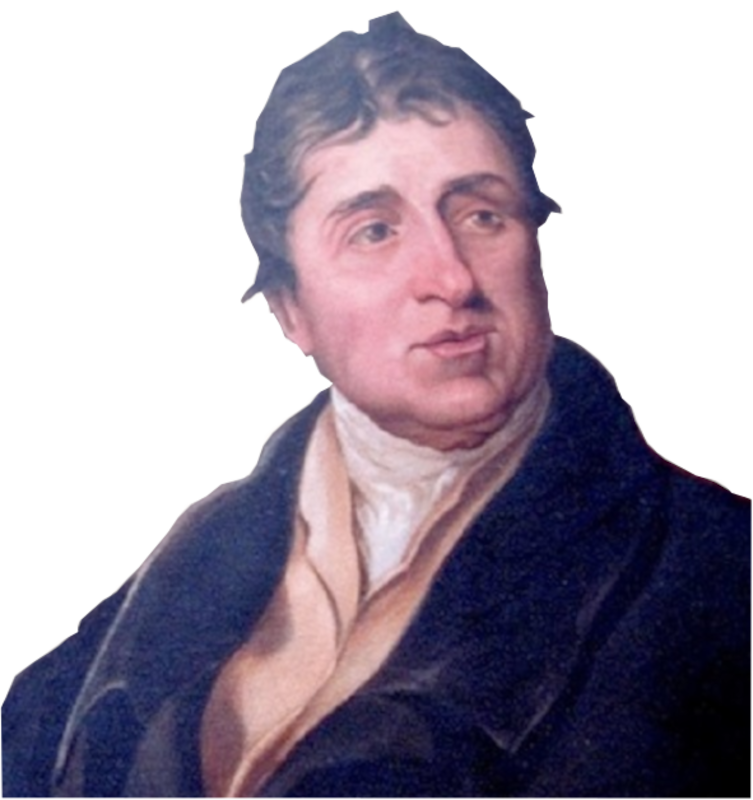
    Of course people had lived along the route of the A5 from prehistoric times, and they would have used the river valleys, just as Thomas Telford did, and the road still does.
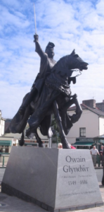
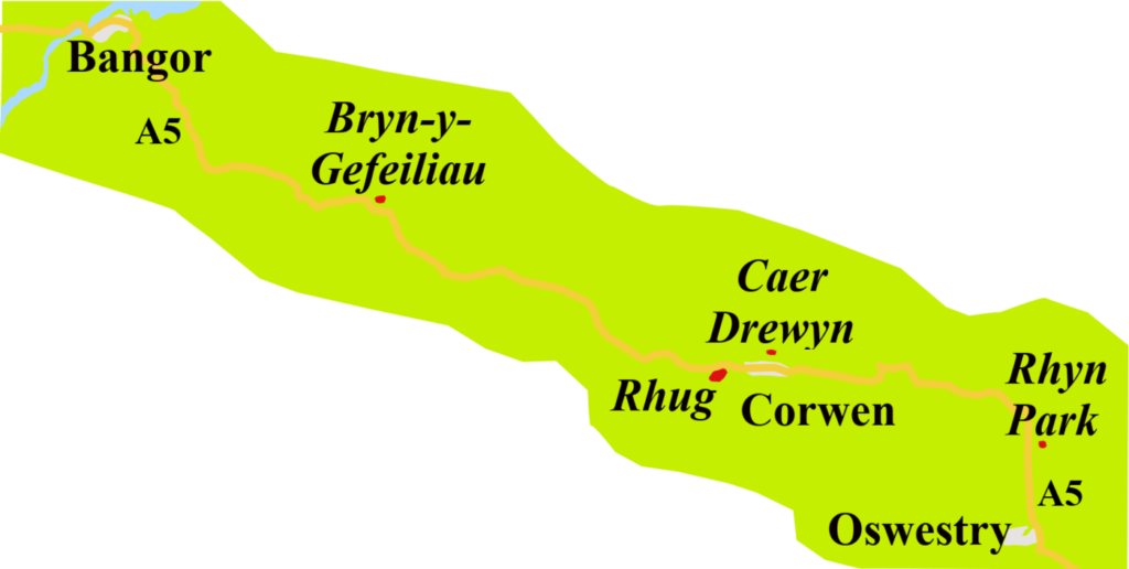
    There were Iron Age hillforts at Dinas Bran near Llangollen, and Caer Drewyn, a mile north of Corwen, Caer Drewyn is associated with Owain Glyndŵr, whose dramatic statue stands in the square in Corwen.

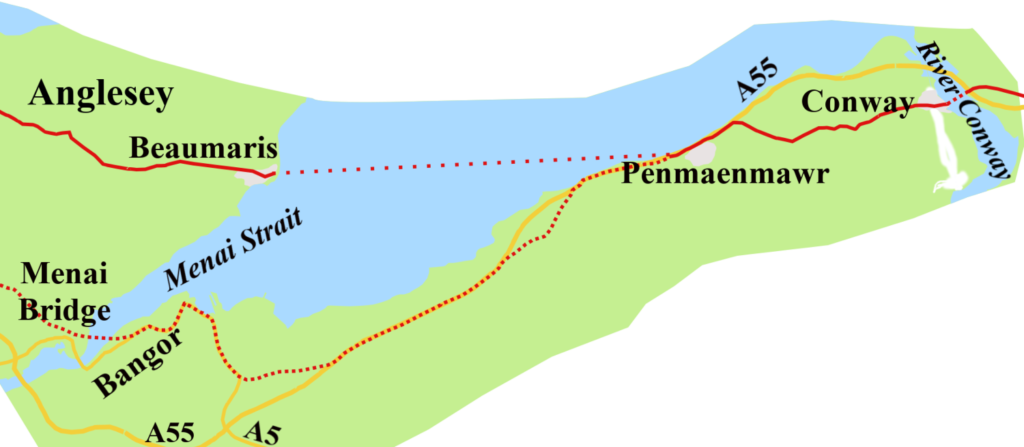
    Needless to say, the Romans caused trouble. In 60 CE, Guias Suctonius Paulinus led an expedition to root out resistance from the druids of Anglesey, (Mona to the Romans). He didn’t use the A5 route, but went from Chester, round the north coast, to Bangor, where they crossed the Menai Strait. He made short, and bloody work of the Britons, before having to hurry away to help with a bit of local difficulty in England: Boudica’s uprising.


    There was a Roman fort, perhaps two, at Rhyn Park, across the A5 from Chirk.2 From there, twenty miles of road, ran north of the Dee, to the Rhug Estate, near Corwen, which, today, boasts North Wales’s most exclusive farm shop.3
    The road may have continued, because further west, near the A5, are earthworks believed to mark a short stretch of Roman road. Another fort stood, from around 90 CE, north of the A5, near Capel Curig.4 Perhaps the first stirrings of the A5?

    Middle Years: No Real Road

    When Ogilby mapped the Road to Holyhead in the1670s, he followed the post route from Chester to Conway, where he marks a ferry over the river, in use until Thomas Telford’s Conway Suspension Bridge arrived in 1826.5 He does, however, give us an insight into the perilous nature of the Menai Strait crossing in the late seventeenth century.
    It all depended on the state of the tide. When low, the postboy might follow a narrow, steep path over the seaward edge of Penmaenmawr mountain to reach what Ogilby calls “The Sands.”

    “The Ascent being rough and steep, giving you a perpendicular Precipice or Declivity on the Right to the Sea, and a kind of over-hanging Rock of as great a height on the Left.”6

    Intrepid voyagers then went across the mud to the water’s edge, where they hoped to attract the attention of the ferryman in Beaumaris. The boat was designed to take a horse, though it must have been a hazardous business rowing across the Strait with a horse on board.
    If the tide were high, and you were not prepared to wait, you were forced to make the equally difficult trip along the Sychnant Pass. and over the top of Penmaenmawr Mountain.7 Having braved this peril, you continued to Bangor for a ferry to the town of Pothaethwy, which today is called, by the English at least, Menai Bridge.

    Ogilby’s route across Anglesey is difficult to plot on a modern map, and has nothing to do with the A5. Eventually, he marks Llanenghhennel, the modern Llanynghenedl, now on the A5025, about eight miles from Holyhead. To reach Holy Island, the options were:

    “observe the Right-hand Way to Cleveock Sands, leading to Holyhead when the Tide is out, otherwise you proceed by Way of the Bridg, unless 4 Furlongs farther you pass over the Sands and Rocks, all uniting before you come to Holyhead.”8

    Going “by Way of the Bridg” refers to the road to Trearddur Bay, over Four Mile Bridge, which has been there since, at least, 1530.9 The bridge derives its name, not from its length, which would be amazing, but because it was reckoned to be four miles from Holyhead. The Road to Holyhead Ogilby described remained, more or less, the accepted route for the next hundred years.

    Turnpikes to the Rescue?

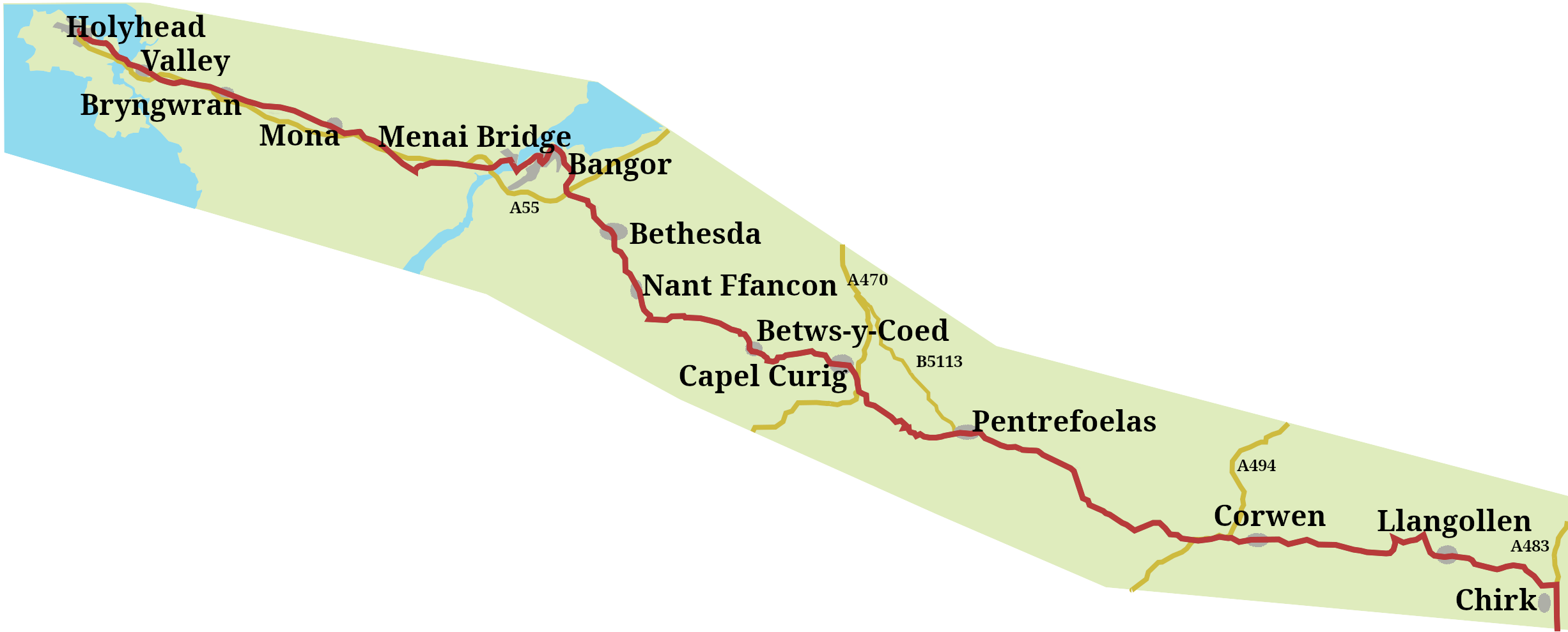
    Eventually, about halfway through the eighteenth century, turnpike roads began to push along the road. You could ride, or drive, along a turnpike between Shrewsbury to Oswestry from 1752, and by 1777, have followed turnpikes through Llangollen, Corwen, and on another fifteen miles to Pentrefoelas.

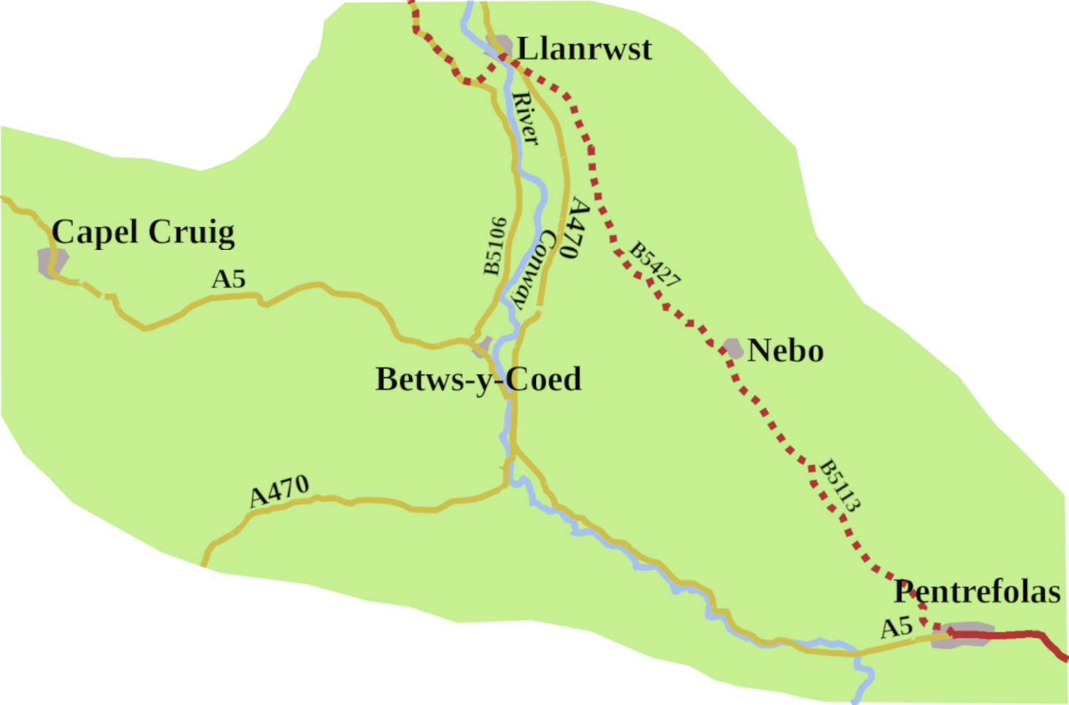
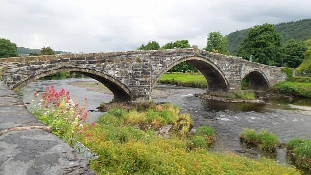
    At Pentrefoelas, you abandoned the A5 to go through Nebo, to Llanrwst. Here you crossed the Conway over Pont Fawr, possibly designed by Inigo Jones. After that, you headed north to meet the Conway to Bangor turnpike.

    This cross-country route was necessary, first because it avoided the ferry at Conway. Secondly, beyond Pentrefoelas the way was still little more than a track, with the section through the Nant Ffrancon Pass unuseble for much of the year

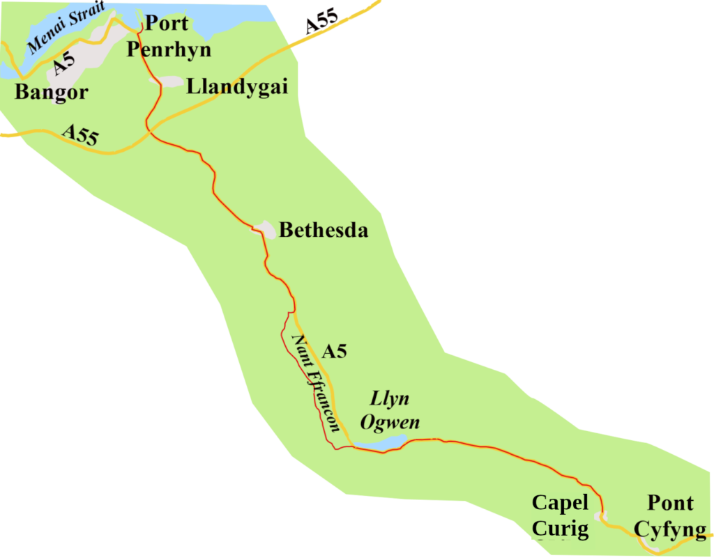
    Then, in 1790, a quarry owner, Lord Penrhyn, began work on a road from Capel Curig, through Nant Ffrancon, as far as Llandygai so he could move slate to his harbour at Bangor. His lordship didn’t need to go to Pentrefoelas, so the road there from Capel Curig remained as bad as ever.

    Twelve years on, the Capel Curig Turnpike Trust took responsibility for maintaining the whole stretch from Pentrefoelas to Llandygai. It didn’t follow the exact route of the A5, but crossed the Conway several times using pack-horse bridges. One such, Pont Rhydllanfair, with its telltale low parapets, can still be found by taking a left off the A5 by the Ty’r Bont B&B, (which I think is still there?) about three miles from Pentrefoelas, signed for Cwm Eidda. From Capel Curig, the turnpike could follow Lord Penrhyn’s road.
    Once cross the Menai Strait, the first stop was the Three Tuns Inn. It’s still there, on Cambria Road, Menai Bridge, though now called the Cambria, and is no longer an inn.10 After that, you took the Porthaethwy Ferry to Holyhead turnpike, (1765 to 1823);11 not the A5 route, but cross-country to Llanynghenedl, and over Four Mile Bridge.

    Thomas Telford’s Holyhead Road

    Following the Act of Union with Ireland in 1800, traffic along the road increased, as did the volume of complaints about the lamentable state of the road. In 1810, it was decided something must be done. That something was Thomas Telford’s survey of the road between Shrewsbury and Holyhead, published in 1811.
    The government, as ever, was reluctant to lay out the cash, particularly with the war against Bonaparte at full pitch. So the Holyhead Road Commission was not established until 1815, but at least, Telford was made its engineer in chief. He straightway set about building a road that would be the A5 through Wales. The surface was smooth, slightly cambered, to allow water run off, and the gradient never more than 1 in 22.

    Telford also built two bridges along the road that were critical to the whole project.
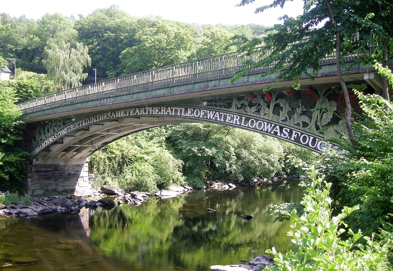
    The first was the Waterloo Bridge over the Conway at Betws-y-Coed. The cast legend on the bridge reads: “This arch was constructed in the same year the Battle of Waterloo was fought,” though it was not actually completed until 1816.12

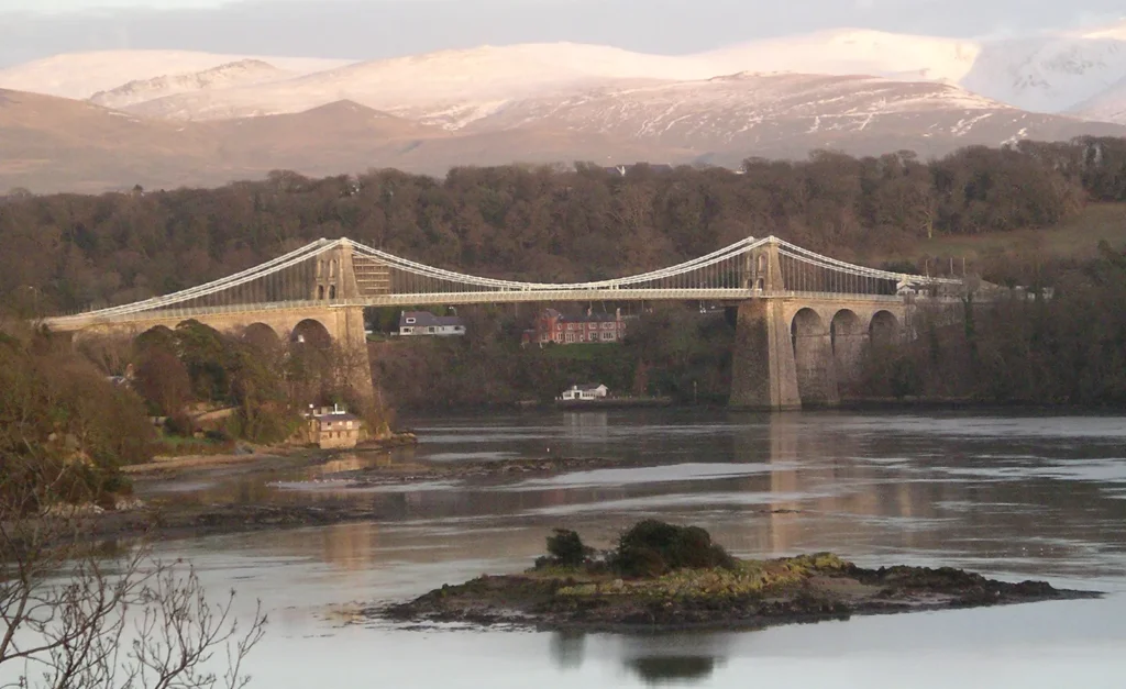
    The second is the, more famous, suspension bridge across the Menai Strait, started in 1819, though not opened until 1826.13 At the time, it was the longest suspension bridge in the world, and stood thirty metres above the water to allow tall-masted ships so sail under it. Work has been done on it over the years, but Telford’s basic structure still carries the A5 over the Strait.

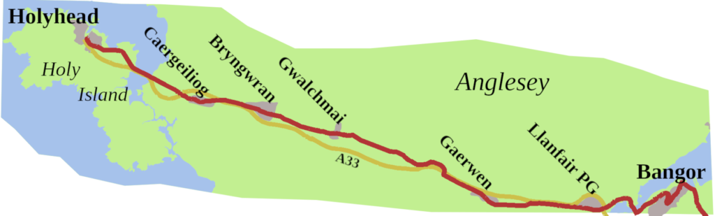
    Once on Anglesey, faced with the dreadful state of the old turnpikes, Telford created an entirely new road. It went through Llanfairpwllgwyngyll (Llanfair PG), Gaerwen, Gwalchmai, Bryngwran, and Caergeiliog, with a 120-foot embankment across the Stanley Sands to reach Holy Island.
    By the time he was finished, he had transformed the Holyhead road in Wales from being one of the worst roads in the land into one of the best. As a result, by 1828, the journey time for the New Royal Mail coach from London to Holyhead was 32 ¾ hours.14 He had also laid out the line of the future A5.

    All Change

    The railways eventually arrived, and from 1837, as lines were opened, coach routes closed.
    The London to Holyhead mail coach through Shrewsbury ended in May 1838, though a coach continued to collect the Holyhead mail from Birmingham station until October 1847.
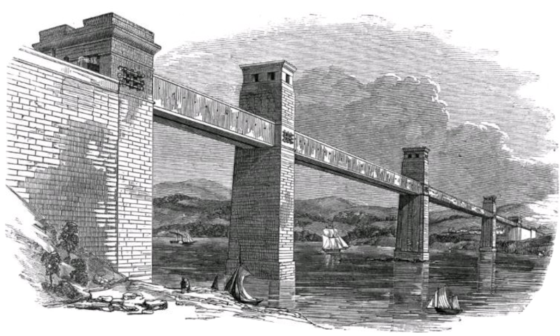
    By 1850, Robert Stephenson’s Britannia Bridge was carrying the railway over the Menai Strait, which meant from then, the post went by train. For the Holyhead Road, the great days of the stage coach were over.

    In a sense, the Welsh section of the road never recovered. Nonetheless, it was Telford’s route that the Ministry of Transport made the A5 through Wales.
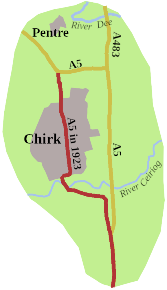
    Of course, changes have come. We now have the Chirk Bypass, finally opened in 1991. It runs north/south past the village, as far as the Halton Roundabout. Here you need to take the first exit, a sharp westerly turn, which takes you to the Whitehurst Roundabout, to connect with the old line of the A5.


    After Chirk, the 1923 version of the road picks up the modern A5 south of Pentre, and it is mostly Telford’s road until you come to the junction with the A55 North Wales Expressway. The A55 has become the dominant road, from the Llys Gwynt Interchange to Holyhead Port.
    The A5, Telford’s A5, is still there, a two-way road, passing through the same towns and villages it did in his day. The Stanley Bank, affectionately known as The Cob, still carries the A5 onto Holy Island, and so to the port.

    Back at the Menai Straits, there has been some chopping and changing. The A55 now runs along the upper deck of the new Britannia Bridge. Stephenson’s original burnt down in 1970, and its two-story replacement carried the A5 from 1980 to 2001. By then, the A55 had been made dual carriageway across Anglesey, and was routed over the Britannia Bridge, allowing the A5 to return to where it should be: Telford’s bridge.15

    Today, few of us use the A5 through Wales to reach Holyhead. Your satnav, or route-finding app, will point you to the North Wales Expressway. However, the A5 is still the only single digit ‘A’ road in Wales, and it continues to mark the boundary between zones 4 and 5. You might drive it to reach Snowdonia, or simply to enjoy a leisurely trip through lovely countryside, offering, in places, some of the most majestic, and stirring views to be seen on this island.

    The first three posts have all featured single digit roads, but the next post will be Part 1 of a 2 part look at the A57, which runns from Liverpool to Lincoln.


    1. Wright, Thomas, 1838. Queen Elizabeth and Her Times: A Series of Original Letters, Selected from the Inedited Private Correspondence of the Lord Treasurer Burghley, the Earl of Leicester, the Secretaries Walsingham and Smith, Sir Christopher Hatton, and Most of the Distinguished Persons of the Period, Volume 1, H Coburn ↩︎
    2. White, Kevan, 2018 Roman Britain: Rhyn Park, Roman Britain Website, http://roman-britain.co.uk/places/rhyn_park.htm ↩︎
    3. Cooke, Richard, 2016, Ty’n Y Llidiart, B5437, Corwen, Denbighshire, LL21 9RJ.October 2016 V 2.0, Aeon Archaeology ↩︎
    4. Wiles, John, 2007, Caer Llugwy, Bryn-y-Gefeiliau Roman Site, Royal Commission on the Ancient and Historical Monuments of Wales Website, http://www.coflein.gov.uk/en/site/95274/details/caer-llugwy-bryn-y-gefeiliau-roman-site ↩︎
    5. Wats, Edward, 1917, The Royal Mail to Ireland, Edward Arnold ↩︎
    6. Ogilby, John, 1699. The Traveller’s Guide, or a Most Exact description of the Roads of England, Abel Swall ↩︎
    7. Ayres, George, 2017. History of the Mail Routes to Ireland until 1850, Lulu.com ↩︎
    8. Ogilby, John, 1699. The Traveller’s Guide, or a Most Exact description of the Roads of England, Abel Swall ↩︎
    9. Cooke, Richard, 2011. Capel Horeb, Four Mile Bridge, Isle of Anglesey Archaeological Building Record, Gwynedd Archaeological Trust, ↩︎
    10. British Listed Buildings, The Cambria, British Listed Buildings Website ↩︎
    11. Rosevear, Alan, 2008. Turnpike Roads in England and Wales Website, http://www.turnpikes.org.uk/ ↩︎
    12. History Points, Waterloo Bridge, Betws-y-coed, HistoryPoints.org Website, http://historypoints.org/index.php?page=waterloo-bridge-betws-y-coed ↩︎
    13. Ayres, George, 2017, History of the Mail Routes to Ireland until 1850, Lulu.com. ↩︎
    14. Cary, John, 1828. Cary’s new itinerary; or, an accurate delineation of the great roads, both direct and cross, throughout England and Wales; with many of the principal roads in Scotland, Published by G & J Cary, 86 St James Street ↩︎
    15. Britannia Bridge, SABRE Website, https://www.sabre-roads.org.uk/wiki/index.php?title=Britannia_Bridge ↩︎
  • Settling the A1

    Settling the A1

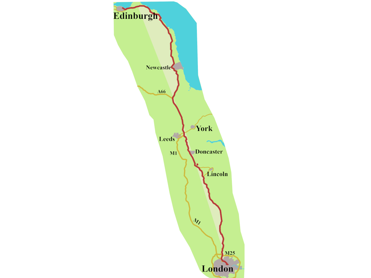
    This first post is about what happened to the A1 between when it got its number, in 1923, to the road we have today.
    [There will be an article later on how the road numbers came about.]

    The A1 is the longest road in Britain, and one of the oldest. Some of it is Roman, though it’s possible stretches existed even before they arrived. Not the A1, of course, but the beginnings of the North Road, which is what it was held to be, for, getting on for, two thousand years. As the highway which connects the capital cities of two kingdoms, through the ages, armies have marched it, kings have travelled it, and people of note have voyaged it. Then there is the countless number of folk who have gone up and down it, but left no record, no trace. We must not forget, it is these nameless people who are, far and away, the overwhelming majority of those who have used The North Road, and still do.

    How Many North Roads?

    One of the decisions the newly created Ministry of Transport faced, just after the First World War, was the where the A1, pivotal to the whole scheme, should run. Such a thing sounds bizarre to us today, but in the nineteenth century, you could use a number of routes, and still feel you were on The North Road.
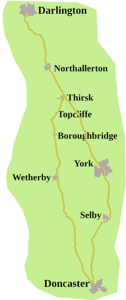
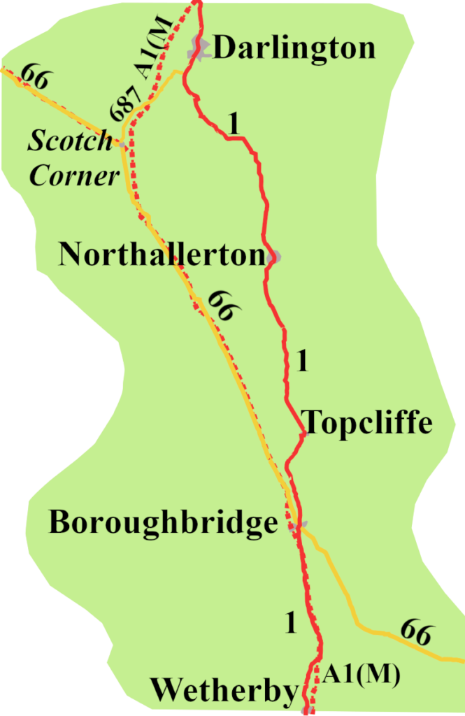
    Heading north, for Edinburgh, after Doncaster, you might go via Selby, to reach York. From there it was by Thirsk and Northallerton to reach Darlington. More and more though, during the coaching era, the mail had missed out York to go through Wetherby, Boroughbridge, and Topcliffe to reach Northallerton.

    Great or Old North Road

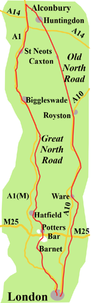
    Heading south, even at the height of the coaching boom, the road divided at Alconbury, outside Huntingdon. The left fork took you along The Old North Road, through Huntingdon, Royston, and Ware, arriving in London by Bishopsgate.
    (South of Royston, what was the Old North Road is now the A10, and I will devote future posts to it)
    The right fork, the Great North Road, went through Baldock and Hatfield, then Potters Bar, Barnet, Whetstone, and Finchley, and so into London along the Holloway Road and Islington.

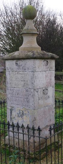
    The stone marker, which stood where the two ways separated, has been moved to stand beside the B1043, once the Great North Road, near, what was, the Alconbury airbase. It informs southbound travellers that, to reach London by the Old North Road, they still had sixty-five miles to go, while by the Great North Road it was sixty-eight.

    The A1 Arrives, but it’s not Right

    On 1st April 1923, the list of road numbers, and accompanying Ordnance Survey maps, were finally published. What they showed was, the A1 would follow the Great North Road past Alconbury. It would not go to York, but reach Darlington through Boroughbridge, Topcliffe and Northallerton.
    Such a route may have been convenient in the days of stagecoaches, but not for cars. There must have been shaking of heads and sucking of teeth at the ministry, but they decided something must be done.
    As it happened, there was another road, known as Leeming Lane, running north from Boroughbridge, following the line of a Roman road, called Dere Street. On the official map, Leeming Lane was numbered A66, which ran from Hull, through York, to Penrith.
    Perhaps they could move the A1?
    Radical! But, it’s what they did. By the end of 1924 the A1 ran along Leeming Lane as far as Scotch Corner, before heading north-east to Darlington. This was a novel route for the North Road, though today, it seems it was the way the A1 must always have gone, but of course, it wasn’t.

    Bypasses and other Disruptions

    Needless to say, it wasn’t the end of the matter. Leaving London, the A1 continued to follow the line of the Great North Road, through Barnet and Potters Bar, until 1927.
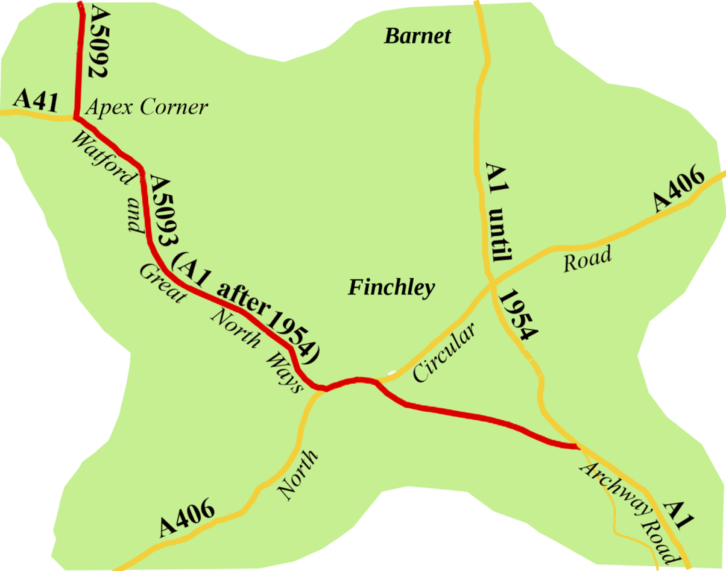
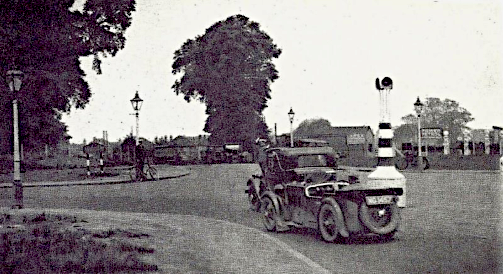
    Then, the Barnet Bypass opened. It started where Archway Road met North Hill, coming up through Highgate Village. Here, you took a left turn off the A1, onto a new stretch of road which took you to the North Circular. After about half a mile, you turned right onto Great North Way, and on to Watford Way. It was initially given the number A5903, which seemed bizarre to me, until someone at SABRE pointed out that, at the time, the ministry simply gave new roads the next number on their list.

    Next you would look out for a further right turn, already known as Apex Corner by the 1920s. Now you were on the southern end of the A5092, which fed you back onto the A1, just beyond Hatfield.It was the blueprint for the A1, as we now have it. In fact, it became the way you would have been most likely to choose through the 1930s and 40s. By 1937 the Barnet Bypass had been renumbered A555, and was part of the London to Edinburgh trunk route, even though the A1 still ran from Highgate, through Barnet, to Hatfield. It was not until 1954, the year after Queen Elizabeth II’s coronation, that from the top of Archway Road past Apex Corner to Hatfield was numbered A1. The original Great North Road route, through Barnet and Potters Bar, became the A1000, as it is today.


    The A1 was never given time to settle. More than fifteen bypasses had arrived before the outbreak of World War Two.
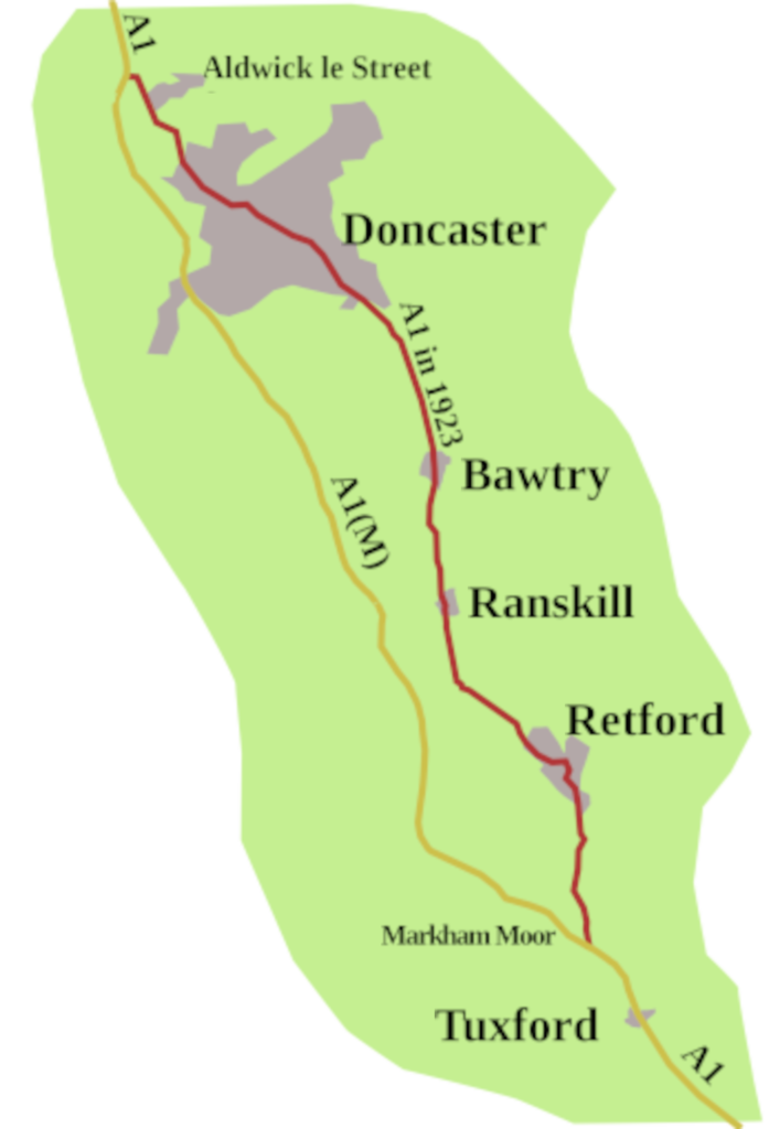
    The war put abreak on things, but it all got going again at the beginning of the 1960s. One of the most significant changes was the Doncaster Bypass, opened in the summer of 1961, which put the A1 onto an entirely new route from Markham Moor to Aldwick le Street. As a result, not only Doncaster, but towns such as Retford and Bawtry were no longer on the A1.

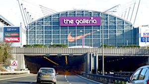
    By 1970 Darlington and Durham were bypassed when the road just north of Scotch Corner was upgraded to motorway standard. And then, in the south the A1 had to accommodate the coming of the M25. By the end of 1975, Bignell’s Corner, a three-level roundabout where the M25 crosses the A1, was being built. It marked the southerly limit of the A1(M), though Junction 1 was not fully there until 1979, and it would take another seven years for the A1(M) to join up with the Stevenage Bypass. Then one day in late 1986, as we drove towards London on the A1, Hatfield had disappeared, and we simply sped through the Galleria tunnel. It was somehow unnerving.

    “Improvements” continued, often causing frustration and annoyance. But, as with banging your head on the wall, it was better when it stopped. Between the A14 spur at Alconbury, (which has since become the A3107) and the A 605 junction for Peterborough, the road was upgraded to motorway standard in 1998, to give a ten-mile stretch with four lanes in each direction. By the end of the first decade of the twenty-first century, all the roundabouts, between Buckden and the one giving access to Berwick-upon-Tweed, had disappeared.
    Then, after seven years tribulation, the whole of the road from Darrington, near Pontefract, to Leeming Barr was upgraded in 2012. The stretch after Scotch Corner that bypasses Barton was finally raised to A1(M) status in 2018, making the road a motorway up to junction 65, south of Gateshead. After that, it’s just A1 again, though still dual carriageway past Newcastle, to a little north of Morpeth.
    From then on, the A1, one of the country’s major thoroughfares, keeps reverting to a single carriageway road reminiscent of the late 1940s. There are bursts of dual carriageway, such as the ten-mile section which bypasses Felton and Alnwick, but it is more or less two-way traffic north of the Tweed. As you go on, you come across two stretches of dual carriageway, one of which takes you into Scotland, but fades away after about a mile. Until you reach the Dunbar bypass, opened in 2004 the A1 barely has the feel of a twenty-first century highway, but from then on, it is good dual carriageway, albeit with roundabouts, all the way to Edinburgh.
    Over three years up to 2020 the A1 between Buckden and Alconbury Hill was seriously disrupted, not for its benefit but as a result of upgrading the A14.


    Has the A1 settled?

    Given its history, I doubt it
    As I write, work on the A421 flyover at the Black Cat Roundabout is causing the usual disruption. No doubt it will be better when it stops.
    Will they put another lane on the Doncaster Bypass? It’s been mentioned, but I can’t find any definite plans. What’s for sure is, however permanent roads seem to be as we drive along them, it is an illusion. Even a road as venerable as the A1 has taken decades to settle; the North Road centuries. My guess is, it may never finally settle.

    In the next post, we’re gong North of the Border, to look at the A8/M8, the road from Edinburgh, through Glasgow, to Greenock.