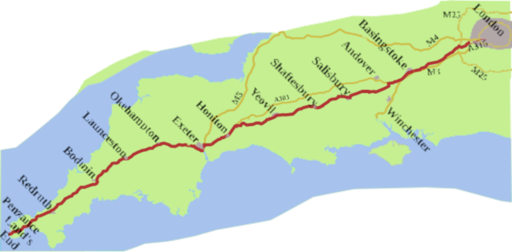
In the previous post, we followed the history of the A30 to the end of the seventeenth century. This post is about what happened next.
Daniel Defoe was making his Tour Thro’ the Whole Island of Great Britain1 in the 1720s. He describes a trip to Land’s End, but how did he get there?
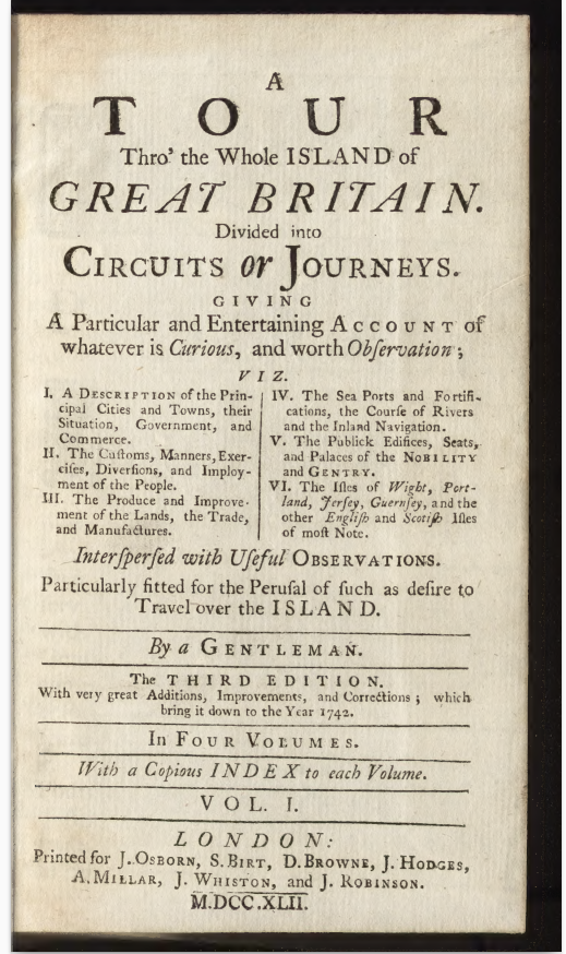
On an earlier trip, he had waxed lyrical about the Thames at Staines, but when he eventually starts his journey to the South-West, he sets out from Hampton Court, so crosses the river at Chertsey. He made his way over Bagshot-Heath, then a bleak place, renowned, throughout the eighteenth and early nineteenth centuries, as a centre of highway robbery.
Once safely at Basingstoke, he goes off to Winchester. Eventually, he does tip-up at Salisbury, then on to Shaftesbury, and pretty much follows our road to Exeter.
After that, though, he abandons the A30, travelling round the south coast, through Dartmouth, and Plymouth. He arrives at Penzance, (which he spells with an ‘s’ instead of a ‘z’) via Helston.
It looks as though he reached Land’s end along part of the A30, then the B3263. On his return trip he goes to Bodmin (Bodmyn) via St Ives, Redruth and Padstow, Once he makes Bodmin he seems to then follow the future A30 across the moor to reach Launceston. Once over the Tamar, he’s off along the north Devon coast, and that’s the last of any A30.
The First Turnpike on the Land’s End Road
The earliest turnpike along the road was the Kensington to Powder Mills and Cranford Bridge Trust from 1716. It’s all A315, which, as we saw in the last post, was always part of the Land’s End Road. In a way, the A315 might have been the A30, but it looks as though the ministry men wanted to tie the A30 to the A4, both significant routes to the West Country.
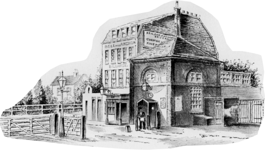
In 1717, the gate had been at “the sign of the Robin Hood” perhaps a forerunner of the Bell and Anchor, which stood on the site of today’s Olympia near the junction with North End Road.
The turnpike started at Couter’s Bridge, which carried the road over Couter’s Creek, one of London’s lost rivers. Today, the railway line running through Kensington (Olympia) station follows the line of the creek, at this point. The line of the turnpike then ran west, through Hammersmith, Chiswick, Brentford, and Hounslow. It finished at the Bedfont Powder Mill, on the western edge of Hounslow Heath, which was much larger at the time.
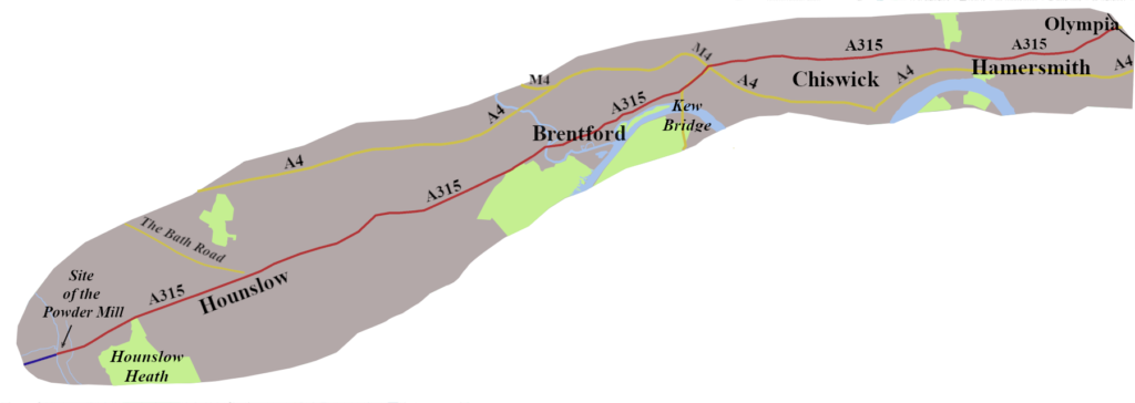
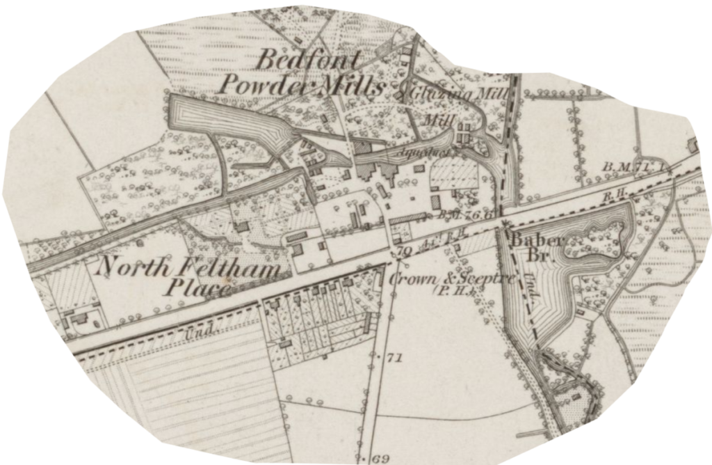
The Powder Mill made Gunpowder, and has a long history. There is evidence of it being there around 1610. For a period, mid-century, it became a sword manufacturer, but returned to making “Black Powder” around 1655.
It continued to make gunpowder until after the First Wold War.2 It is remembered today as Mill Way, a no-through-road lined with bungalows.
Staines to Salisbury Turnpikes
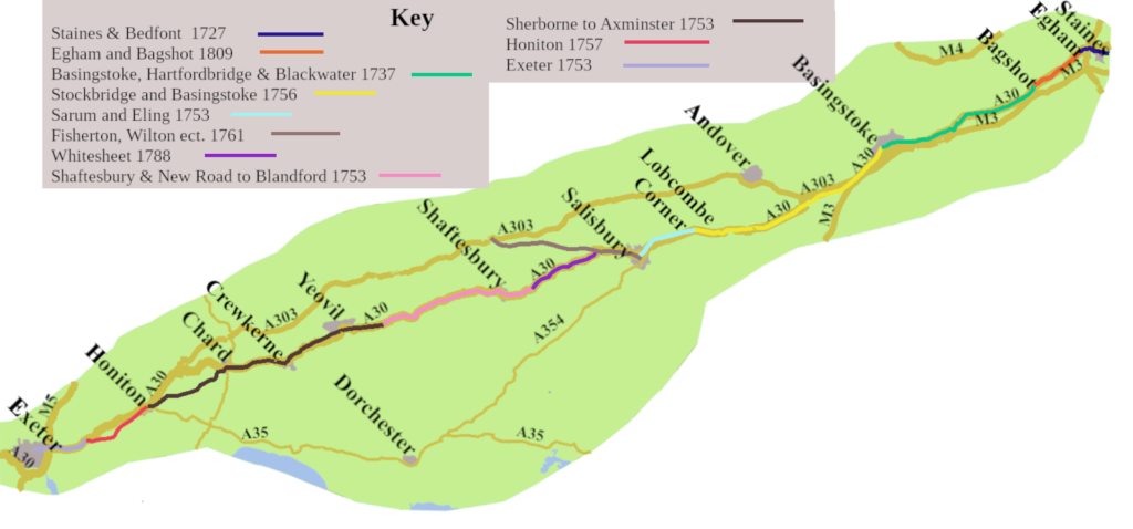
There were, at least eleven trusts between Staines and Salisbury.
The one that ran from the Powder Mill went as far as Egham by 1727. It reached Bagshot ten years later. Then in 1809 the trust was split in two, with the section Egham to Bagshot becoming a separate turnpike, in it’s own right.
From Basingstoke a turnpike followed the line of the A303 for a bit, but then went across country joining the route of today’s A30 at Sutton Scotney, about seven miles north-east of Stockbridge. It continued through Stockbridge to finish at Lopcombe Corner. Today, you turn left to keep on the A30. A right turn would put you on the A343, from Andover, which was the A30 until 1933.
Turnpikes on from Salisbury to Exeter
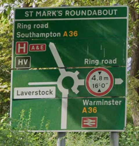
Following the A30 through Salisbury is curious. You come in via the north-east corner and leave by the north-west corner. The sign before you join the ring-road at St Mark’s roundabout is not encouraging, only offering the A36 for either Southampton or Warminster. You are directed to the third exit, which feel counter-intuitive, but there is an A30 Shaftesbury sign. This oddness is not a result of modern planners, but an inheritance from the turnpikes.
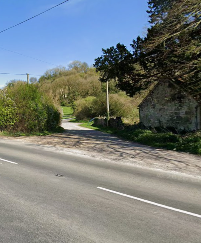
There is an ancient route starting at Harnham, a south-western suburb of Salisbury, which today is a right of way along the edge of a beautiful chalk landscape. Eventually the path drops steeply down Whitesheet Hill to meet the A30 about five miles east of Shaftesbury.
In 1756, a turnpike, the Whitesheet Hill to Harnham Hill, took over the management of this piece of road. It kept going for thirty years, despite the route being steep and hard to maintain.
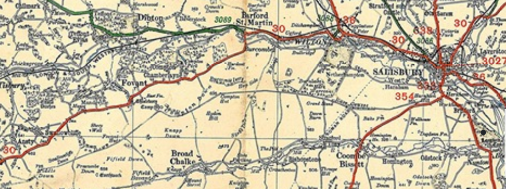
What finally did for it was a new turnpike, begun in 1788 which ran along the easier ground of the valley. To achieve this its northern end ran off an existing turnpike, with a ridiculously long name,3 some six miles west of Salisbury, at Barford St Martin. The die was cast. In 1923, the MOT map shows the A30 taking precisely that route.
Once the new turnpike, called the Whitesheet, was up and running, the rest of the way was pretty straightforward. On the map above, a turnpike, the Sherborne to Axminster, is shown, but it soon divided into four trusts which took the road across Somerset. The Honiton Turnpike is not all A30, though the Exeter is.
Exeter to Land’s End Turnpikes
By 1760, two turnpikes were in place maintaining the road from Exeter, through Okehampton to Launceston. It took another nine years before the old pack-horse road across Bodmin Moor got a turnpike.
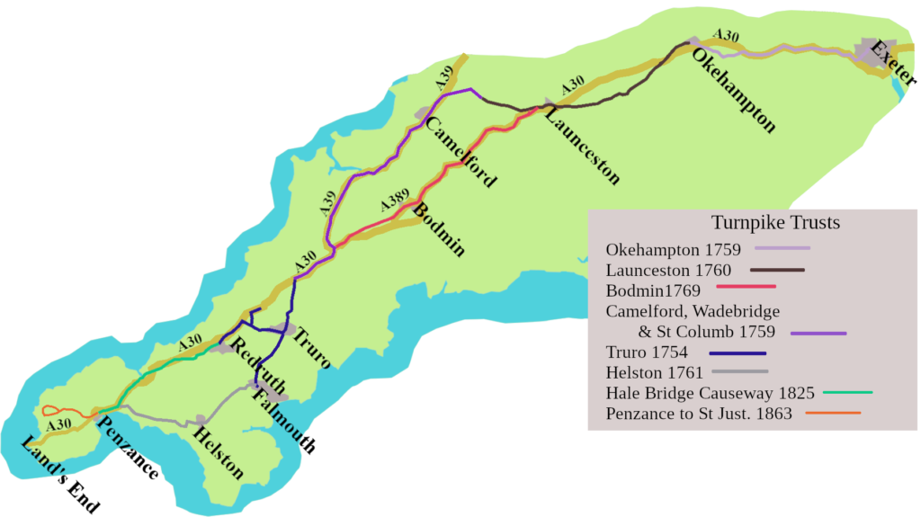
Beyond Bodmin, even after the turnpike arrived, things were complicated. There was no direct route to Penzance for fifty years. Instead, you joined a turnpike, for a few miles, which had gone through Camelford, then run along the north coast, to avoid Bodmin Moor. That fed you onto the Truro Turnpike, and you had to go all the way to Falmouth, before cutting across country to Helston, and on to Penzance.
Eventually, in 1825, the Hayle Bridge Causeway arrived, which took the road over the Hayle river, and from there into Penzance. It’s not quite today’s A30, but close. Very late on, a turnpike was opened, from Penzance to St Just, though none of it was A30.
Coaches Along the A30
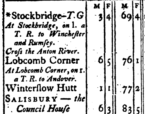
If you hunt around, it’s possible to piece together most of our A30 route in Cary’s 1798 Itinerary,4 though none of the three versions he offers gives us the entire modern road. His main route goes through Andover, just as the road did in 1923. However, he does offer an alternative, which is more the modern A30, going via Stockbridge.
In the 1828 edition we find the Royal Mail leaves the Swan with Two Necks, Lad Lane, London. It took twenty-two hours to reach Exeter, going via, Andover, Salisbury, Blandford, and Dorchester.
Beyond Exeter, though, with turnpikes south of Bodmin in place, Redruth, Camborne Church, and Angarrack, at the foot of the charming named Steamers Hill, are all listed. Next we have the River Hayle crossing, then on to Crowlas, to reach Penzance, all A30.
However, we can’t be sure coaches ran from London to Penzance. The London Stage Coach Directory, section of the Itinerary list six coaches a day heading out to Exeter. A note under the Phoenix,5 tells us, from Exeter coaches run to Plymouth, Falmouth, Penryn, Truro, Bodmin etc. Perhaps the ‘etc.’ covered Penzance, but perhaps not.
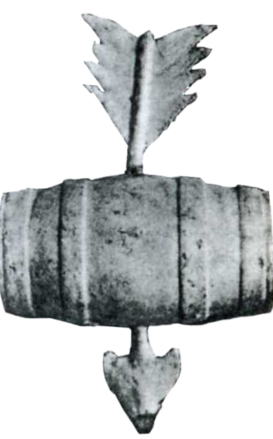
Just to add a further complication, William Hanning, the chief engineer of the Ilminster Turnpike Trust, made an alternative, fast coaching route between London and Exeter around 1800. His New Direct Route, left the A30 after Basingstoke, to go via Andover, over Salisbury Plane, past Stonehenge, to Wincanton and Ilchester, joining the original route a little north of Honiton. Cary tells us that in 1828 The Subscription Coach left the Bolt-in-Tun inn, Fleet Street, every day to go along the New Road to Exeter. Other coaches, such as, Quicksilver and New Exeter Mail also used the route. Of course it was never A30, but a certainly version of the Land’s End road.
Jamaica Inn
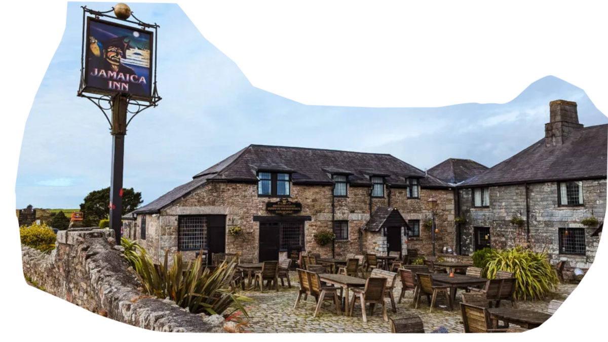
About halfway between Launceston and Bodmin, at the village of Bolventor, was an inn, built, in 1750, by an important Cornish landowning family, the Trelawneys. It was originally called New Inn, which hints at there being an older pub on the site, probably dating from the sixteenth century.
Once the turnpike arrived, it was a natural stop for coaches. In the late 1770s it was renamed Jamaica Inn, in deference to the Trelawneys, who were Governors of Jamaica. It was made famous by Daphne du Maurier using it for her 1936 novel of wrecking, smuggling, and a clergyman of dubious character. Today it is a thirty-six bedroom hotel and restaurant, though it, and the village of Bolventor, were bypassed in 1991.
The impact of the Railways
We’re at the high-water mark of coaching days because the railways were coming. They didn’t arrive all at once along the A30, but by 1844 there was a train service between London and Exeter. You could take a train from Plymouth to Launceston by 1865, but a direct line to London was not in place until 1886, and the connection to Bodmin had to wait until 1888. Inevitably, over time, long-distance travel between London and Cornwall moved from coach to train.
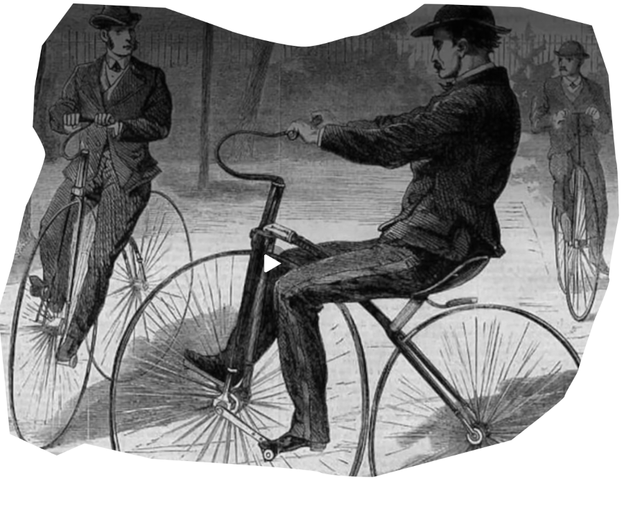
Inevitably, over time, long-distance travel between London and Cornwall moved from coach to train. As with many roads in that era, the A30 was used to reach the nearest station, for local journeys, and later, by cyclists. Bike clubs were founded at Exeter and Launceston in the 1870s, Salisbury in 1885, and Basingstoke in 1892. Most cyclists didn’t join a club, they rode them to work, to go into the village, to take a message to the doctor, or just for the pleasure of a jaunt with friends.
Hardy Country
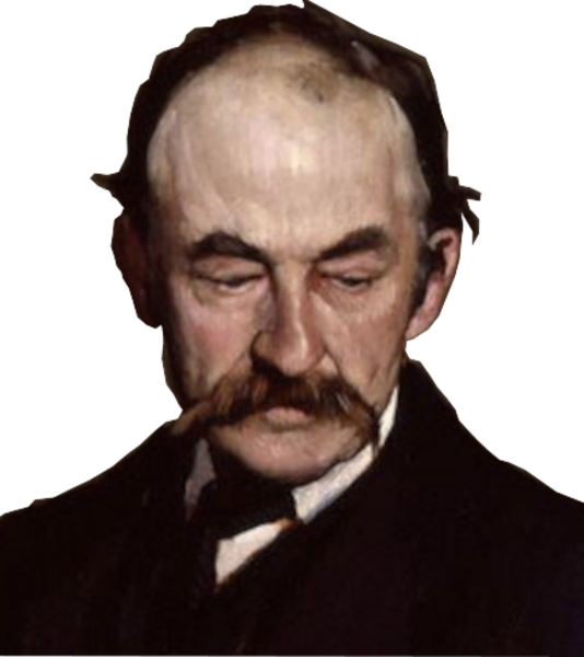
Thomas Hardy’s novels appeared in the 1870s through to 1895. The A30 runs through his Wessex, itself, an echo of Alfred the Great’s kingdom. Even if the road keeps north of Alfred’s capital, Winchester, (Casterbridge in the books), stretches carry a Hardyesque feel.
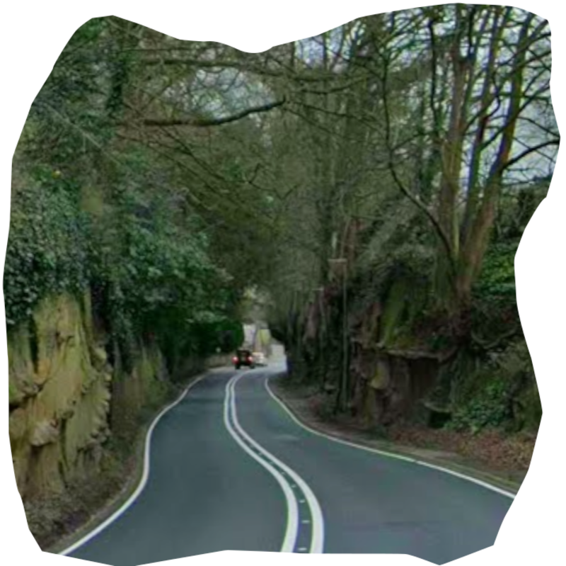
There’s the sunken lane as you come to West Coker (Narrowbourne in Hardy), with its Post Office on the corner of East Street, and Church Street to your right, taking you to the lychgate of St Martin’s. On, between wooded slopes, which open up to rolling downs to the south, with their field patchwork, then down the hill into East Chinnock, past set-back stone houses, half hidden among greenery. You arrive at Crewkerne along another, perhaps, green lane, with the glimpse of the town laid out before you. Amid the warm stone of the town, where King Ethelred had coins struck, it is possible to imagine you might catch a glimpse of a Tess Durbeyfield, Giles Winterborne, or Bathsheba Everdene.
The Royal Military College, Sandhurst
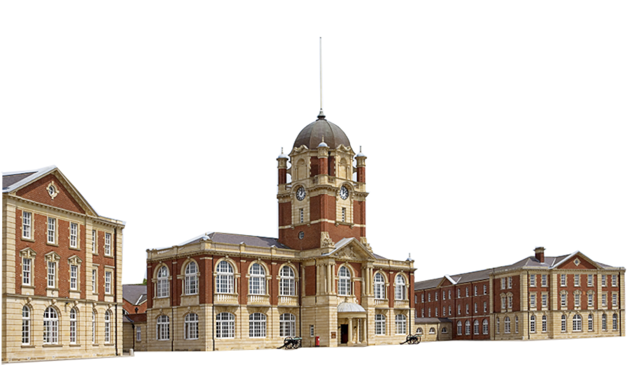
In 1812, the Junior Department of the Military College, which had been established at Great Marlow in 1802, moved into new buildings at Sandhurst. The senior section joined them some years later.
In 1947, the site became the Royal Military College, universally known as Sandhurst. Thus, for two hundred years, young men, and from 1984, young women, would have been up and down the road between Bagshot and Blackwater. A mile of the A30, along Camberley High Street forms the south-eastern boundary of the College, so no doubt, future military leaders would have known the road pretty well.
Trevethick’s ‘Puffing Devil’
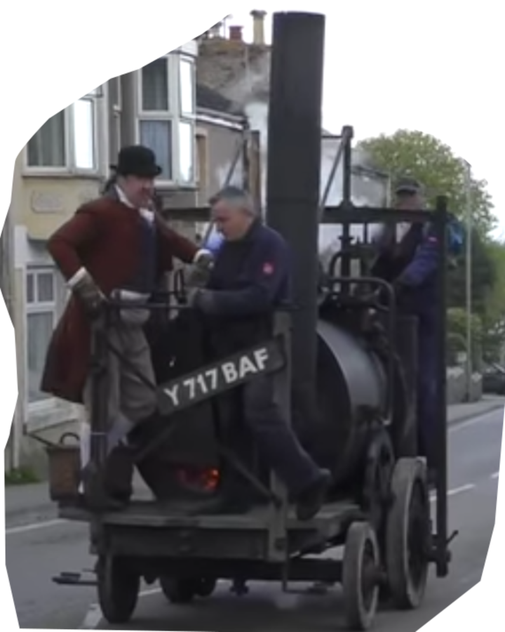
Two milestones along the path of the arrival of self-powered vehicles are found along the A30.
The first happened in Cambourne, five miles south-west of Redruth. On Christmas Eve, 1801, Richard Trevithick ran his “Puffing Devil,” a steam powered, passenger carrying, vehicle up Camborne Hill. Onlookers were astonished.
‘The horses stood still,
The wheels went round,
Going up Camborne Hill coming down.’
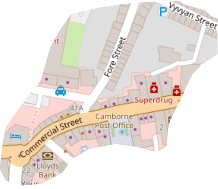
There is a plaque on the wall just where Fore Street meets Commercial Street, which was the A30 until a bypass arrived in 1975. Though “Puffing Devil” only made one successful run, it was the progenitor of the traction engine, the steam lorry, and the whole notion of an automotive road vehicle. Yes, we had to wait for the internal combustion engine, but the idea was abroad.
The First Motor Car Import.
The second milestone was passed ninety-four years later, and it involved a car with an internal combustion engine.
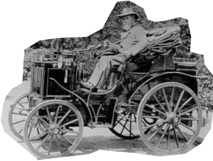
In July 1895, the Honourable Evelyn Ellis collected his Panhard-Levassor from Micheldever Station, a little south of today’s A303. It was the first car to be imported into Britain, having arrived at Southampton two days earlier.
Ellis drove his prize to Basingstoke where he picked up the line of the, not yet arrived, A30. He was heading for his home in Datchet, between Windsor and Slough. He stayed on the the A30 beyond Bagshot, before turning north for Ascot, Windsor, and Datchet.
Given his class, and temperament, he didn’t feel the need to worry about the four mile an hour speed limit. (It was claimed he reached at least twenty mph.) Nor did he bother with the law requiring a man, carrying a red flag, to walk in front of him, to alert oncoming horses and their riders.
Other Early Cars Along the A30
People up and down the A30 tried their hand at cars.
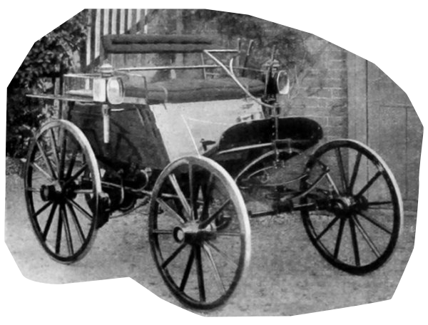
The Yeovil Motor Carriage Company began making small two-person motor carriages in 1897. They were well named as they were clearly converted carriages, with no space for horses. The business only lasted two years.
In Exeter William Shepherd and his sons built a car in 1899, and went on to open W. Shepherd and Son, Motor Car manufacturers & Repairers, in 1901.6 I wonder how many cars they actually repaired in their first few years? They were successful enough, however, to have continued in the city into the 1950s.
The first car in Exeter, a Benz, came with the circus in 1896 or 7. The brewer John Evony Norman was the first man in the city to get a numberplate, in 1903, the year the Motor Car Act was passed. His number, FJ1 was joined by eight other registrations by the end of the year.
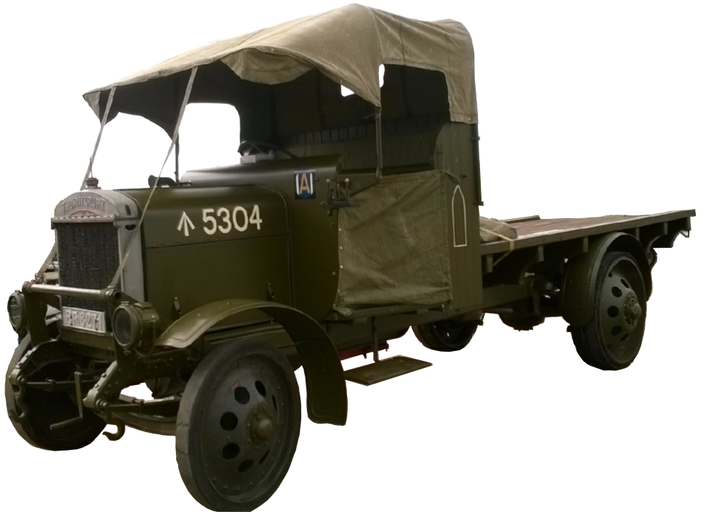
In Basingstoke, the Thornycroft Steam Wagon Company Ltd arrived from Chiswick, in 1898, where from 1903 to 1912 they manufactured high-end motorcars. What they were best known for, however, were commercial vehicles.
Their Type J, 4 ton lorry, gained a reputation for reliability and durability during WW1. The company continued making a range of large vehicles at Basingstoke until 1972.
Along the road at Salisbury, a firm called Dean and Burden produced the ‘Scout’ car. They changed their name to Scout Motors in 1906, eventually producing fifteen hundred cars before they folded in 1921.
The Road gets a Number
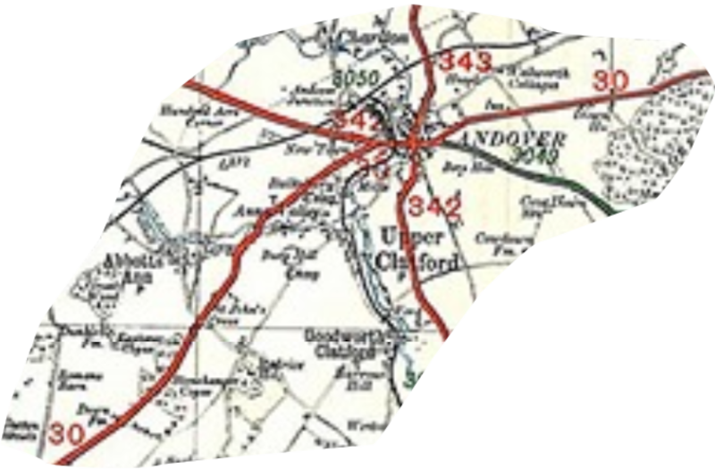
All of these enterprising concerns were started before there was an A30. But it did arrive, in 1923. The MoT map shows the road, west of Basingstoke, running along what is now the B3400 to Andover then along the A343 to Lopcombe Corner, where it joined today’s A30 once more. From there on it’s basically the modern A30, except, no bypasses, it simply ploughs through Salisbury, Shaftesbury, Yeovil and Exeter. Back then, the road south-west from Exeter, took you through Okehampton and Launceston, where today it is not so much a question of bypasses, as a complete realignment of the road.
After Launceston, the 1923 road was much as today’s, if a bit wigglier. Of course, it went past Jamaica Inn and through the centre of Bodmin, emerging via what is now the A389 through Lanivet, before rejoining the modern A30. All the towns and villages the A30 once went through are now bypassed. Some of those bypasses, such as the first one round Redruth date back to the 1940s. It was upgraded when Camborne was bypassed in 1975, and a bypass round Hayle arrived in 1984. Originally, the A30 finished at Penzance, but not for long. In 1925, the green 3318 (no letters in 1923, ‘B’ roads were green) became the A30.
The Alternative to theA30: the A303
Of course, the road wasn’t to be left alone, and 1933 saw a major rearrangement. Summer traffic was already beginning to be a problem, so the planners created the A303 as an alternative route between Basingstoke and Exeter. You may search in vain for the 303 on the 1923 map, for it wasn’t there.
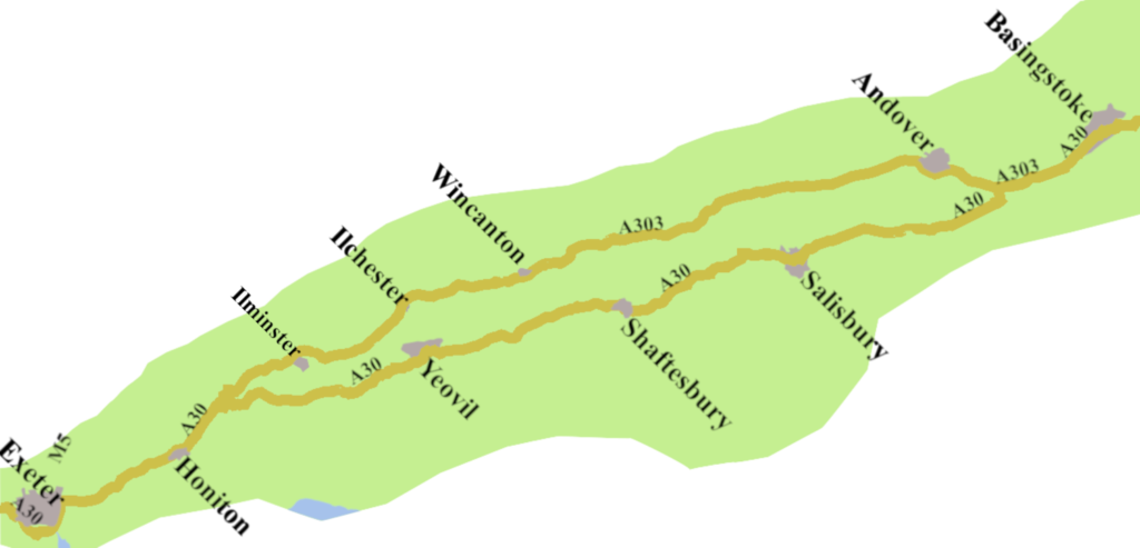
The new-made road mostly followed William Hanning’s eighteenth century New Direct Route, including some seriously old ways around Stone Henge. We are not doing the A303 here, but anyone who is interested should read Tom Fort’s highly entertaining, and well-informed book The A303: Highways to the Sun.
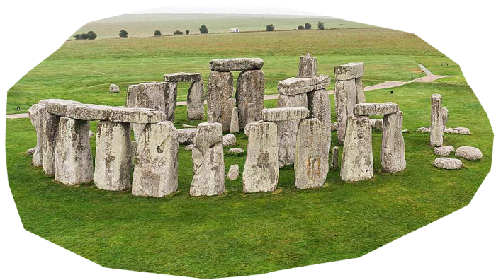
All I will say is, for generations, the trip across Salisbury Plain, past the ancient standing-stones, was part of the whole business of going on holiday.
The rearrangement had an impact on the A30. Instead of going to Andover, from Basingstoke it followed the A303 as far as Micheldever Station, where it forks left, for Egypt and Stockbridge, while the A303 forks right towards Andover. On a 1951 Bartholomew map, the A30 is shown as continuing along, what is now, the unclassified Stockbridge Road, to Sutton Scotney. From there on, it’s Stockbridge, and so on to Salisbury.
A Shy Road
On modern maps, between Basingstoke and Honiton, the A30 seems surprisingly coy. It’s there, but you have to look for it. To be fair, when you find it, it’s not a swift drive, but that’s the point. If you’re in a hurry, there’s the M4/M5 route. Though, if you are looking for a pleasant trip though a particular version of English countryside, with echos of Alfred the Great, and Thomas Hardy, the A30’s as good a road as any.
Dip off the bypasses to take in Salisbury, Shaftesbury, Yeovil, and the other pretty towns the road once served. Beyond Exeter, you can get a move on, provided you avoid peak holiday season. Launceston, Bodmin, and Penzance all fine A30 towns, and worth stopping off for. Indeed, much of the road offers the feel of a way that has been travelled through the long arc of time.
- Defoe, Daniel, 1724 to 1727. A Tour Thro’ the Whole Island of Great Britain, George Strahan London ↩︎
- Philo, Phil, and Mills, John, The Bedfont Gunpowder Mills, https://www.wargm.org/WASC/Files/wasc_1525_00.pdf ↩︎
- It was called the Fisherton, Wilton, Heytesbury, Willoughby Hedge & Redhone Turnpike Trust, 1761. ↩︎
- Cary, John, 1789, Cary’s New Itinerary, Printed for John Cary, 181 Strand London. ↩︎
- Cary John, 1828, Cary’s New Itinerary, Printed for John Cary, 181 Strand London. ↩︎
- W. Shepherd and Son, Grace’s Guide to British Industrial History, https://www.gracesguide.co.uk/W._Shepherd_and_Son ↩︎
Leave a Reply