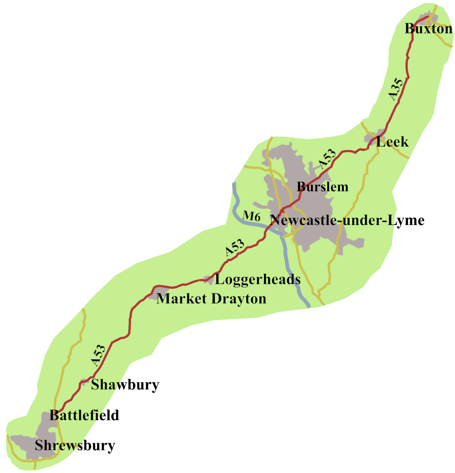
Though the A53 only covers some fifty-five miles, there is more history along it than you might expect. As a result, this post is slightly longer than some. The road is mostly rural, some of it dating back to the Romans, except for where it goes through Stoke-on-Trent, the historic centre of Britain’s pottery industry.
The Roman Connection
Buxton has a natural warm spring, so of course, the Romans were there. They called the town ‘Aquae Arnemetiae’, built bathhouses, and made votive offering at the spring itself. A hoard of coins, whose dates covered the occupation period, was found in 1975.1 The only other ‘Aquae’ town in Britain was Bath, in Somerset.
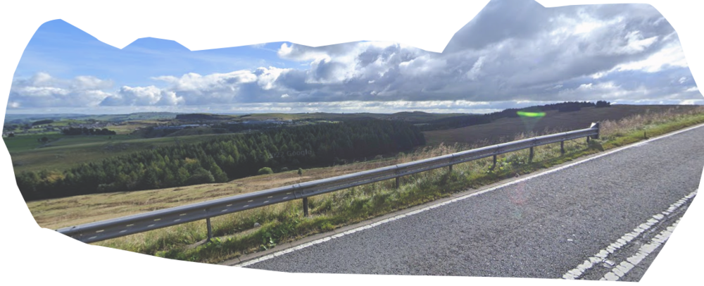
Romans built a road from Buxton to Leek, which, as today, kept just east of Axe Edge Moor, offering spectacular views over the Derbyshire landscape. This part of the A53 mostly follows the route the Romans laid out.
After Leek, the Romans left the line of our road, and went to Blythe Bridge.
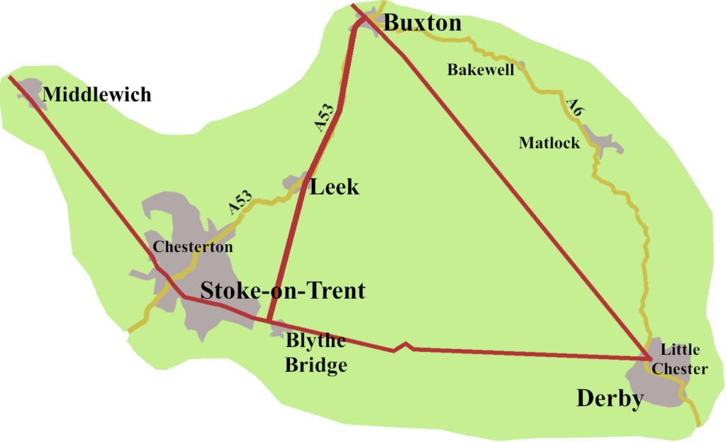
There it met a road from Little Chester, in Derby, which went through Blythe Bridge, to a fort and settlement at Chesterton, just north of Newcastle-under-Lyme.2 That road, continued through Middlewich with a branch going to Chester, while another headed north to cross the Mersey at Warrington. It was a part of a network of roads in the area, including one running directly from Buxton to Little Chester.
Saxon Settlements along the A35
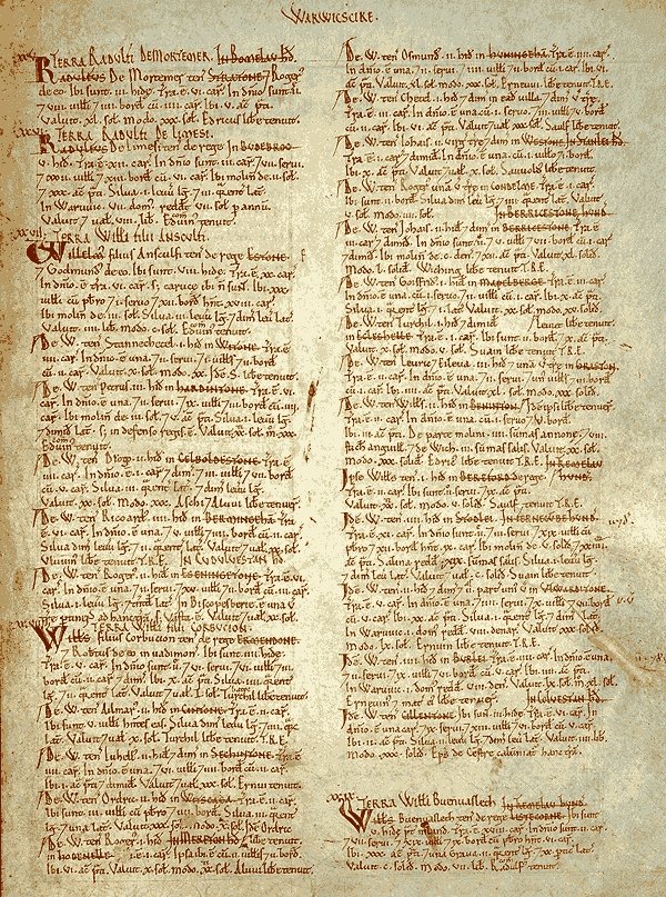
One way to get some idea of which towns and villages arrived along the road in the Saxon period is to see if they are listed in the Domesday Book of 1087. Of course Buxton and Leek appear, but then there is no other settlement until you reach Burslem, (which is listed as Bacardeslim) so is Woolstanton. Neither are on our A53, but they were on the turnpike, until the 1840s.
Further south-west, more places were already established by 1087. Before you reach Market Drayton, which is in the book, we find Whitmore, recorded as Witemore. Beyond Market Drayton, Wolerton, and Hodnet, are both in Domesday. They aren’t on today’s A53, but were until the 2003 bypass arrived. Shawbury and Shrewsbury, both founded in the Saxon era, are listed. A line of settlements, yes, but no record of a road, though there must have been one, we just don’t know where it ran.
The A53 in the High and Late Middle Ages
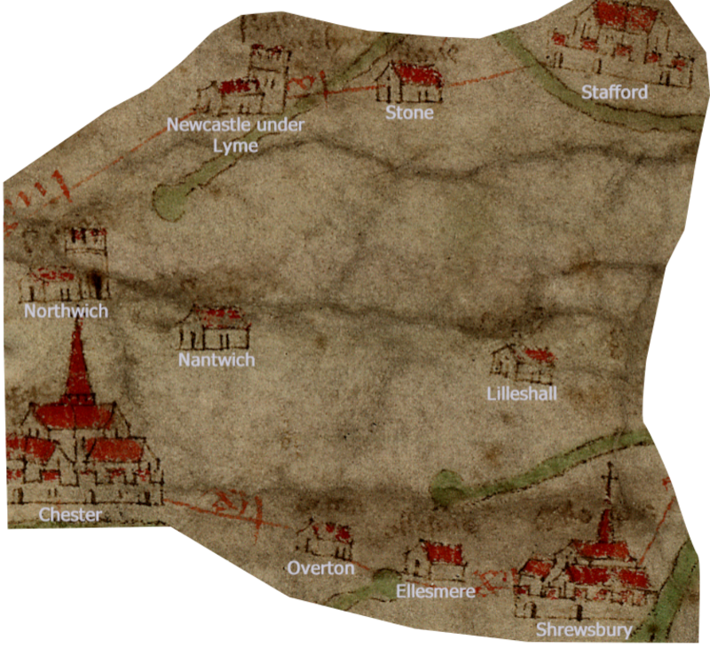
Throughout this period, it is difficult to find direct evidence for a road which might be the forerunner of the A57. The Gough Map, from the late fourteenth century, does mark Shrewsbury and Newcastle-under-Lyme, though no sign of a road. That does not always matter, but none of the other towns or villages along the way are given. The road shown tends to run more east-west than north-south.
Important abbeys stood at Shrewsbury and Dieulacres, just north of Leek. Shrewsbury was pilgrim centre, but I can find no records of the roads along which pilgrims travelled.
15th Century Battles along the Road: the Battle of Shrewsbury
It is a sad fact that evidence of a road too often comes from warfare and battles. I have been saying the A53 runs from Buxton to Shrewsbury, in fact, it never reaches Shrewsbury, stopping about three miles to the north-east at Battlefield. The village gets its name from being the site of the Battle of Shrewsbury, in July 1403.3
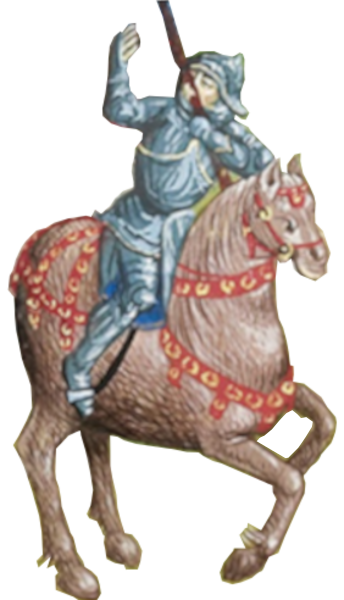
On one side were the forces of Henry IV, who had deposed Richard II and seized the crown. Against him was an army led by Henry ‘Hotspur’ Percy, the son of the Earl of Northumberland. Though they had helped Henry Bolingbroke to seize the crown, the Northumberlands had fallen out with him. Hotspur had been involved with trying to suppress Owain Glyndŵr’s uprising in Wales, but had changed sides, and was bent on taking Shrewsbury, and link up with the Welsh forces. Neither army marched along our road, but where the battle was fought marks the southerly end of today’s A53.
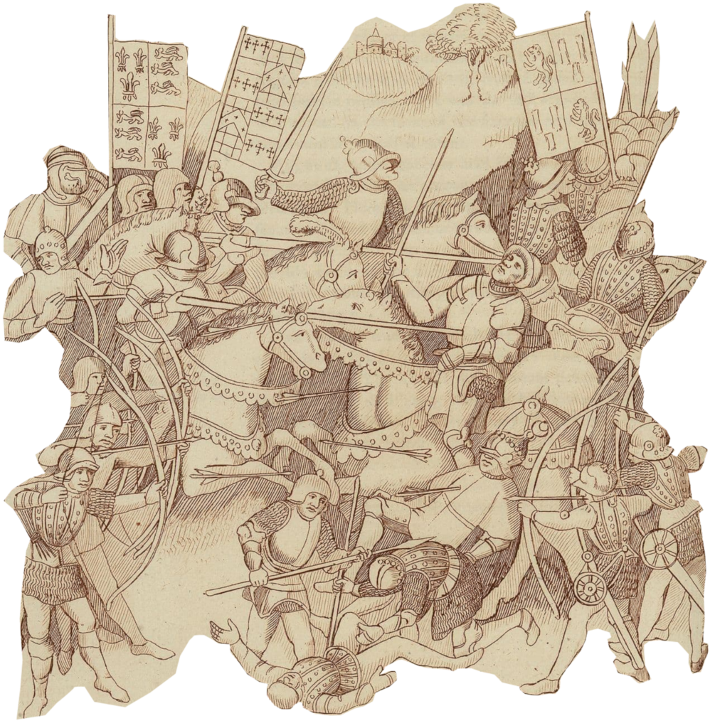
It was the usual bloody affair. Although Hotspur’s men were outnumbered, at first, they held off the king’s forces. In the end, though, they were overcome, and Henry ‘Hotspur’ killed. The result was to consolidate Henry IV’s grip on power.
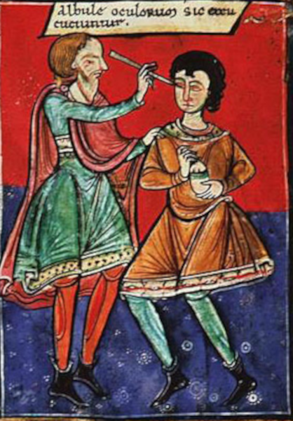
An interesting note is that Henry, Prince of Wales, the future King Henry V, (there are a lot of Henrys in this story) took part in the battle, though still only fifteen. During the fighting, an arrow hit him in the face, just beside his nose. He, refused to leave the field, fearing it would dishearten the troops, but later the London surgeon, John Bradmore, removed the shaft, leaving the arrowhead where it was. It is difficult to know what damage was done, but the arrow must have smashed Henry’s maxillary bone, and could have broken upper teeth, or pierced the nasal cavity. Whatever the case, he had to wait some days while Bradmore devised a special tool with which he was able to extract the rest of the arrow.5 The whole process must have been excruciatingly painful, and, remarkably, no serious infection developed. The Prince of Wales recovered, though he must have carried a scar for the rest of his life.
15th Century Battles along the Road: the Battle of Blore Heath, 1459
Another battle took place fifty-three years later, a little north of Market Drayton at a village now called Loggerheads, It is a relatively recent arrival, not marked in my 1952 Bartholomew Atlas. An inn, called the Three Loggerheads, which stood by the road from the sixteen hundreds is still there today, now called The Loggerheads, just off a mini-roundabout on the outskirts of the village. The name is the subject of some debate, but rather than celebrating three not very clever chaps, it probably refers to the three leopard heads, known as ‘loggerheads’, on the coat of arms of Shrewsbury.
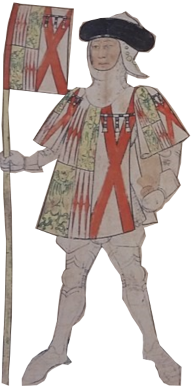
The village wasn’t there in September 1459, when Richard Neville, Earl of Salisbury, brought his troops towards Market Drayton, down the road from Newcastle-under-Lyme. He was hurrying to join forces with those of his bother-in-law, the Duke of York, at Ludlow. It led to the first set-piece battle in what we now call the Wars of the Roses, the Battle of Blore Heath.6
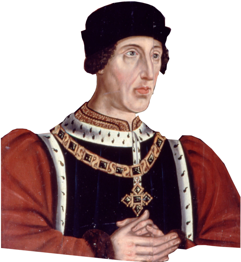
The tie to the Battle of Shrewsbury is, Henry IV grandson, Henry VI, was king. He suffered from a psychiatric disorder, which allowed other warlords, particularly Richard of York, to try for the throne. The king may not have been in a good way, but his queen, Margaret of Anjou, an intelligent and forceful character, had taken charge of the situation.
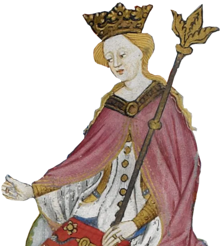
The Queen ordered Lord Audley to go to Market Drayton to cut-off Salisbury’s advance, and take him prisoner. It is likely the line of the road sat further north at the time, but eventually the opposing forces faced each other at Blore Heath, close to Loggerheads.
The details of the battle are complicated, but Audley seems to have made a reckless charge, his forces becoming mired crossing a brook, allowing the Yorkists to counter-attack. The Lancastrian infantry joined the fray, and during the vicious struggle that ensued, Audley was killed. That was the end really, the Lancastrian troops broke, some joining the Yorkist ranks.
It is believed Margaret of Anjou watched the defeat of her army from the tower of St Mary’s Mucklestone church, a mile north of the A53. The tower still stands, having survived several restorations to the rest of the building.
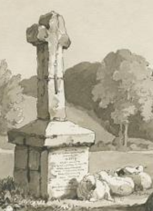
A cross was erected at the spot Lord Audley died. It was replaced in 1765 with the stone one which stands today.
Turnpikes Arrive Along the Road
We’re skipping a couple of centuries because I can’t find any evidence of a road from Buxton, through Newcastle-under-Lyme, to Shrewsbury during that time. One was there, for sure, but no record of it. None of the usual suspects, John Leland, John Ogilby, Celia Fiennes, are any help. They do show us Shrewsbury, and Newcastle-under-Lyme existed, but didn’t use the road running between them.
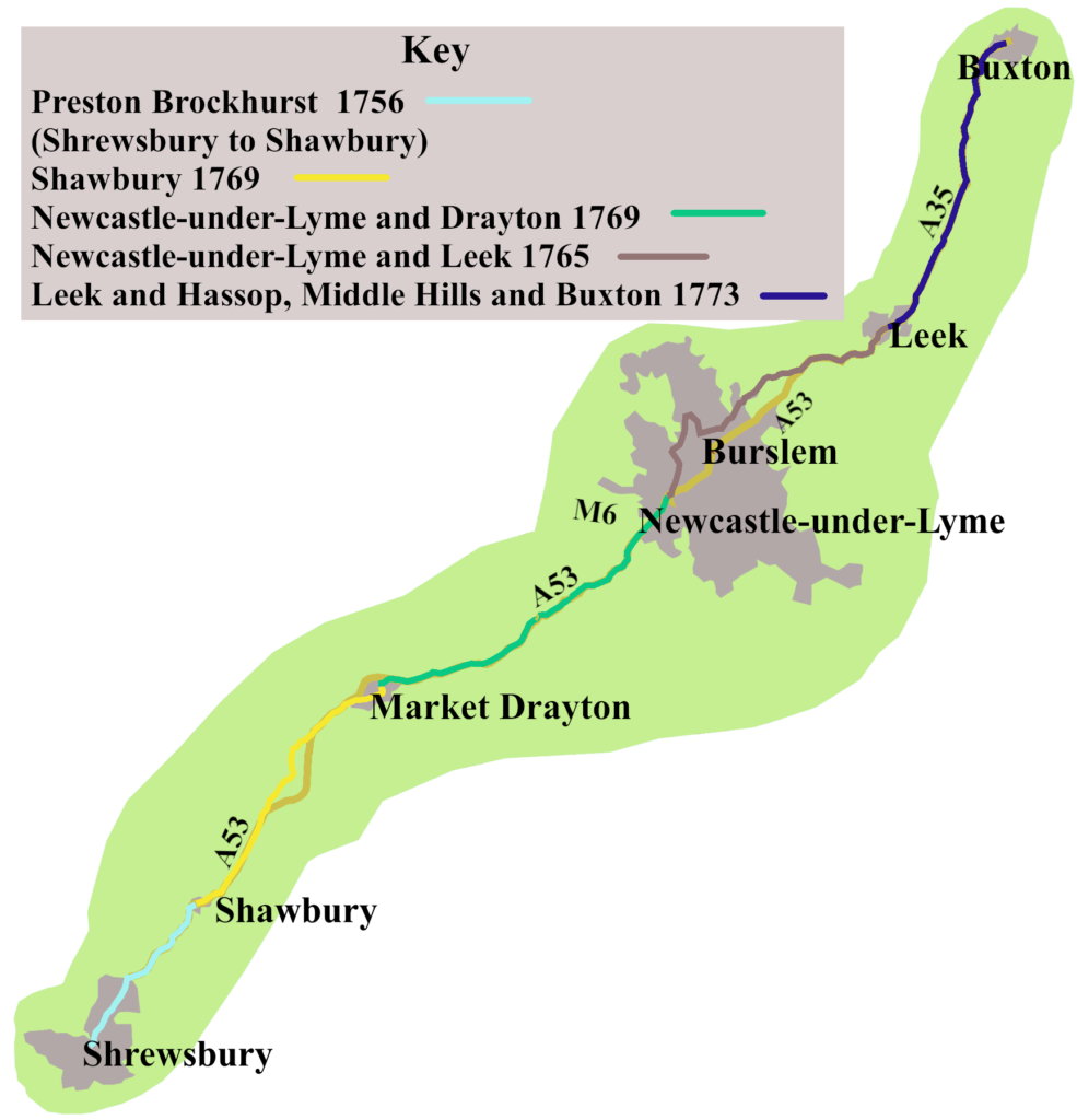
The first turnpike along the road was between Shrewsbury and Shawbury, came in 1756. It was part of a trust covering several roads, so is called the Preston Brockhurst Trust. That was it for nine years.
In 1765, Josiah Wedgwood wrote, in a letter to his brother, “We pray to…. have the Road made turnpike from Buxton and Bakewell to Leek, & from Leek to Newcastle.”7
His wish was partly granted, in that the bill establishing the Newcastle-under-Lyme and Leek Trust was passed that year. He had a wait until 1773 for the road from Leek to Buxton to have a turnpike. Meanwhile, two trusts, established in 1769, covered the road from Shawbury to Newcastle.
Though the turnpikes laid down the basic outline of the future A53, they didn’t give the exact route.8 We’ve already seen that the villages Hodnet and Wollerton were on the road until 2003, and the Shawbury Turnpike ran through them. It must be remembered, there was no call for bypasses. Stage coaches needed to stop at inns every eight to ten miles. So the turnpikes went through the centre of Shawbury, and Market Drayton.
The Turnpike Through Newcastle-under-Lyme
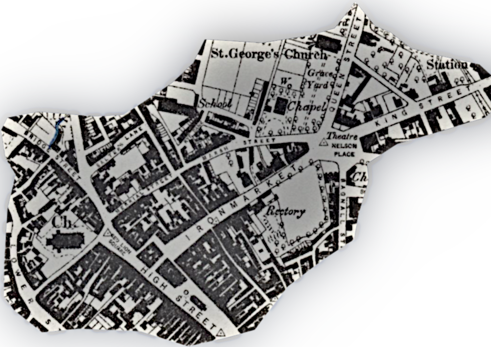
Getting through Newcastle, matters became complicated. There was a north/south turnpike from before the Newcastle-under-Lyme and Drayton Trust began. The turnpike on our road would have come into Newcastle along Church Street to end at Lion Square. The square has gone now, but it sat where High Street, Liverpool Road and Bridge Street meet. The Newcastle-under-Lyme and Leek Trust, established four years earlier, took over, going along Merrial Street, which used to become Marsh street. On the late 1870s map, Nelson Place is marked, but it wasn’t fully developed until 1818. In the eighteenth century, Marsh Street took you to Queen Street, and on towards Burslem.
Through ‘The Potteries’
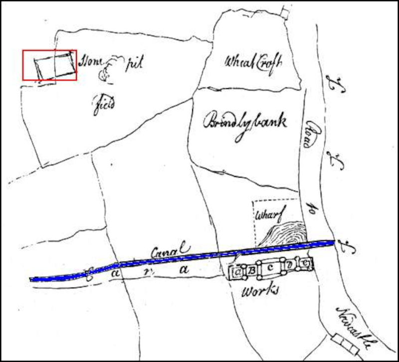
The sketch map on the right, the Ridgehouse Estate, bought by Wedgwood in 1766. It shows the “Road to Newcastle” running past what would become Etruria in 1769. The blue line is the Trent and Mersey Canal, which wasn’t finished until 1777.
The mid-eighteenth century was the period when the six towns, which we know as ‘The Potteries’, expanded to become one of the leading ceramic manufacturing centres in the World.
The area, particularly around Burslem, had been known for its potters from at least the fourteenth century, if not before. It offered easily dug clays of several different types, and coal. In addition, people held their land as ‘Copyholders’9 which gave them more freedom to operate independently from the great landowners.
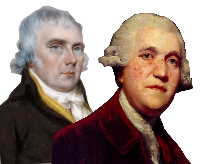
The Wedgwood family were an established pottery makes, but Josiah Wedgwood, who opened his first ‘potbank’ in 1759, had the drive and vision essential to the explosive rise of ‘The Potteries’. He was by no means alone, however. The likes of William Greatbatch, Thomas Whieldon, and of course, Josiah Spode, among others, revolutionised what could be made from clay.
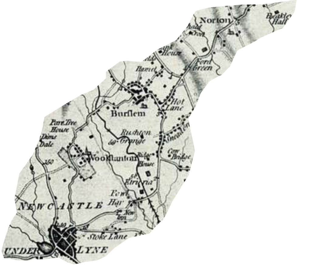
How the turnpike make its way through ‘The Potteries’ is complicated. To try to make sense of it, we can turn to William Yate’s map of North Staffordshire, 1775.10
We see after it left Newcastle, the road climbed toward Corbridge, which is marked as Cow Bridge. It must have picked up the southern end of today’s Elder Road. This in turn fed into what we now know as Nile Street. One branch of the road continued north into Burslem. The road to Leek, though, took a right turn into Hot Lane, continuing on through Norton, to meet with the line of the modern A53 at Endon.
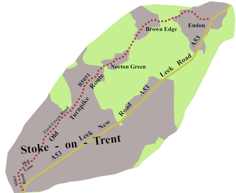
We’re not quite finished with the A53 turnpikes through the Potteries. A new, straight piece of road was built, starting about 1839, running off from the southern end of Elder Road, through Stockton Brook, to Endon. Leek New Road is still the line of our road today. From Endon, the turnpike pretty much mapped today’s A53 as far as Leek.
Leek to Buxton
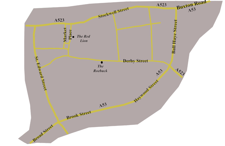
The basic road pattern in the centre of Leek hasn’t changed much from the eighteenth century. The road from Derby, via Ashbourne to Stockport, the A523, runs north-west/south-east, with our A53 going in the other direction. Today you are kept away from the centre, directed along roads which were always there, but now form a ring round the town.
The turnpikes, though, would have made for the Market Place, or Derby road to stop at one of the two principal inns the Red Lion, and The Roebuck, both still with us. They would then have set out, once more, along Stockwell Street to reached Buxton Road, which is today’s A53.
From Leek, the turnpike went through Upper Hulme, which was bypassed in the 1950s and on to Flash Bar, a little north of Flash, the highest village in England.
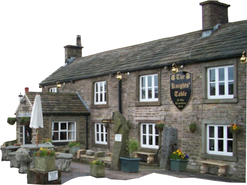
There was a tollgate here, and an inn called the Travellers Rest, which is now a bed and breakfast, called the Knights’ Table. In its time, Flash had a reputation for roguery. The remote setting, on the borders of Derbyshire, Cheshire, and Staffordshire, allowed the lawless to skip from one jurisdiction to another to avoid being arrested. The village was particularly known for counterfeiting coins, to the extent that “Flash money” entered the language.
Just past Flash Bar, the road, which has been climbing steadily since leaving Leek, starts to head down, revealing sweeping views to your right. The turnpike went this way, down hill past the junction with a turnpike heading for Congleton, now the A54, and so into Buxton.
Cycling along the Road
As the turnpikes faded, a boom in cycling happened, all around the country. The North Staffordshire Bicycle Club began in the 1870s, in association with the Victoria Athletic Club, which was formed in 1868 to organise a sports meeting for the annual Wakes Week.
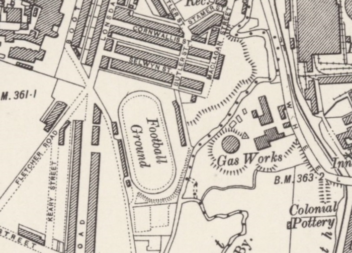
In 1878, the club opened the Victoria Athletic Ground, which included an oval cinder track, with space enough in the middle to be the home of Stoke City F.C. The Bicycle club held its first races there the same year.11
Further on, we find the Leek and Moorlands Club, formed in 1876. It changed its name to Leek Cyclists’ Club, and is still going strong. As always, the enthusiasts who joined clubs were a tiny minority of the millions who cycled, pretty much everywhere, in the last quarter of the nineteenth century.
Along the A53, though, cyclists may not have had it all their own way because horse-drawn transport must have continued at both ends of the road. The reason: only Stoke and Leek had a direct railway connection, which began in 1867. No trains ever ran from Buxton to Leek, or Stoke-on-Trent to Shrewsbury. So it’s a good bet people used horses, carts, traps, and even carriages.
Cars Begin to Arrive
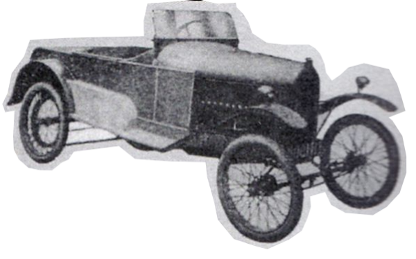
Cars took a time to arrive along the road.
The Menley Motor Company12, in 1920, manufactured a ‘cyclecar’, between Newcastle and Etruria, on what would become the A52. It wasn’t a great success. They only built sixteen of them, and went out of business within the year.
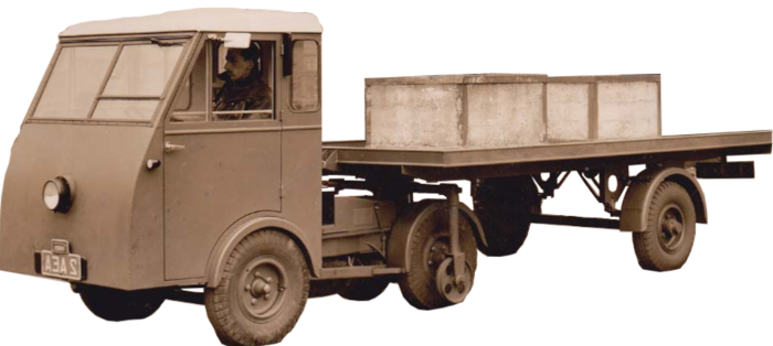
Starting in 1947, Jensen manufactured commercial vehicles at their Campbell Road works in Stoke13. They pioneered lighter vehicles, and made an early articulated lorry, the ‘Jen-Tug’. The move to Stoke was always intended to be temporary, so in 1951 they transferred to their new plant at Kingswinford in the West Midlands.
Today’s Road
It turns out the A53 has been an unusually stable road. Coming off a mini-roundabout on the A6 in Buxton, it takes you up over the moors, and down towards Leek as the Romans, and the turnpikes did.
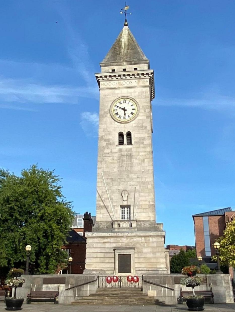
The route through Leek doesn’t show you the best of the town, though you do pass the Memorial Tower, on the corner of Ball Haye Street and Ashbourne Road. It was built by Sir Arthur Nicholson in memory of his son, and the other sons of Leek, killed in the Great War.
As you move on, apart from the bypass round Market Drayton which means you don’t see much of the town, the A53 stays close to the late eighteenth century route.
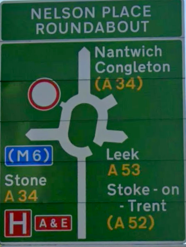
Through Stoke along Leek New Road, from the 1840s, and on to Etruria Road, to go past the New Vic Theatre, there is a worrying moment when the sign for the Nelson Place Roundabout only offers the A53 heading back for Leek. Grit your teeth and follow the A34, and eventually, you are on your way to Shrewsbury.
Of course, you never reach the town, for our road stops at the Battlefield Roundabout, where it meets the A49 from Ludlow to Whitchurch.
So we see the A53 is a short road with much to say for itself. The next post will be about a longer road, which also has much history running along it: the A10
- Aquae Arnemetiae, Historic England Research Records, Heritage Gateway Website, https://www.heritagegateway.org.uk/Gateway/Results_Single.aspx?uid=306059&resourceID=19191 ↩︎
- Ratledge, David, 2026, Derbyshire’s Roman Roads, Travelling with the Romans Website, https://www.twithr.co.uk/derbyshire/derbyshire.html ↩︎
- Shilston, Peter, G., 2018, The Battle of Shrewsbury, 1403,Peter G Shilston’s Blog
https://petergshilstonsblog.blogspot.com/2018/10/the-battle-of-shrewsbury-1403.html ↩︎ - Pennant, Thomas, 1781, A Tour in Wales, Printed by Henry Hughes ↩︎
- Battle of Shrewsbury, BritishBattles.com, https://www.britishbattles.com/one-hundred-years-war/battle-of-shrewsbury/Battle ↩︎
- Historic England, 1994, English Heritage Battlefield Report: Blore Heath 1459, https://historicengland.org.uk/content/docs/listing/battlefields/blore-heath/ ↩︎
- Hunt, Tristram, 2021, The Radical Potter. Josiah Wedgwood and the Transformation of Britain, Allen Lane ↩︎
- Rosevear, Alan, 2023, Turnpike Roads in England and Wales Website, http://www.turnpikes.org.uk/ ↩︎
- Wedgwood, Josiah, C., 1913. Staffordshire Pottery and Its History, Sampson, Low, Marston & Co. ↩︎
- Yates 1775 Map of North Staffordshire – Public domain old map, https://picryl.com/media/yates1775mapofnorthstaffordshire-b9d7e6 ↩︎
- Baxter, Tony, 2025. Stoke-on-Trent – Victoria Athletic Grounds, oldvelodromes.co.uk Website, https://oldvelodromes.co.uk/HTML%20tracks/804.html ↩︎
- Did You Know? – there was once a car manufacturer in Stoke-on-Trent, thepotteries.org Website, https://www.thepotteries.org/did_you/015.htm ↩︎
- Jensen Motors – Pensnett Factory, Kingswinford, Jensen Museum Website, https://www.jensenmuseum.org/jensen-factory-pensnett-kingswinford/ ↩︎