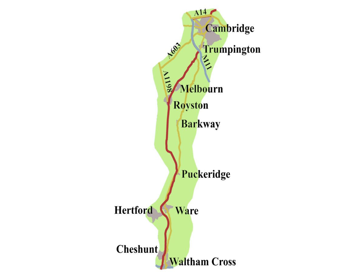
This second part of the history of the A10 road takes us from where it crosses the M25 to Cambridge. We will find today’s route took a time to settle. The Romans approached Cambridge differently from how people in the Middle Ages went, and the modern route did not arrive until the eighteenth century. As you may imagine, a certain amount of history has played out along the A10.
The Roman A10: Ermine Street
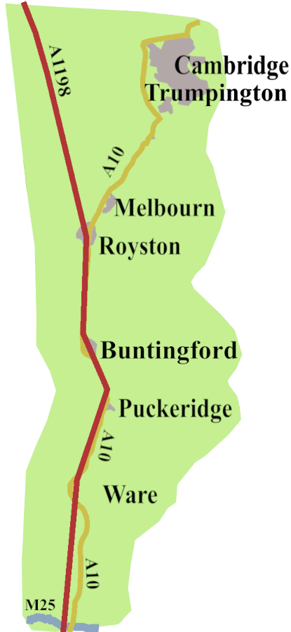
We like to say the A10 runs along Ermine Street, (Margary number, 2) but, it turns out to be more complicated. By the time the Roman road crossed where the M25 would be, their road lay west of our A10. It headed straight north, skimming the western edge of Hertford Heath, to cross the River Lea at Ware, already an Iron-Age settlement.1
From there, the Roman road followed the Cambridge Road, through Wadesmill to Puckeridge. About three-quarters of a mile beyond Puckeridge, the road crossed the River Rib, near Braughing, a significant Roman settlement on the junction with Stane Street running east/west between St Albans and Colchester2
Ermine Street rejoined the line of the A10 a little south of Buntingford. Today’s road bypasses the attractive market town, but the ghost of the straight Roman road runs through it, still called Ermine Street on its way north. The A10 maps Ermine Street to Royston. The Romans continued north, to Godmanchester along the A1198, originally the A14, but that number got used for a completely different road.
The Roman A10: Akeman Street
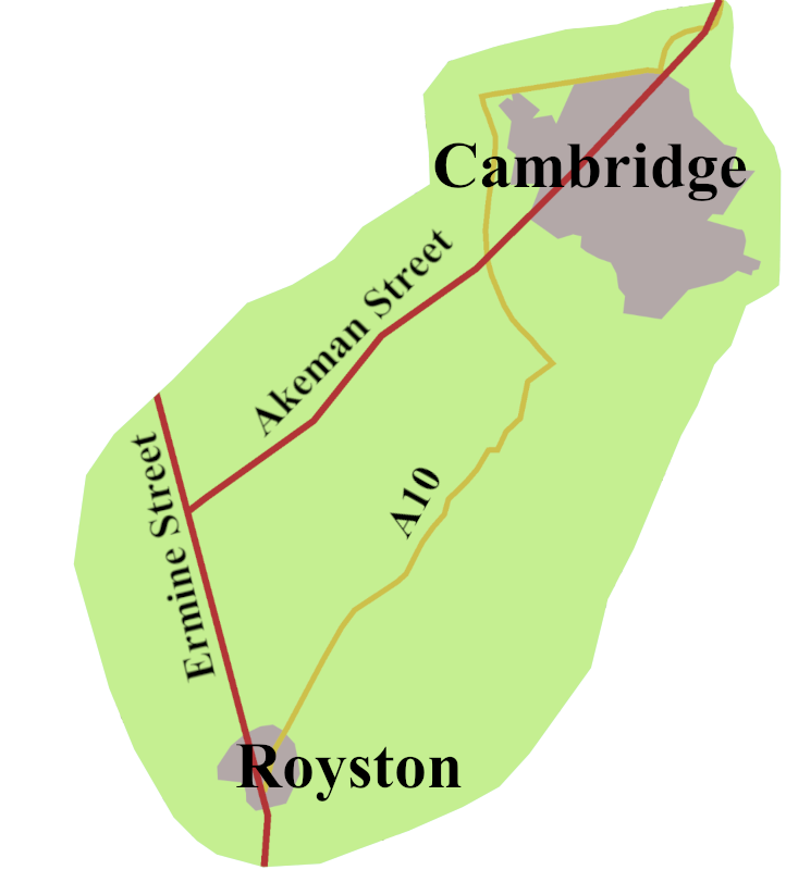
Nowadays, as you come into Royston, you hit one-way signs, and the A10 follows a long right-hand bend towards Cambridge. The Roman route, though, continued along Ermine Street for about four and a half miles, to a junction with a road running south-west to Sandy, on today’s A1. On the other side of this junction, a road, known as Akeman Street (Margary Number 23), made off north-east, more or less, following the route of today’s A603. In Roman times, it arrived at Castle Hill, in Cambridge, where there was a fort called Duroliponte, or perhaps Durolipons.
The Anglo-Saxon Road
Waltham is perhaps one of the oldest Saxon settlements in that part of Essex, its church dating from 700 BCE.3 As Cheshunt and Hoddesdon are both in the Domesday Book, we can assume they were there before the Normans came.
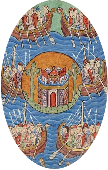
Ware had been a Romano-British settlement, whose significance increased when the River Lea was made the boundary of Danelaw territory in 886. Alfred the Great set about building weirs, to prevent the Danes from sailing down river to attack London. It is now generally believed that the name Ware came from the Saxon word for a weir, ‘waras’.4
Once the Romans left, Angles, and other Germanic groups began to arrive at Cambridge. There were settlements around Market Hill, and by the river, with an inland port for vessels coming up from the Wash. During the Saxon period a bridge was built over the Cam where Magdalene Bridge (also known as Great Bridge) is today. It would carry the A10 until the 1980s. The town was overrun by Danish invaders in the ninth century, and was sacked, and burned by Vikings, in 1010. Naturally, such a thriving settlement was immediately rebuilt, and is recorded as a sizeable town in Domesday5.
The Road Through the Middle Ages
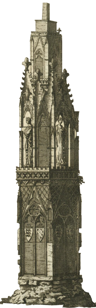
When the Normans arrived, Ermine Street already ran north from London, coming to be known as The Old North Road. Waltham Cross was the first town they met. An abbey had stood on the east bank of the River Lea from 1030, but Waltham Cross, on the other bank, came later. It grew up because, following the death of his beloved wife, Eleanor of Castile, in 1290, Edward I had her coffin carried to Westminster to be buried. At each place the sad procession halted overnight, Edward commanded a cross to be built. A town grew up around the elaborate cross, one of only three that survive from the original twelve, which became Waltham Cross
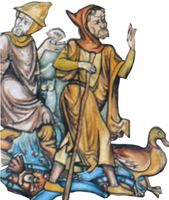
Further up the road, Ware was a known stopping-off place for pilgrims heading to the shrine of Our Lady of Walsingham. After Canterbury, Walsingham was perhaps the most visited shrine in England. In fact, for a long time, the main street through Ware was known as Walsingham Way.
Pilgrims would have continued up the A10, turning off at Puckeridge to go through Barkway, before turning east along the Icknield Way to Newmarket and Bury St Edmunds, and on to Little Walsingham.
Royston Arrives
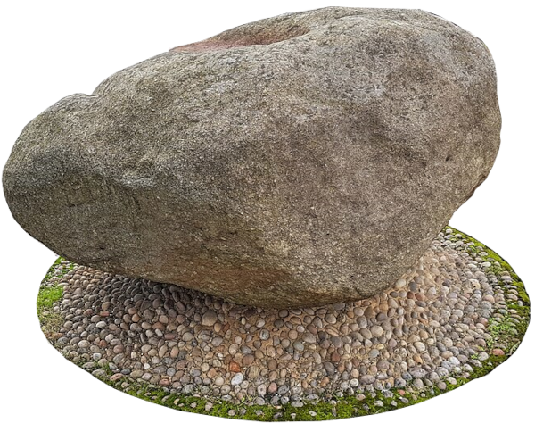
Royston is a town which came because of the road. Early in the Norman period a woman, known to us as Lady Roysia, (there are two contenders) had a cross erected at the Ermine Street/Icknield Way crossroad. She used a boulder, probably glacial moraine from the last Ice Age, as the base. The cross is long gone, but the stone still sits where the ancient roads met. No town yet, though as it arrived it became known as Roysia’s Stone, and eventually, Royston. A Papal Bull of 1184 tells us there was already a small priory at Roysia’s Cross. The following year, Richard I granted the priory a charter to hold a weekly market, and a fair at Whitsun. Now we have the makings of a town. Given its position on two major highways, it is not surprising Royston flourished.
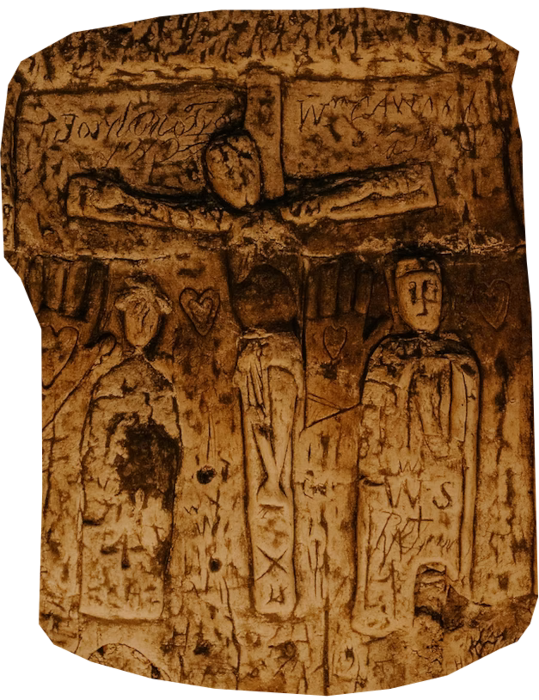
There is a curiosity; a man-made cave found in 1742, just to the east of the crossroad. The walls carry religious images, and perhaps, Royston Cave was used by the Knights Templar. Unfortunately, as all the soil that filled the space, together with anything buried in it, was thrown away, there is really no firm evidence for who dug it. You can, though, book a guided visit, at the weekends in the summer.
The Gough Map and the Cambridge Road
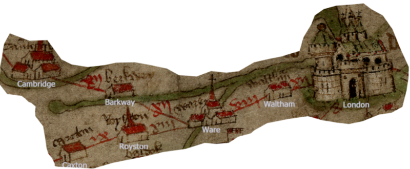
Pilgrims heading for Walsingham were unlikely to go through Royston to reach the junction with Akeman Street.
The Gough map, from the late fourteenth century, clearly shows the road from London to Cambridge left the Roman road after Ware, to go through Barkway to reach Cambridge. The turning was probably at Puckeridge, foreshadowing today’s B1368. The route became known as ‘The High Way to Cambridge’. Once the university at Cambridge was established in 1209, it was the road students travelling from London would certaily have taken.6
Tudor on the A10
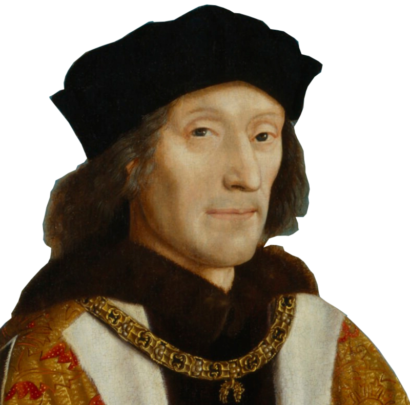
Henry VII visited Cambridge at the end of the fifteenth century. It is recorded he
“rode to Waltham; and from thens the High Way to Cambrige…where he was honourably received both of the university and the town.”7
He visited four more times, including in April 1506. On that occasion he attended a service at the uncompleted King’s College Chapel, and was so impressed he began financing the next phase of the work, and left money towards its completion in his will.
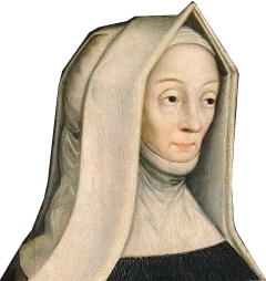
Henry was following his mother’s example. She, Margaret Beaufort, re-founded Godshouse as Christ’s College in 1505, and St John’s College in 1511.
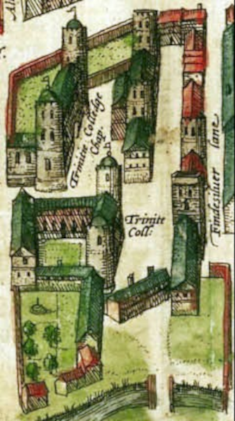
Margaret’s grandson, Henry VIII, only visited Cambridge once, in 1522. However, he did found Trinity College in 1546. It grew from the merger of two existing colleges, Michaelhouse and King’s Hall, both of which dated to the fourteenth century. Structures from both of the former colleges exist within Trinity, including The Great Gate which had been part of Kings Hall.
John Leland was in Cambridge, on Henry’s business, sometime in the 1530s. From the point of view of the road, he provides some vital information. He says, he left Cambridge, and went through Hauxton, (Hauston) to reach Royston (Reiston). Thus, he gives us of the first records a route that prefigures the A10 from Cambridge to Royston. It has to be said, Leland was not overwhelmed by the charms of Royston, and the surrounding area.8
Queen Mary I’s Travels in 1553
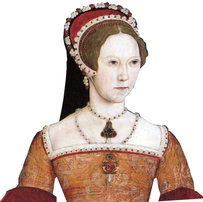
On the 6th July 1553 Edward VI, Henry VIII’s only son, died. John Dudley, the Duke of Northumberland, de facto regent over the fifteen-year-old king, kept his death a secret. According to Henry VIII’s will, Mary, his elder daughter, by Catherine of Aragon, should succeed. Northumberland, though, mounted a coup d’etat to put the protestant Lady Jane Grey on the throne.
Knowing how ill the boy was, he had already sent urgent letters to Mary, and her half-sister, Elizabeth, calling them to Greenwich.
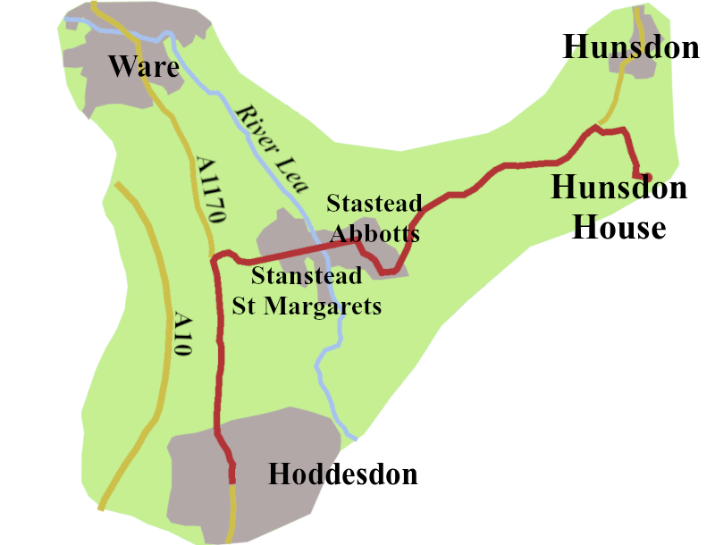
Mary had been living in seclusion at Hunsdon House, about four miles south-east of Ware. In response to Northumberland’s letter, she set out for London, probably joining the Old North Road just beyond Stanstead St Margarets. She then headed south as far as Hoddesdon, on the London Road, three and a half miles south of Ware. Here she was intercepted by her supporters, who told her the invitation to Greenwich was a trap, and urged her to flee into East Anglia.9
Mary turned north up the line of the original A10, then along the familiar High Way to Cambridge. It is probable she took the road through Barkway, but, further north, most likely turned east onto Icknield Street, (now the A505). That night, she stayed at Sawston Hall, six miles south of Cambridge, leaving early the next morning to travel to Norfolk.
Elizabeth I and William Cecil’s Visit to Cambridge
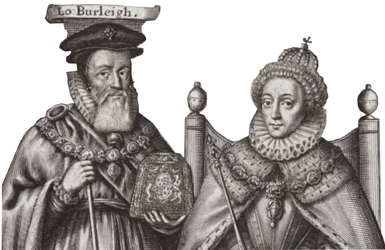
Queen Elizabeth I made a sumptuous four day visit to Cambridge in the summer 1564. However, it doesn’t look as though she used the A10.
William Cecil, the Queen’s Secretary, did though,travel our road to oversee the preparation for the visit He set out, from Enfield Palace, along Ermine Street, turning off to stay with friends at Standon, near Puckeridge.10 That put him on the The High Way through Barkway, to Cambridge.
James I along the Cambridge Road
James must have travelled the A10 frequently. He was certainly in Royston on 30th April 1603, on his journey from Edinburgh to London for his coronation. So taken, was he with the quality of the hunting there, he reserved an area of fourteen miles surrounding the town for his exclusive use.
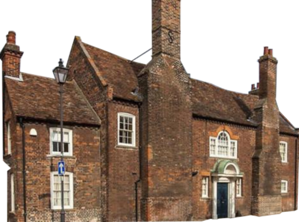
Next, he began building, what became known as, The Old Palace, on Kneesworth Street, which was on the A10 until the late 1960s . The palace was large enough for part of his retinue to follow him there, but small enough for James to feel it was an escape from Westerniser. However, having the king takeover the centre of their town did not go well with many people in Royston, not that they could do much about it.
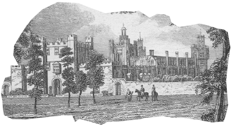
James also favoured another house, further south. Theobald’s House, or Palace, was just west of our road on the borders of Waltham Cross and Cheshunt. William Cecil, Lord Burley, had built it, on the site of an older house, over a period of twenty years, starting in 1564. The king clearly coveted the place, to the extent that, in 1607, he persuaded Robert Cecil, Williams’s son, to swap it for Hatfield House. James used Theobald”s regularly, indeed he died there, in March 1625.
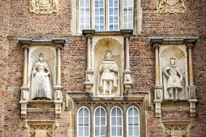
James would, almost certainly, have travelled at least part the A10 when he visited Cambridge, twice, in 1615. If he started out from Royston, there is the possibility that he began establishing the modern A10 route from there to Cambridge. The visits are commemorated by statues of the king, Anne of Denmark, and Charles, then Prince of Wales on the inner face of the Great Gate of Trinity College, facing the Great Court.
James returned to the city, once more, in 1624, to, among other things, sign the treaty agreeing the marriage of Charles to Henrietta Maria of France.
Oliver Cromewell
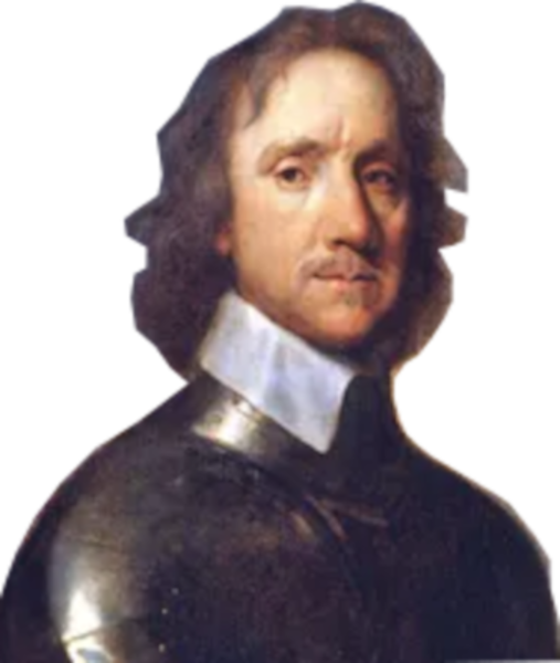
Cromwell would have been very familiar with the Old North Road, and The High Road to Cambridge. He had gown up in Huntingdon, and owned a house in Ely, for a decade starting in 1636. When in 1640, Charles I, after eleven years of ruling without a Parliament, was finally forced to recall one, Cromwell sat as the member for Cambridge. That Parliament only lasted twenty-three days. Cromwell, though, retained his seat when Parliament was recalled in November 1640. It was the start of what is called ‘the Long Parliament’, in which Cromwell played a leading role until 1653.
Unrest on the Road to Cambridge
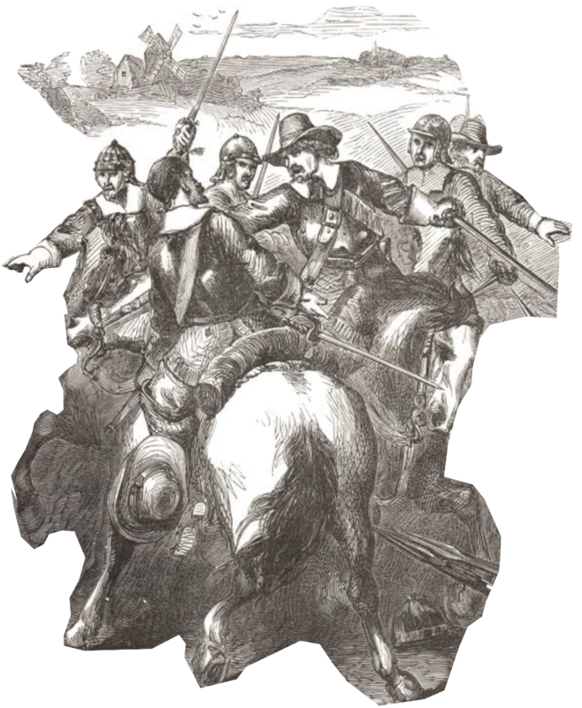
In 1647 during the political ferment following the king’s capture, a section of the parliamentary army mutinied at Corkbush Field, a little north of Ware. The trouble started when Sir Thomas Fairfax refused to accept a copy of the Agreement of the People, drawn up at the Putney Debates, presented to him by the radical, Thomas Rainsborough.
As the disturbance came to a head, Cromwell, himself, rode against the mutineers, sword in hand. One agitator was shot, and the upsurge of discontent quelled.11
The First Turnpike
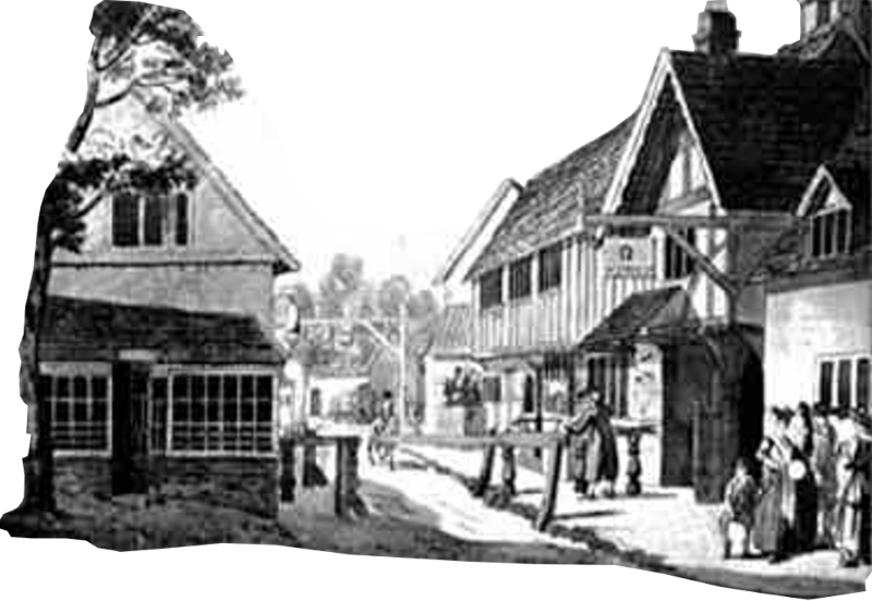
The first-ever turnpike gate was erected at Wadesmill in 1663. The village, about two and a half miles north of Ware, stands on Ermine Street, and between 1923 and 2004, was on the A10. The Feathers Inn, a coach stop dating from the early seventeenth century still stands in the middle of the village.
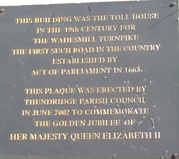
The system was not what it would be. Responsibility for the upkeep of the road was put in the hands of magistrates, with the luckless Parish Surveyors tasked with summoning “Stature Labour” to carry out repairs. It was an Old North Road scheme, running from Cheshunt through Ware to Royston, with a branch from Puckeridge to Barkway, and Barley.
It was a start, but took time to catch on. More than sixty years passed before a turnpike was opened south from Cheshunt (the Cheshunt Turnpike Trust, May 1725 11 Geo. I c 11), connecting to the road coming out of London.
A10 Turnpikes Heading North
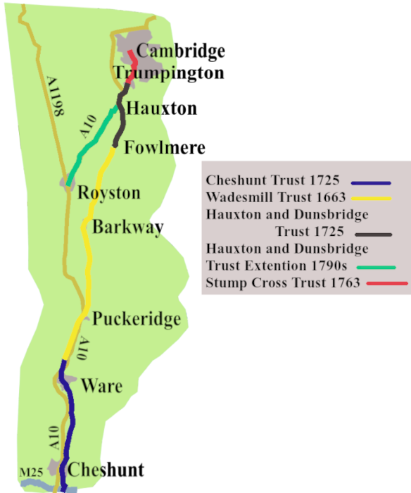
The branch of the Wadesmill Turnpike which went through Barkway, fed into the Hauxton and Dunsbridge Turnpike (1725) which took the road as far as Trumpington. Here it joined the Stump Cross Turnpike, coming in from Essex, which continued our road into central Cambridge.
Late in the century (1793) the Hauxton and Dunsbridge Trust also took responsibility for a stretch of road coming up from Royston, which met the existing route at Hauxton. This is the branch which was destined to become the A10.
Drive it today, and you will cover a short stretch of road, north of Melbourn, which still calls itself Dunsbridge Turnpike. The bridge is Dun’s Bridge over the River Shep, which easily goes by unnoticed.
Thus, by the end of the eighteenth century there were turnpike roads all the way from London to Cambridge. Once there were better roads, the coaching business could grow.
Cary’s Itineraries
In the 1798 edition of Cary’s Itinerary, the first route from London to Cambridge is familiar. Out of London along the Old North Road, to Puckeridge, then through Barkway to Trumpington. However, the Itinerary offers two other routes. One is through Royston, then along a path that will be the A10 to Cambridge. The third almost prefigures the M11, going via Bishop Stortford, then across country to Trumpington.
This early edition of the Itinerary does not tell us from which London inns coaches left for Cambridge, but it does give us some inns along the way.
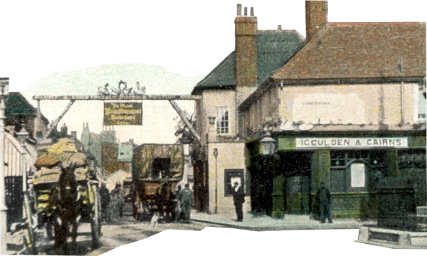
In Waltham Cross were two inns. Of the Falcon, which disappeared in 1974, there is no trace.
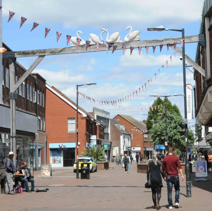
However, the Four Swans, also a martyr to development, is remembered by a replica of its sign, which once straddled the North Road, to be found on the High Street.
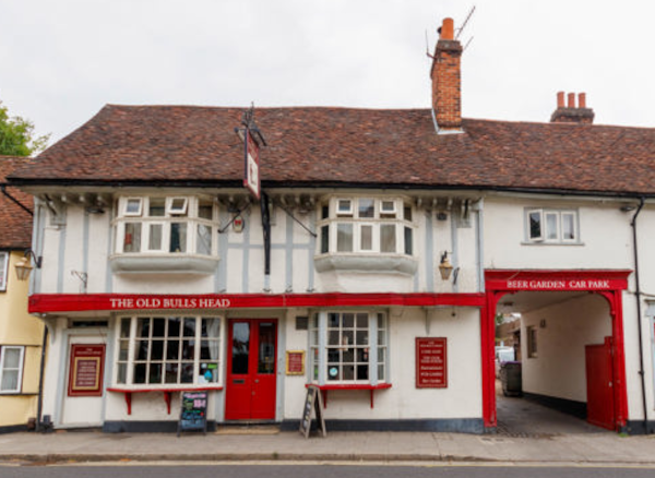
In Ware, The Old Bull’s Head, just called the Bull by Cary still stands on Baldock Street. It was one of the places the Great Bed of Ware was displayed, around 1765.
I’ve already mentioned the Feathers at Wadesmill, which Cary lists. None of the other coaching inns along the next stretch of road, given in Cary, have survived, until we come to the Coach and Horses, Trumpington. No longer an Inn, it survives as the Sole & Duck restaurant.
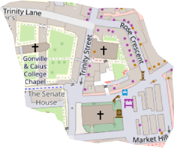
In Cambridge, all the hostelries in the 1798 Itinerary have gone. One of the two in Trumpington Street revelled in the name of The Cardinal’s Cap, presumably a throwback to pre-reformation times. We can find the ghost of the Rose in Rose Crescent, where the inn once stood.
By the 1828 edition of Cary we read Cambridge coaches set off from popular inns in London such as the Belle Sauvage on Ludgate Hill, and The Golden Cross, at Charing Cross. We also learn, that by this date more coaches were using the route through Royston, rather than through Barkway.
Cyclist on the Road
As everywhere, the arrival of the railways destroyed long-distance coach travel. Trains arrived in Cambridge in July 1845, leaving the route of the A10 available to cyclists. A club, the Southgate Cycling Club was established in 1882 south-west of Enfield. Even though Southgate isn’t quite on the A10, It’s not far off, and members must have ridden it from the word go. No doubt they still do.
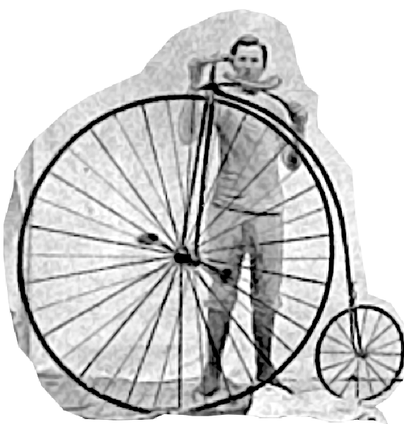
At first, bicycles were expensive, and dangerous, so became the playthings of the rich and daring. One such was Ion Keith-Falconer. His enthusiasm for bikes had started while still at Harrow School, but blossomed when he went up to Cambridge in 1873. When the Cambridge University Cycle Club was founded the following year, he became a vice-president. Given his background, Keith-Falconer was able to afford an ‘Ordinary ‘or ‘Highwheeler’, otherwise known as a ‘Penny-farthing’, specially built to accommodate his robust six-foot three inch stature. In a letter to his brother’s wife, he wrote:
”Today I am going to amuse the public by riding an 86-inch bicycle to Trumpington and back … It is great fun riding this leviathan: it creates such an extraordinary sensation among the old dons who happen to be passing.12
‘He was said to be the fastest cyclist in the world, during his time at Cambridge. In 1882, he rode from Land’s End to John o’Groats in 13 days. Quite an achievement riding over un-tarmacked roads, on a machine with a high centre of gravity, and virtually no brakes.
Of course people such as Keith-Falconer were a tiny exception to the millions who took to two wheels, as designs improved, and reasonable priced bikes became available.
Cars are Coming
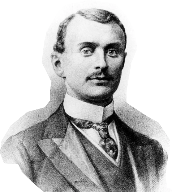
Charles Rolls was the first Cambridge undergraduate to own a car.
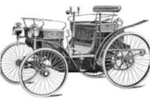
He had imported a 3¾ hose power Peugeot Phaeton, in 1896, around the time he started at the university.
His later career, and subsequent meeting with Henry Royce, took him away from the A10.
Cars were the coming thing though, and would have an impact on all our roads. As it became clear how important motor transport was likely to be, the pressure to devise road categories and numbers became irresistible.
The A10 Gets a Number
The number A10 was attached to our road, along with all the others, in 1923.
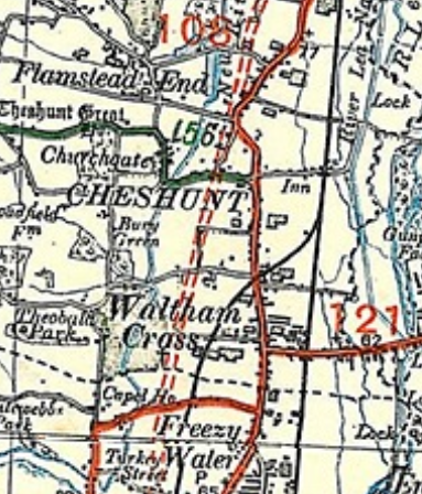
The road, pretty much, ran along the turnpike route, making its way through all the towns in its path.
However, on the section of the map showing Waltham Cross and Cheshunt, there is a dotted line to the west of the road which shows the planners already had a route bypassing the towns, in mind. It would, eventually be today’s A10.
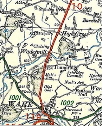
North of Ware the road went through Wadesmill on its way to Puckeridge. It didn’t turn along the older High Road, but carried on to Royston, then through Melbourn, and Harston, to reach Trumpington.
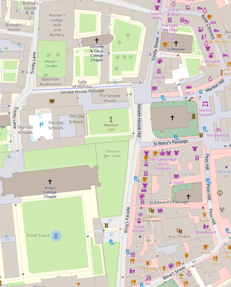
From Trumpington the road ran into Cambridge, not unreasonably, via Trumpington Road. It then went straight along King’s Parade, and Trinity Street.
Of course, it went on from there, but that is for the next post.
The First Half of the 20th Century along the A10
By the time the A10 got its number the first of the century’s two catastrophic World Wars was over. During the second, there were two air force bases, close to the A10, between the M25 and Cambridge.
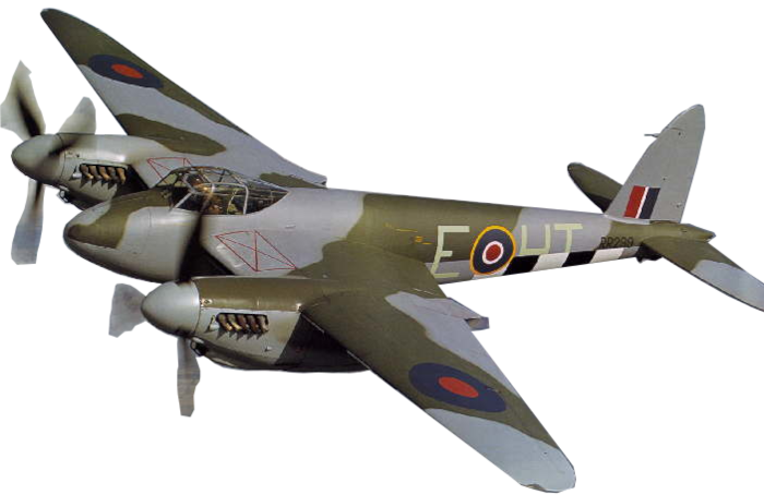
We’ve met Hunsdon, east of Ware, in connection with Mary I, but there was an airfield there which was a base for Mosquito fighter-bombers from 1942
Fowelmere is not on A10, but it was on The High Road to Cambridge. The airfield was originally a satellite for Duxford, then later, used by the USAF as a fighter base.
Early Bypasses along the Road
The first bypass along the A10 happened between the wars. We saw, on the 1923 MoT map, that a road diverting traffic around Waltham Cross and Cheshunt was always in the plan. By 1925 it was up and running, as the A108. It had to wait until the early 1950s to become the A10, as we have it today.
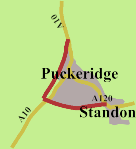
There were no other changes for almost fifty years, then in 1973, Puckeridge was bypassed. The scheme involved rerouting the A120 from Bishop Stortford, which insted of meeting the A10 in the centre of Puckeridge, joined at the southern end of the new bypass.
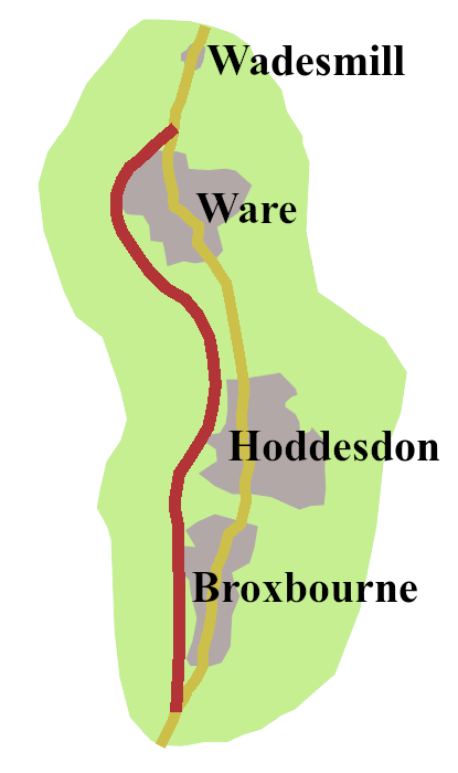
By 1976 an eight mile stretch of new road took the A10 west of Broxbourne, Hoddesdon, and Ware.
North of Ware though, it reverted to its original Ermine Street and turnpike line as far as the Puckeridge bypass.
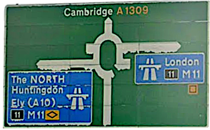
The most sinfifcant change came in February 1980, when the final section of the M11, between the A11 junction and the Girton Interchange, opened. As a result, as you make your way past Hauxton towards Trumpington, you meet a sign which directs you onto the motorway. The A10 no longer goes to, or through Cambridge. The traditional route has become the A1309.
Originally, once at the Girton Interchange, where the M11 ends, you were sent east, along the A45 Northern Bypass. But in 1994, it became A14. The result is, the Cambridge Road no longer goes to Cambridge.
That is how matters stand. The stretch of the A10 passed Wadesmill was finally bypasses in 2004. In general though, if you’re going from London to Cambridge, you will use the M11. Our road is still there, still useful to reach Ware or Royston. From the M25 to south of Buntingford, it’s good dual carriageway, in fact, though parts may feel as if they are in genteel decline, it’s a good road to drive.
We must also remember, the A10 goes beyond Cambridge, across the fens to King Lynn. But that’s for the next post.
- Barbrook, Karys, The Roman Roads of Hertfordshire: Ermine Street, Herts Memories Website, Hertfordshire County Council, https://www.hertsmemories.org.uk/content/herts-history/towns-and-villages/ware/roman-roads-hertfordshire-ermine-street ↩︎
- Ermine Street, SABRE Roads Website https://www.sabre-roads.org.uk/wiki/Ermine_Street ↩︎
- Powell, W., R., (Ed.), 1966. Waltham Holy Cross: Introduction and Manors, British History Online https://www.british-history.ac.uk/vch/essex/vol5/pp151-162 ↩︎
- Ware Town Council Website, Town Hstory. https://www.waretowncouncil.gov.uk/visit-ware/town-history/ ↩︎
- Boyd, Stephanie, 2023, The Story of Cambridge, Cambridge University Press ↩︎
- Kilby, Marty, 2009, Milestones: a very short history of the B1368 milestones from Puckeridge to Barley, A Hormead Parish Viewpoint Website, https://hormeadvillagehall.org/wp-content/uploads/2020/09/13milestones.pdf ↩︎
- The Herald’s Memoir a rare contemporary manuscript—housed in the British Library as Cotton MS Julius B. XII ↩︎
- Toulmin Smith, Lucy (ed.), The Itinerary of John Leland in or about the years 1535–1543, Appendix III, Vol. 1 ↩︎
- Cornish, Alan, 2012. England’s Forgotten coup d’etat, The Friends of Wanstead Parkland Website, https://wansteadpark.org.uk/history/tudors-twenty-eight-days-to-wanstead/ ↩︎
- Purdy, Gilbert, Wesley, 2021. Elizabeth I’s Progress to Cambridge University, 1564: Final Inspections, Virtual Grub Street Website, https://gilbertwesleypurdy.blogspot.com/2021/04/elizabeth-is-progress-to-cambridge_11.html ↩︎
- The Corkbush Field Mutiny, November 1647, B C W Project Website, https://bcw-project.org.uk/military/second-civil-war/corkbush-field ↩︎
- Cambridge Cycling Pioneers, 2021. The lives of Ion Keith-Falconer and Edward Conybeare, Museum of Cambridge Website, https://www.museumofcambridge.org.uk/2021/04/cambridge-cycling-pioneers/ ↩︎