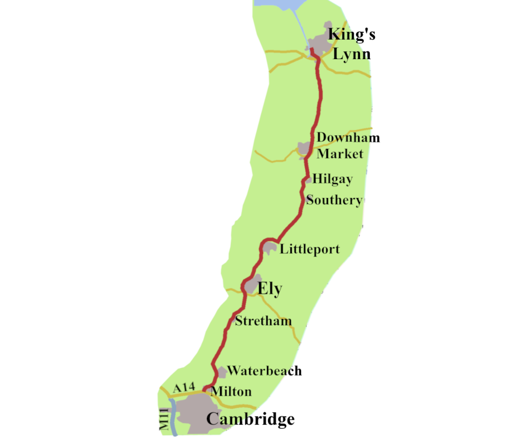
Here is the third part of the history along the A10, covering the road between Cambridge and King’s Lynn. It takes us to Ely, with one of the country’s most beautiful cathedrals, then across The Fens to Downham Market and King’s Lynn.
Picking up the Road
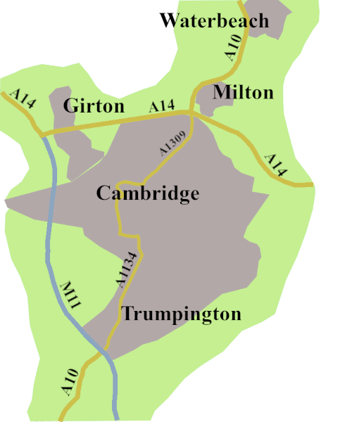
At the end of the previous post, we saw that the A10, once the Cambridge Road, no longer goes through the city, instead, you are directed to head north on the M11. At the Girton Interchange, where the M11 finishes, you are signed to join the A14, eastbound. You come off the A14 at Junction 33, signed, A10 for Ely, Cambridge, and Milton.
In the meantime, the original route of the A10 through the city is, not quite, the A1134, becoming the A1309 about a mile and a half before it reaches the A14.
The Roman Road Heading North.
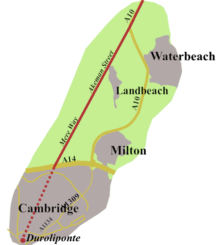
The dotted line is speculative, the solid one more certain.
The Romans called their fort and settlement around Castle Mound in Cambridge, Duroliponte or Durolipons. A Roman, setting off north from there, would follow Akeman Street, a road coming up from Ermine Street, a few miles north of Royston.
The first part of the journey, by where today’s Science park sits, is only an educated guess. More certain is, just the other side of the A14, our Roman would have gone along Mere Way, now a footpath west of Milton. That led to a minor road, with the give away name of Akeman Street. Our traveller passed, what today is, the village of Landbeach, where there was a Romano-British settlement from at least the second century, if not before. Akeman Street continued north, until, to the west of Waterbeach, it settled to the line of our A10.1
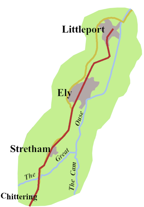
The rivers a shown following their modern courses. The Great Ouse, beyond Ely has been much straightened, and in Roman times did not flow int to the sea past King’s Lynn.
Now, the roving Roman begins to find the way damper. In places the road is built up above the water level. Both sides, there’s an expanse of open water, and marsh, dotted with small islands.
Next, our traveller must wait for the ferry to take him across the river, we know as the Great Ouse. The road climbs slightly, past Stretham, and it’s generally dryer underfoot. N0 Ely, which would not exist for several hundred years.
After a while the road dips again, zigzag to find dryer ground, before a gentle upslope into what we know as Littleport. Why would a Roman from Duroliponte travel there? There is evidence of a least one high-status house, and the working of salt pans on the brackish fen edge, but not much else.2
The End of the Road
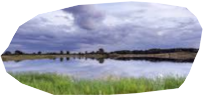
Where next? Some want to think Akeman Street pushed on to Denver, just south of Downham Market, to meet the causeway coming from Peterborough, but there is no evidence it ever happened. Had the Romans wanted to build a causeway across the fens, they could have, but there was nothing for them. They already had two roads to the North Norfolk coast, Icknield Street and Peddars Way.
Of course, people had lived in The Fens from the earliest times, fishing and fowling, as well as grazing cattle on higher ground, through the sprig and summer, and even growing some grain.3
After the Romans
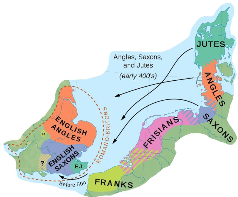
Source: The Colecter Website, https://www.thecollector.com/genetic-studies-anglo-saxon-migration/
The Romans, when they abandoned Britain, early in the fifth century, bequeathed us a road which would develop to be theA10 between Cambridge and Littleport.
Though much debated, genetic research supports the idea that there followed a substantial migration of Germanic peoples into the east and south of England. We call these settlers, and this era, Anglo-Saxon.4
Centuries passed where we have no direct evidence of what happened to the road. We can, though, trace the arrival of some of the towns and villages found along it.
Anglo-Saxon Settlements from Milton to Ely
There are records of land exchanges in Milton from the 970s.5 Two people, considered important, Oswi and Oschetel are mentioned in the Liber Eliensis, as living in Landbeach, in the middle of the tenth centenary.6
I can’t find any pre-Norman documents relating to Waterbeach, though a settlement had existed since Roman time, as had the hamlet of Chittering but again, no Anglo-Saxon records.
There is however a record of Abbot Brythnoth, the first abbot of the restored Ely monastery, buying land at Stretham, between 970 and 996. I assume, therefore there was an estate at Stretham from at least the middle of the tenth century.
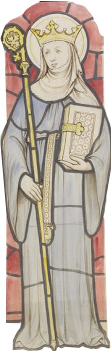
For the Isle of Ely we have extensive records going back to the seventh century.
King Æthelberht of Kent had a church built there, a mile from today’s cathedral. Seventy years later, St. Æthelthryth, usually known as St. Etheldreda, fled to the Island from her unhappy marriage. (Marriage was a problem for her, as she had vowed never to relinquish her virginity.) She owned land in the area, where she founded a double monastery for men and women. The Danes destroyed that, in 870. A hundred years later it was re-founded as a Benedictine monastery, for men only. It became a Catherdral in 1109.
From Littleport Across The Fens
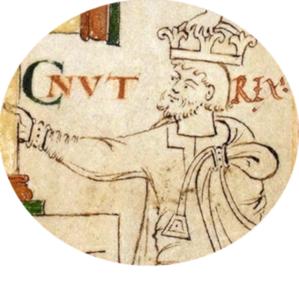
We can’t know the state of the road running north out of Ely, but the settlements we find along the A10 were mostly in place by the end of the tenth century.
The legend that King Canute, (1016 – 1035) founded Littleport is a good story, but unlikely. Littleport is mentioned much earlier, as part of the endowment from King Edgar, (959 –975) to the re-established Ely Monastery.7 There is no record of a church at Littleport, which suggests there was not a significant community there. It would have been a stopping off place for ships, travelling between Cambridge and the Wash, to load salt and fish.
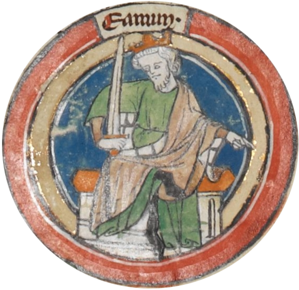
Still no road to Southery, though there was a Southery (Suthereye) by 942, for it appears in a land grant made by King Edmund I, in 942, to Bishop Theodred, of London.8
You’d have to go across open water, once more, to reach Hilgay. The holding there was given to Ramsey Abbey, by Duke Ailwyn (Æthelwine) the Ealdorman of East Anglia, some time after 969, when the Abbey was founded. 9 The grant included Snore, and a nearby mill, plus a half share in the fisheries.
Downham Market to King’s Lynn
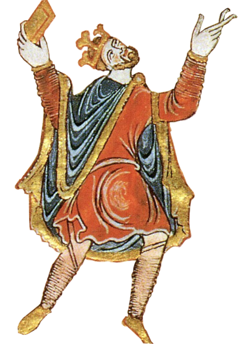
Downham Market grew up because it was always safely above The Fens, as was Denver, immediately to the south. It is possible a road, of sorts, developed between them, but of course, there is no record.
We first hear of Downham Market during King Edgar’s reign (959 – 975) when he granted it to Ramsey Abbey. The town claims to have one of the oldest markets in Norfolk, run by the Abbey under a 1046 charter from Edward the Confessor. However, it seems likely the charter was a forgery dating from Henry I’s time.10 There may have been a market from the early eleventh century, and the Abbey were covering their backs when the Normans realised they were running it without authorisation.
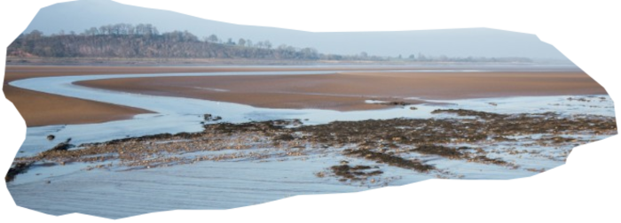
In Saxon tines, the landscape around the south-east corner of The Wash was made up of mudflats, creeks, and salt-water lagoons with the Rivers Nar and Gaywood winding their way through to the sea. (Remember the Great Ouse still reached The Wash further west.) This area, which would become King’s Lynn, supported a scattered population living off salt production and fishing, alongside some subsistence farming.11 There is no evidence of anything resembling a village, and no record of a church, though the landowners included the Bishop of Elmham. (North Elmham was the centre of the dioceses until 1070.)
And the road? We simply don’t know. There were at least two villages along the line of the original A10, north of Downham. If there was a market at Downham before the Normans came, people from these settlements would have wanted to go there. I doubt there was anything heading towards King’s Lynn. There was nothing to go there for.
The Normans: Hereward the Wake
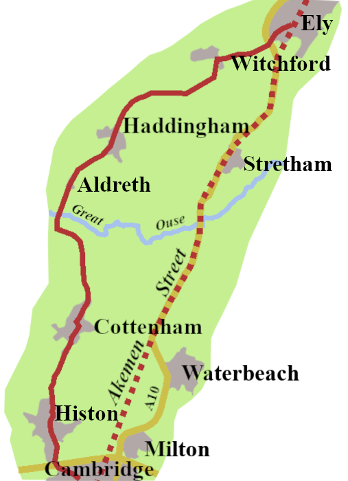
In 1970-71, William the Conqueror was trying to deal with Hereward the Wake, who was holed up on the Isle of Ely. Around this time a causeway was built from the island’s southern edge, running south across the fens. It started at Aldreth, a hamlet which was mostly on dry land, and gave us the name Aldreth Causeway.
We don’t know if it was an existing route, or was made by William in his endeavours to suppress the Saxon ‘terrorists’. Whatever its origins, from the eleventh century the preferred way to get from Cambridge to Ely, was not along Akeman Street. Instead people went through Histon to Cottenham and then onto the Aldreth Causeway. From there, they went through Haddingham and Witchford to reach Ely.
The Aldreth Causeway remained the choice for pilgims and other travellers for the next six hundred years. The old Akeman Street route, which would be the A10, may have started to be used once the fen drainage got under way. Certainly when a bridge was built in the late eighteenth century, it replaced an existing chain-ferry.
Post-Norman Developments
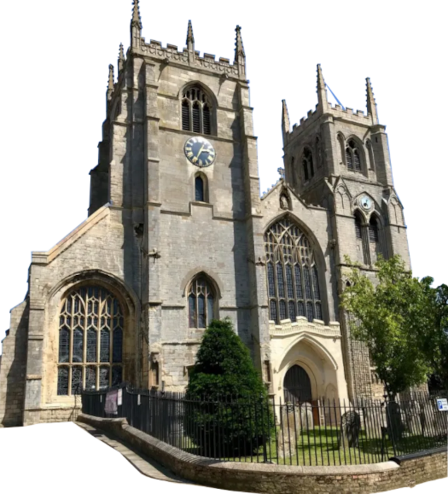
The Normans began a process of change. Significant for the northern end of the A10 was the founding, in 1090, of the priory of St Margaret at Lena. The town that grew up round it was called Bishop’s Lena, to us, Bishop’s Lynn.
By 1230, Ely, Littleport, Downham, and Lynn all had chartered markets. Once there are markets, people will want roads to reach them. The 1205 charter for Bishop’s Lynn’s market specifically allowed the town to collect and keep taxes from road use, so there were roads.
I can’t find any evidence of a road between Littleport and Downham Market. There may have been a way through Southery, and Hilgay to Denver, and Downham, but it would involve boats, and picking your way across the marshlands.
The Great Ouse Moves
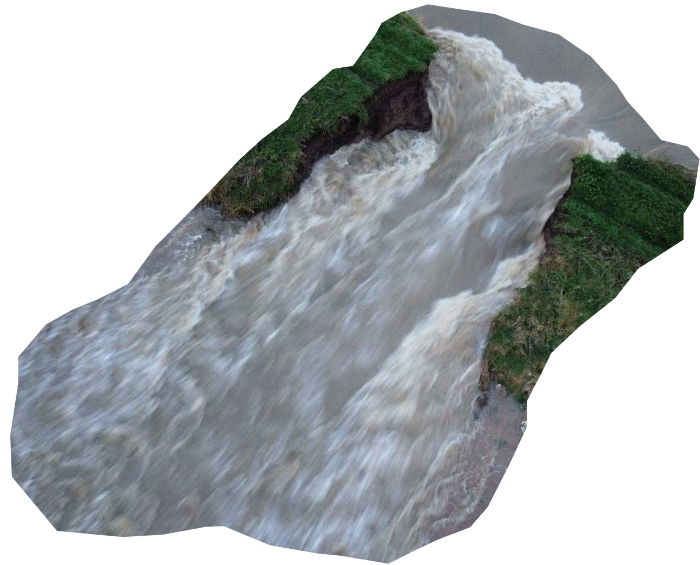
There was a major flood throughout The Fens in 1236. It resulted in the Great Ouse changing course, to flow past Downham, and into The Wash by Lynn, with a significant impact on the town, and our road.
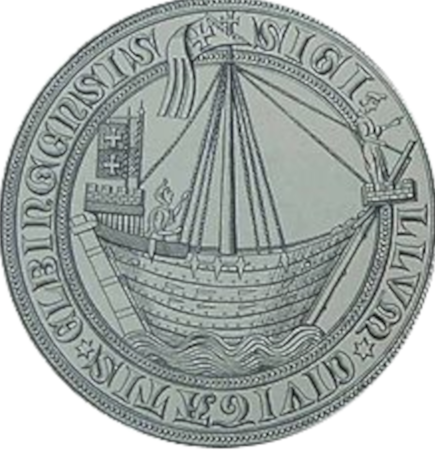
By 1271 Bishop’s Lynn had trading privileges with merchants from around the Baltic, and Hamburg, which became the Hanseatic League. The relationship would last until the sixteenth century, making Lynn, for a time, one of the most important ports in England.
The Gough Map
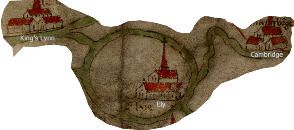
The thick green lines are rivers, not roads,. We see the how a river connected Ely and Lynn, that would be the Great Ouse,
When we look at the Gough Map, from the late fourteenth century, we find Cambridge, Ely and King’s Lynn marked, but not Littleport or Downham Market. A road out of Cambridge is shown, but it’s heading for Newmarket. There is nothing that predicts the coming of the A10. In fact Ely is shown as entirely surrounded by water. It is likely, churchmen, and pilgrims would have used the Aldreth Causeway route, though even that might be hazardous in the winter.
Perhaps it was possible to travel from Cambridge to Ely, and even on to Lynn, but, for the next two hundred years, we have no record of a road, or who was using it .
Tudor Times along the A10
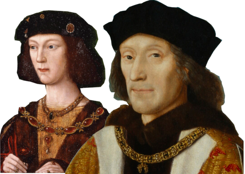
Henry VII and his son the future Henry VIII visited Bishop Alcock while he was Bishop of Ely between 1486 and 1500. How they got there is not recorded.
In the reign of Henry VIII’s son, Edward VI, we get an indication of a road running south from King’s Lynn. (It was King’s Lynn by then, Henry had renamed it in 1537). In the summer of 1549, two years after the boy king came to the throne, there was a rural rebellion led by Robert Kett. It arose from a number of causes, economic, religious and social.
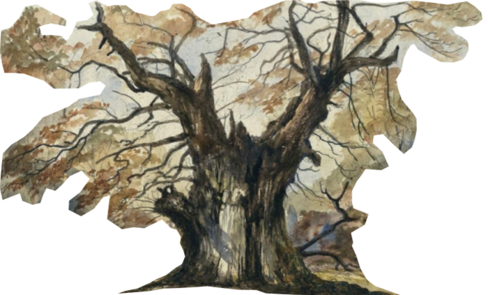
In support of the rebellion, men from villages between Kings Lynn and Fakenham, gathered north of Lynn, intending to attack the town. The plan was thwarted by Lord Willoughby, so the rebels marched down the future A10 to Ryston Hall, just outside Downham Market. The rebellion is remembered in Norfolk for Kett’s Oak, near Wymondham, but there is another Kett’s Oak in the grounds of Ryston Park.
It’s not clear how long the contingent stayed at Ryston. It was more a rallying point than a permanent encampment but legend has it, they left a carved wooden tablet carrying the following piece of doggerel:
Dear Mrs Pratt,
Your sheep are very fat,
And we thank you for that.
We have left you the skins,
To buy your lady’s pins,
And you’ll thank us for that12
The Mrs Pratt was the wife of the owner of Ryston Hall, whose family is still there. The original wooden plaque rotted and was replaced by a stone tablet in the nineteenth century.
Eventually, having feasted on Mrs Pratt’s mutton, the rebels headed across country to join the main force camped on Mousehold Heath, outside Norwich.
Cromwell on the A10
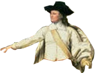
Through the English Civil Wars, (1642 to 1651) the future A10 ran through predominately Parliament supporting areas.
Oliver Cromwell would have been familiar with the road, as he lived in Ely for about ten years from 1636. After 1640, he served as MP for Cambridge in the Short, Long, and Rump Parliaments, until he dismissed Parliament in 1653.
He was at the siege of Kings Lynn in August 1643. We have no record of his coming up the A10 to get there, though it’s possible. The Royalists held the town for the best part of three weeks, until, on 15th September they offered to negotiate a surrender.
Charles I on the A10

During his last days of freedom, in the spring of 1646, King Charles I took refuge in Downham Market.
It’s not clear how he arrived there. He seems to have cut across the fens, to avoid Ely, so perhaps picked up our road at the Southery Ferry. There is a tale that Charles, and his companions, were guided through The Fens by the landlord of the Silver Fleece Inn, Southery who revelled in the name of ‘Mucky Porter’. I suspect the story is more folklore than history. What seems more certain is the king spent the night of 30th April 1646, at Snore Hall,13 between Hilgay and Denver.

Next day, Mayday, Charles went on to Downham Market. He stayed at the White Swan, which stood as The Swan on the High Street, until August 2023. The High Street was the A10 from 1923 to 1979.
Charles changed his disguise, had his hair trimmed, and bought a hat suitable for a parson. Next day, the king and his companions left the line of the A10, going, instead, to Stamford, in Lincolnshire, and then to Southwell, in Nottinghamshire, where he surrendered to the Scottish Army on the 5th May.
Ogilby’Britannia
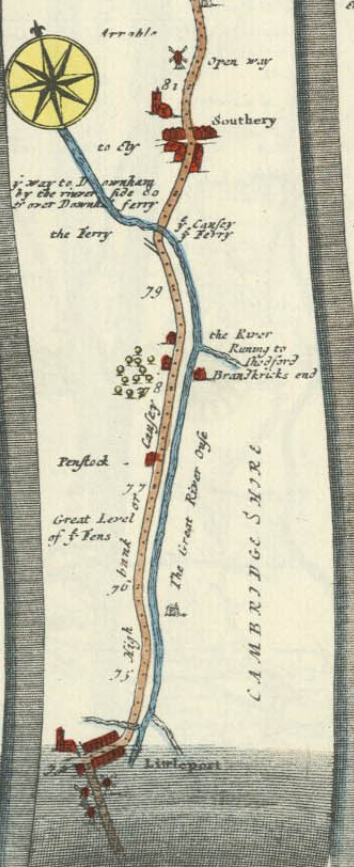
Looking at Ogilby’s Plate 43, we see his route follows Akeman Street, and the future A10, through Milton to the Stretham Ferry. So, a ferry was operating by the 1670s.
Britannia’s road through Ely to Littleport gives the line of the A10 in 1923. There was no bridge over the Great Ouse at Littleport, however. The first wave of fen drainage , including cutting of the Old Bedford and New Bedford rivers happened between 1630 and 1650. Thus, Ogilby offers a route from Littleport along, what he marks, as the ‘High Bank’, which ran along the west side of the Great Ouse. It’s likely it was barely a road, but a track along the bank constructed by Cornelius Vermuyden as part of his drainage scheme

The map shows a ferry across the river about a mile short of Southery. There used to be an inn here called, ‘The Ferry Boat’, which closed in the 1980s. We met this crossing in connection with Charles I’s journey to Downham Market.14
What we have, after Southery is pretty much the line of the A10 in 1923. Hilgay is written as HelGaye, with a wooden bridge marked. Snore Hall (Snowed Hall) is shown off to the east, then Denver (Denber). After Downham the road passes through villages such as Stow Bardolph, given simply as Stow and Setchey which Ogilby calls Seechy, before arriving at King’s Lynn.
Cambridge to King’s Lynn Turnpikes/
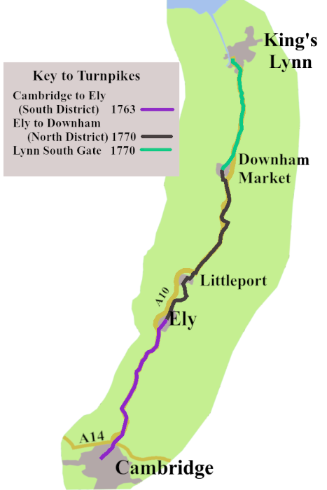
There were only two turnpike trusts between Cambridge and Lynn. The Cambridge and Ely trust was formed in 1763. It was extended as far as Littleport two years later. Then in 1770 and act was passed which allowed for the continuation of the turnpike to Downham Market, which become the Ely to Downham (North District).15 The original Cambridge to Ely trust added South District to its name. Though they were both the same trust they were administered separately.
The Cambridge to Ely (South District) built a bridge to replace the Stretham Ferry, in 1784. River crossings were equally an issue for the road from Littleport to Downham Market.
A bridge across the Great Ouse was built at Littleport by 1774, known as Scotting’s Bridge, in honour of the family who had run the ferry the bridge replaced.

About three miles further on, the turnpike hit the confluence of the Little Ouse and the Great Ouse, at Brandon Creek. There is some confusion about what happened here. Received wisdom says there was a ferry until 1889.16 I’m minded to think that can’t be correct. Not only does Cary’s Itinerary of 1815 (Page 508) record Brandon Creek Bridge,17 but Faden’s 1797 map of Norfolk18 clearly shows a bridge over the Little Ouse at that spot, as does the 1886 Ordnance Survey map.19
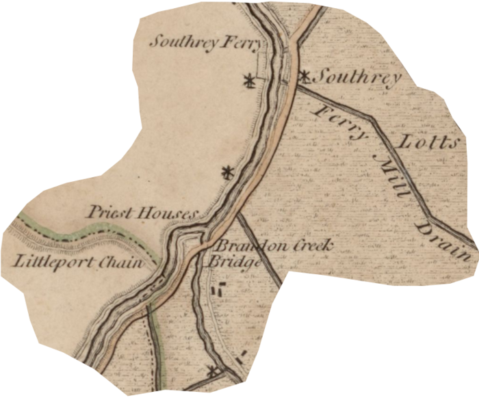
I suspect the Turnpike Trust built a bridge at Brandon Creek sometime in the 1790s. So, by around 1800 there was a turnpike road to take you from Ely to Downham Market, which gave us the route of the A10 in 1923.
Things would have been easier for the sponsors of the Lynn, South Gate Trust, which, in 1770, took responsibility for the road on to Kings Lynn. They followed the well established route down which Kett’s rebels had marched in 1549.
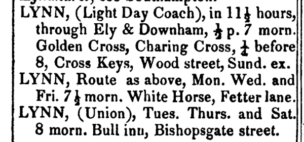
The 1828 edition of the Itinerary tell us there were two coaches a day, except Sundays, leaving London for King’s Lynn, via Ely and Downham Market.
Though well past it’s heyday, Lynn was still an important east coast trading and fishing port, so there would have been plenty of traffic. That is, until the railway from Cambridge reached the town in 1847. It wouldn’t have had a big impact at first, but the writing was on the wall. The turnpike from Cambridge to Downham Market went first, in 1874, while the one from Downham to Lynn hung on until 1877.
An A10 Arrives
Definitive maps, and a list of road numbers, were published 1st April 1923. There was the A10 running along the turnpike route between Cambridge and King’s Lynn.
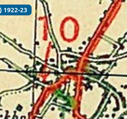
It went through the towns and villages, with the exception of Waterbeach, which always sat just east of the road. The way through Ely was not straightforward, with an important left turn in front of the Lamb Hotel, a well used coaching stop. From there, through Littleport, over the Great Ouse, and the Little Ouse, Southery, Hilgay, Denver, Downham Market, and so on to King’s Lynn.
Of course, by the time the A10 got it’s number, the first of the two world wars which blighted the twentieth century had finished. Inevitably places along the road felt the impact of both of them.
The Two World Wars and the A10
As everywhere across the land, towns and villages gave up their young men between 1914 and 1918, and those along the A10 were no different.
The Norfolk Regiment, (Later Royal Norfolks) were part of the British Expeditionary Force, and were in France from 1914. The Cambridgeshire Regiment, which included a company based in Ely, landed at Le Havre in February 1915.
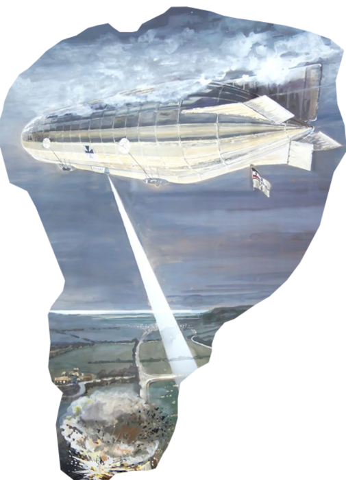
King’s Lynn was one of the first towns to be bombed from a Zeppelin, in January 1915.
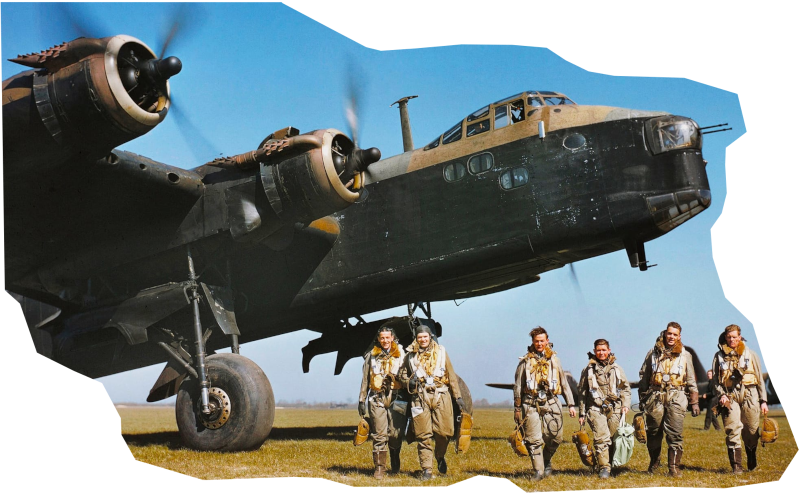
During the 2nd World War there was an important airbase at Waterbeach, which sent out bombing raids on occupied Europe. RAF Waterbeach also played an critical role in training aircrew to fly, and mange the larger, four-engined bombers, a vital part of the war effort.
There was a satellite airfield for RAF Marham at Downham Market. It, too, sent planes out across the North Sea. In fact, the last bombing raid over Germany took off from RAF Downham Market in May 1945.
Bringing it up to Now
After the war, the A10 from Cambridge to King’s Lynn stayed as it had been, more or less, since the 1920s. Changes began in the late 1970s with the opening of the Milton Bypass in 1987.
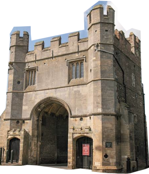
By 1986, all the towns and villages along the road were bypassed. No sweeping stretches of dual carriageway, just a sturdy, two-way road that keeps you clear of places. Eventually you come to the complicated roundabout which is the junction with the A47, from where you can follow what is, probably a very old route, to Lynn’s South Gate, and so into the town.
These days, most people wouldn’t use the A10 to go from London to Cambridge. There is the M11 after all. But if you’re driving from Cambridge to King’s Lynn, the A10 is the only option. It’s a quite, uneventful road, with some spectacular skyscapes over The Fens, and a surprising amount of hidden history.
- Ratleledge, David, 2025. Akeman Street Roman Road from Cambridge to Ely and (probably) Littleport, Travelling with the Romans Website https://www.twithr.co.uk/cambridgeshire/cambridge-ely.htm ↩︎
- Haskins, Anthony, et al, 2016. 16 Station Road, Littleport: Archaeological Evaluation, Oxford Archaeology East, https://eprints.oxfordarchaeology.com/2943/1/LITSTR16_Report_1997_LR.pdf ↩︎
- Sunley, Thomas, 2007, Parish Summary: Southery, Norfolk Heritage Website, https://www.heritage.norfolk.gov.uk/record-details?TNF1715-Southery-(Parish-Summary) ↩︎
- Genetic evidence for Germanic migration into England after the Romans left. Gretzinger, J., Sayer, D., Justeau, P., et al, 2022, The Anglo-Saxon Migration and the Formation of the Early English Gene Pool, Nature, 610(7930), 112-119. https://doi.org/10.1038/s41586-022-05247-2 ↩︎
- Wright, A., P., M., and Lewis, C., P., (Eds.), 1989. Milton: Manor and other estates’, in A History of the County of Cambridge and the Isle of Ely: Volume 9, Chesterton, Northstowe, and Papworth Hundreds, British History Online https://www.british-history.ac.uk/vch/cambs/vol9/pp179-182 ↩︎
- Liber Eliensis is an account of the history of the Isle of Ely compiled by a monk of Ely in the later twelfth century. See: Fairweather, Janet, 2005, Liber Eliensis: A History of the Isle of Ely from the Seventh Century to the Twelfth, Compiled by a Monk of Ely in the Twelfth Century, Boydell Press ↩︎
- Cambridgeshire Historical Background, REED online, https://ereed.org/collections/cambs/background/ ↩︎
- Kelly, S.,E., and Rushforth, R., 2010, S1526, The Electronic Sawyer: Online Catalogue of Anglo-Saxon Charters, S483, https://esawyer.robinson.cam.ac.uk/charter/483.html ↩︎
- Beeke, Clive, 2006, Duke Ailwyn, Benefactors and Benefactions, History of Ramsey Abbey Website, https://ramseyabbey.co.uk/benefactors-and-benefactions/ ↩︎
- Samantha Letters, Online Gazetteer of Markets and Fairs in England and Wales to 1516 https://archives.history.ac.uk/gazetteer/norf.html#D ↩︎
- Rye, James, 2026, No Empty Marsh: The Roots of King’s Lynn Before 1066, Circato Website, https://circato.co.uk/lynn-before-1066-salt-power-wash ↩︎
- Bale, David 2015, A Glimpse of Norfolk’s Other Kett’s Oak, Eastern Daily Press, https://www.edp24.co.uk/lifestyle/20902988.glimpse-norfolks-ketts-oak/ ↩︎
- Snore Hall (Snowre Hall), Dicamilo Website, https://www.thedicamillo.com/house/snore-hall/ ↩︎
- TL6193: The former Ferry Boat Inn beside the River Great Ouse, Geograph Website, https://www.geograph.org.uk/photo/3410056 ↩︎
- Acts of the Parliament of Great Britain1770 c. 97 (Regnal. 10_Geo_3), legislation.gov.uk Website, https://www.legislation.gov.uk/apgb/Geo3/10/97/enacted ↩︎
- Petty, Mike, 2022, Brandon Creek Bridge, 1889, Fenland History on Facebook, Facebook, https://www.facebook.com/groups/1026849820769556/posts/4684186088369226/ ↩︎
- Cary, John, 1815. Cary’s New Itinerary, S Gosnell, Printer, Little Queen Street, London ↩︎
- Donald, Thomas, and Thomas Milne (with assistants), 1797, A topographical map of the county of Norfolk, surveyed and measured in the years 1790, 91, 92, 93 and 94, W Faden. National Library of Scotland Website, https://maps.nls.uk/view/262718474 ↩︎
- Ordnance Survey, Norfolk Sheet LXXXI.SW, Surveyed: 1886, Published: 1886, National Library of Scotland Website, https://maps.nls.uk/view/101583536 ↩︎