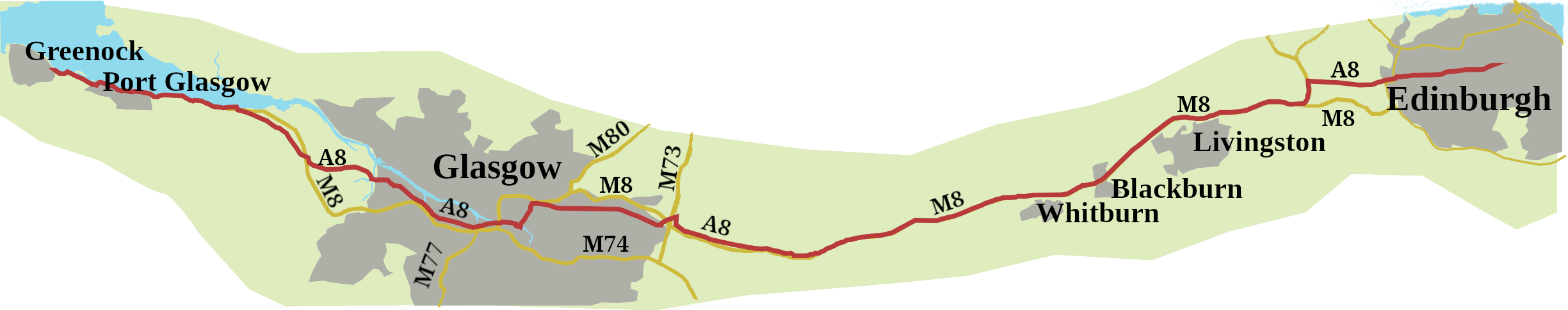
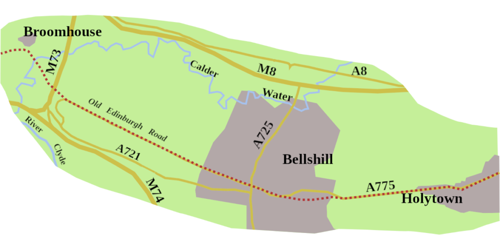
Post number two is about how the road that runs from Edinburgh, through Glasgow, to Greenock, came to be the A8.
Two Roads, or Perhaps Three
Setting out from Edinburgh, the A8 follows a long-established route. But, once you hit the roundabout just before Newbridge, it disappears. I mean, it’s nowhere to be found. Instead, you’re faced with twenty-odd miles of M8.
It turns out, this disappearing road trick is the result of a 1956 Scottish Office decision. It was thought less confusing if there weren’t ‘Ms’ and ‘As’ with the same number. Anyway, you can reclaim the A8 again at junction 6 of the motorway, and follow it past Glasgow Cathedral, and all the way to Greenock.
Tracing the Roots
Pinning down an early Edinburgh to Glasgow road along the line of the A8/M8 turns out not to be straightforward.
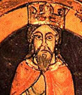
David I (1124 – 1153), and his court attended the consecration of Glasgow Cathedral in 1136, possibly travelling from Edinburgh, but along what road?
The same problem when King William the Lion (1165 – 1214) visited Glasgow in 1175 to grant it a borough charter. He may have been there in 1197, when the cathedral was rededicated, following a disastrous fire.
Timothy Pont’s maps drawn in the last two decades of the sixteenth century give us some early evidence, though he didn’t go in for roads much, being more interested in bridges. And his maps are difficult to decipher.
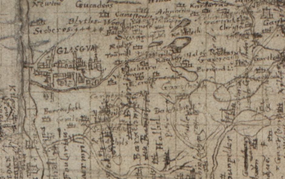
Luckily, clever people at the Old Roads of Scotland,1 and the National Library of Scotland,2 websites have done all the hard work, and I have relied heavily on them in this section. What we see is a number of ‘routeways’ coming out of Edinburgh.
The one of interest to us, crossed the River Almond at Newbridge; no village then, but a bridge. Pont then heads towards Livingston. From there, he goes along the line of the A705, parallel to the M8, as far as Blackburn. The road probably went on to Glasgow, though how, isn’t clear.
Mary Queen of Scots
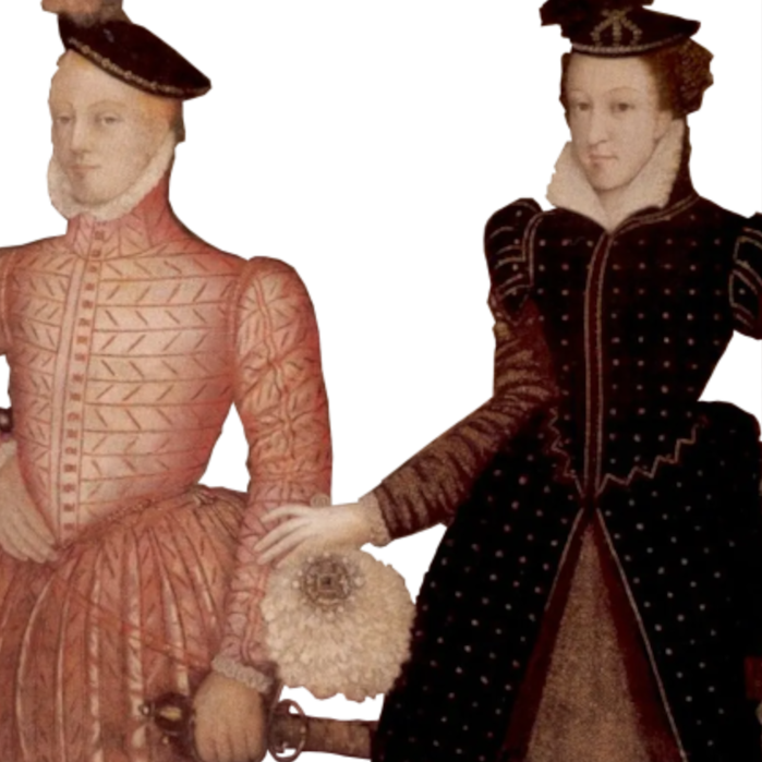
Mary Queen of Scots was in Glasgow, in January 1567, arranging Lord Darnley’s, return to Edinburgh. Too ill to ride, he was carried on a horse-litter, though by what route is not recorded.
Mary had a coach, probably inherited from her mother Mary of Guise. The younger Mary refurbished it in 1562, but given the poor state of the roads, it’s not clear how much she used it. She certainly didn’t make it available to her husband, but perhaps a horse-litter was a more comfortable option than trundling along winter roads in a wheeled vehicle with no springs. Which route the litter took is not recorded. What is recorded is that Darnley was blown-up on the 10th of February.
Taylor and Skinner’s Maps
Plate 10 of Taylor and Skinner’s Survey and Maps of the Roads of North Britain gives a route which looks as though it left Edinburgh, more or less, along the line of today’s A70. Long Hermiston, which was a hamlet to the north of Currie, is marked, as is the turning to Currie. Their route then drifts north-west, to become more A71 as far as East Calder, then on to Livingston Village, which feels more like the A705.
Plate 11 shows the road sticking to the line of the A705, running parallel to today’s M8, through Blackburn, and Whitburn, which is labelled White Burn on the map. It carries on past Kirk of Shotts, after which New Inn is marked, which is where Newhouse is today, and where the modern A8 branches off the motorway.
The map then shows a fork in the road. To the left was the way through Hamilton to Ayr. We want the right fork, though, which went to Holytown (Holy Town) Inn.

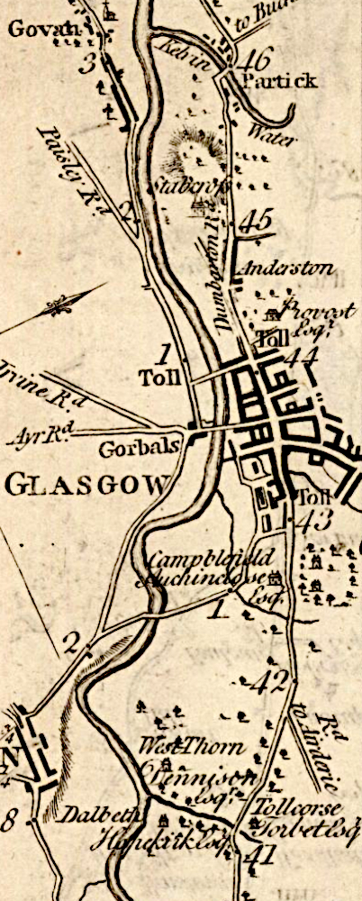
From there the road appears to have gone along, what is now Hamilton Road, past Sandyhills, and on to Tollcross Road. Gallowgate is not marked, though it’s the way people must have gone to reach central Glasgow.
What you will have noticed is, the modern A8/M8, between Edinburgh and Glasgow is not Taylor and Skinner’s route. They did mark out what was the main thoroughfare between the two cities until after the Second World War.
Taylor and Skinner’s Plate 12 shows two bridges over the Clyde, both connected to the road running along the south-west bank of the river, up to Greenock.
It’s not quite today’s A8, but it’s the same, basic route, past Govan, though no Fairfield Shipyard for another eighty years, and over both White and Black Cart Water. There’d been a bridge there since at least 1490, built by Paisley Abbey, though the one on the map must have been the ten-arch affair, built in 1759.
In Taylor and Skinner’s day, the Clyde could not accommodate ships of any significant draft, so Port Glasgow was Glasgow’s port. Ship building began there in the middle of the nineteenth century after a deep channel was dredged, and ships were able to reach central Glasgow. The map goes on to Greenock, which was also a port for Glasgow. The wheel has turned full circle, for today, the Greenock Ocean Terminal handles up to a hundred-thousand containers a year.
Turnpikes and Coaches
It would not be until 1753 that an act was passed to allow turnpike trusts to be established. What was known as ‘The Great Turnpike’ was in place between Edinburgh and Glasgow by the end of the 1750s. Taylor and Skinner’s maps mark tollgates all the way to Greenock. Just when trusts along this stretch of road arrived is not certain, but most likely in the 1760s.
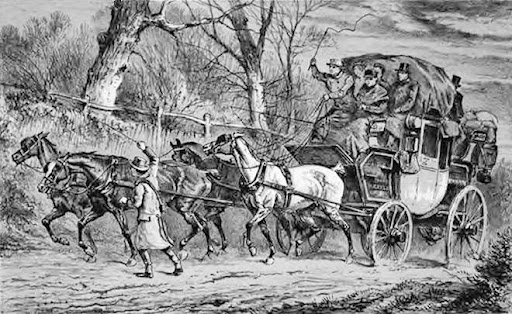
As early as 1678, the Privy Council had granted, for a term of seven years, the exclusive privilege of running a weekly coaching service between Edinburgh and Glasgow to William Hume (sometimes spelt, Hoome), an Edinburgh merchant. We don’t know if it was a success, but probably not. It took the arrival of better roads for proper stagecoach services to start. To begin with, just one coach a day, ‘of the clumsiest construction,’ went in each direction, and the trip could take eleven or twelve hours. Certainly, by 1798, Cary’s Itineraries includes the turnpike road through Whitburn.3
Changes Afoot
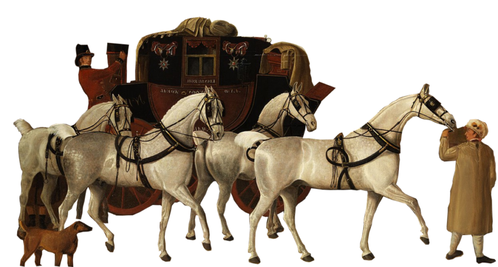
The opening of the Edinburgh to Glasgow railway in 1842 began the coaching decline. One business, Croall and Sons, of Edinburgh, fought back by introducing two new coaches on the route via Whitburn. These were described as “superior to any railway carriage” and undercut the railways on price. It was claimed that “no form of transport can equal that of a well appointed four-horse coach.”4 Despite these efforts, the service only survived until 1847. So, for about sixty years, as everywhere else, few people used the road to go between Edinburgh and Glasgow.
A Confusion of Numbers
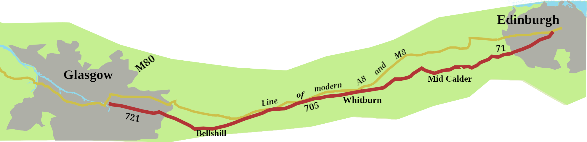
When, in 1923, the road numbers arrived, ‘The Great Turnpike’, through Whitburn and Livingston, was not given the number A8. Instead, the map shows a red road coming out Edinburgh marked 71, (no A’s or B’s on the 1923 map, just red for ‘A’ roads and Green for ‘B’). It went as far as Mid Calder, from where the 705 took over, through Whitburn, to Bellshill. There it became the 721, through Mount Vernon, and Tollcross to reach central Glasgow. In other words, Taylor and Skinner’s route.
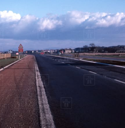
What of the A8? It was attached to a more northerly route, through Bathgate. The story of this original A8 is of interest in its own right, and a post on it is in the works. It seems, however, it was always the intention to create a new east/west road between Scotland’s two principal cities, but it arrived slowly. By the early 1930s, Bathgate and Airdrie had been bypassed. But, one way and another, we had to wait until 1965 for the Harthill Bypass, the first stretch of the new M8, to be opened.
By 1970 there was motorway from junctions 2 to junction 6, at Newhouse, where the A8 re-emerges in its own right, though it shadows the M8 as far as the junction with the M73.
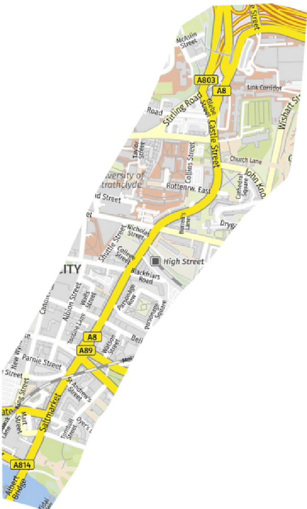
From there it peels of fromthe motorway to run along the Edinburgh Road urban dual carriageway, which was developed in the 1980s. The result is, theA8 comes into central Glasgow, along Castle Street, past the Cathedral, to the Tolbooth Cross.
On to Greenock
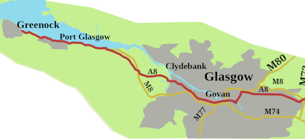
The road doesn’t stop there, and never did. It is too easy to see the A8 as simply the Edinburgh to Glasgow road, and forget it runs along the south-west bank of the Clyde to Greenock, through Clyde-side’s proud shipbuilding territory. There is history here, lots of it. The tea clippers, the first steam ship, merchantmen, and ferries, not to mention Britain’s “battleships built upon the Clyde.” The shipyards produced a certain breed of men, such as Jimmy Read and Billy Connolly. It continues, with a recent order for Type 26 frigates for the Norwegian navy to be built by BEA systems at Govan and across the water at Scotstoun. Indeed, the whole of the road is steeped in Scotland’s industrial heritage, from Livingston’s oil boom to Blackburn rivalling of its Lancashire namesake, not to mention shale and coal mining along its length.
- Lothians and Linlithgow Roads, Roads in the 1600s:The maps of Timothy Pont, Old Roads of Scotland Website, https://oldrodsofscotland.com/Pont%20Lothians.htm ↩︎
- Pont Maps of Scotland,ca 1583 – 1614 -Map Search, National Library of Scotland, https://maps.nls.uk/pont/find.html ↩︎
- Cary, John, 1798, Cary’s Ne Itinerary, Printed for Johan Cary, 181 Strand, Lindon ↩︎
- Fresh Horses at Whitburn, 2018.Scottish Shale Website, https://scottishshale.co.uk/stories/fresh-horses-whitburn/ ↩︎