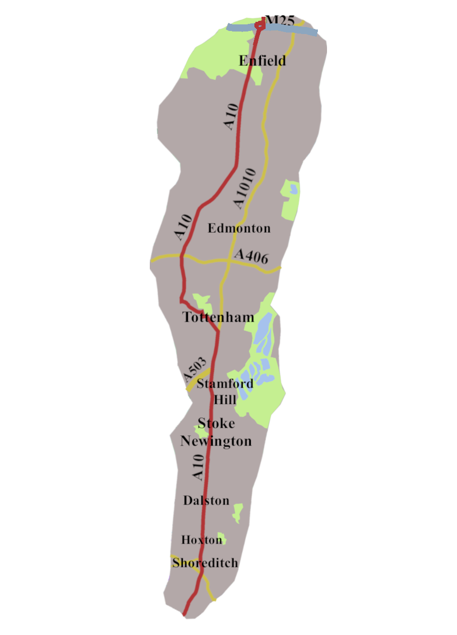
The A10 is an old road with a complicated history. It runs for just over ninety-nine miles, from the City of London, through Cambridge to Kings Lynn. It’s a road with three distinct moods. This first episode follows it along its urban phase, from Gracechurch Street to the M25. The next will take us through a section of Middle England, to reach Cambridge. In the third, we will travel across the fen country to Kings Lynn.
The Road Begins: Ermine Street
In my first post “Settling the A1”, there was a section headed “Great or Old North Road”. Well, the A10, as far as the Cambridge turn, is, or was, the “Old North Road”.

It began with the Romans. They had a road which became known as Ermine Street, which went from London to Lincoln, and on to York. The section of the A10, certainly as far as Tottenham, runs along, or close to Ermine Street.
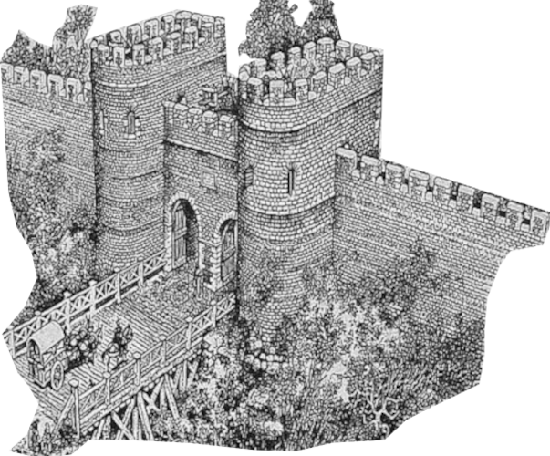
The Roman road started at the northern end of their Thames Bridge, and headed for a gate in Londinium’s stone wall, built around 200 CE. The gate was later called Bishopsgate.1 We’re not sure who the bishop in question was, but tradition has it, it was Erkenwald, or Earconwald, bishop of London from 675 to 693.2
According to legend, the heated dispute over where the sainted bishop should be buried culminated in miraculous happenings. Whatever really took place, he finished up in St Paul’s, as befits a London bishop.3
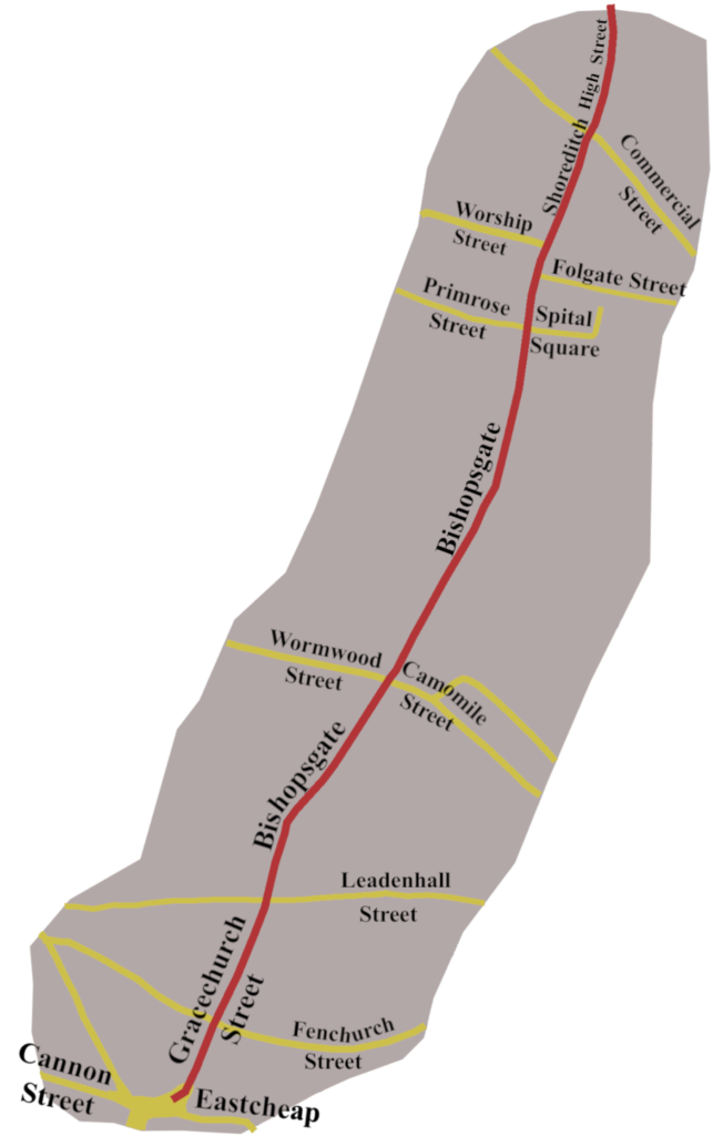
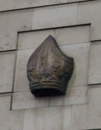
Today, the A10 starts at the junction of Cannon Street, East Cheap and Gracechurch Street. It then heads north up Gracechurch Street, and on to Bishopsgate. The actual gate stood just beyond the junction with Camomile Street and Wormwood Street until the eighteenth century. Now, the only evidence for it is a bronze mitre on the wall of a Boots, on your left, when heading north.
For about a hundred and twenty yards between Primrose Street and Worship Street, the road is called Norton Folgate. There was never a gate. In Domesday, the place is recorded as Nortuen Foldweg which means something like ‘North Part of the Highway’.4
The Romans went in for burying their dead beside roads, and they had a significant cemetery along Ermine Street, just beyond the wall. It continued to be a place of the dead for many centuries. In the early eleven-hundreds, the area was used as a London overspill cemetery.
Two Religious Houses
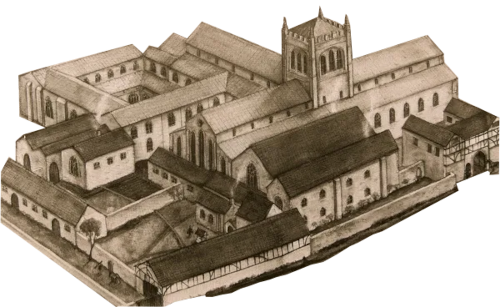
Then in 1197 the Augustinian Priory of St Marie’s Spital was founded beside the road, between Spital Square and Folgate Street. Now, because it was beyond London’s wall, and Augustinian houses were separate from parish control, the area became a law unto itself. The dead continued to pile up, and a charnel house, containing more than ten thousand skeletons, has been uncovered in the area.5
After St Marie’s Spital was dissolved, in 1547, the area continued as a self-governing ‘Liberty’ outside the jurisdiction of the City or the surrounding parishes. And so it remained until the recreation of the London County Council in 1900. Even then, there is some doubt the legislation was properly drawn up, and it may be the ‘Liberty’ remains beyond external control. I wouldn’t count on it though. Inevitably, Liberties attracted a motley crew, ranging from criminals, to artists pushing boundaries.
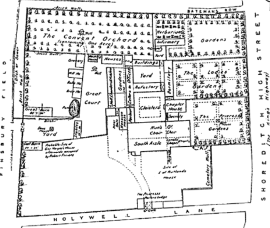
A little further up, on the other side of Shoreditch High Street, was the second religious house. Officially called The Priory of St John the Baptist, it was always known as Holywell or Haliell Priory. That was because it was built on the site of an ancient spring, reputed to have miraculous healing properties. A house of Augustinian Cononesses, which being large, rich, and so close to London, fell victim to the Dissolution of the Monasteries in 1539.6
“The Theatre”
Thirty-seven years after Holywell was dissolved, James Burbage leased a plot of land, once part of the priory. He used it to build The Theatre, which stood about a hundred yards west off the A10.
Shakespeare arrived in the 1580s, and some of his well known, plays, such as Romeo and Juliet, Richard III, and Henry V were first staged there.
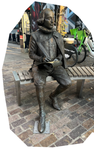
The site is marked by a statue of Shakespeare, made by Raphael Maklouf, with assistance from Hayley Gibb, sitting on a bench at the corner of New Inn Broadway and New Inn Yard.
Battling on through legal disputes, and closures as a result of plague and riotous behaviour, The Theatre continued until Christmas 1598, though James Burbage did not, as he died in January 1597.7 It was his two sons Richard, and Cuthbert who dismantled it, using some of the timbers to build The Globe Theatre, on Bankside.
Kingsland Road
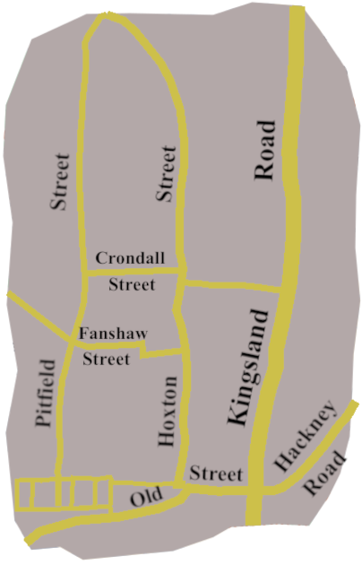
The northern end of Shoreditch brings us to the junction with Old Street, which is indeed old. It may be part of a Roman road, that skirted the north of Londinium, though its origins could be pre-Roman. Now, the A10 becomes Kingsland Road. There is some confusion over the name. Some say, Kingsland comes from Henry VIII using the area as a hunting ground, which he certainly did.
Until the eighteenth century, the Old North Road, which became our A10, went through the Middlesex Forest, which stretched from Shoreditch to Enfield. However, there is evidence the name ‘Kingsland’ may pre-date Henry. We have a record of a John Pope leaving money to the House of Lepers at Kingeslond without London in 1437.8 The hospital known as the Lock had been there since 1280. It was in the manor of Newington and, was known, at different times, as Kingsland, Hackney or Newington Hospital. It may be the name Kingsland did not solidify until the sixteenth century, but we can’t be sure.
Hoxton, and Ben Jonson
The road now enters Hoxton.
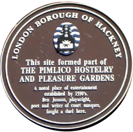
In the sixteenth century, there was a tavern and pleasure gardens called The Pimlico, on Pitfield Street, between Fanshaw Street and Crondall Street, west of Kingsland Road. One of the people who drank there in the 1590s was Ben Jonson. He seems to have been an irascible man, and actually killed an actor, Gabriel Spencer, in a duel, on Hoxton Fields, in September 1598. They no longer exist, but back then, lay to the west of Kingsland Road.
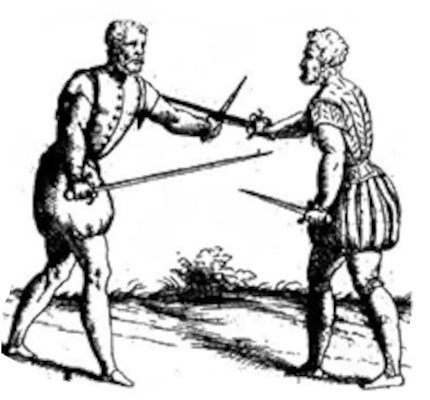
Jonson was found guilty of manslaughter, but avoided being hanged because he was able to recite Psalm 51, the Miserere, which allowed him to plead benefit of clergy. He was, sentenced to be branded on the thumb, painful, but not fatal.
I suspect these haunts beyond London Wall, were pretty racy places back then.
Stoke Newington
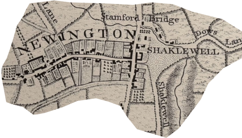
The A10 continues on through Dalston to Stoke Newington, a Saxon settlement, found in Domesday. It was part of a large manor owned by St. Paul’s Cathedral. The original village lay to the west of the A10, with Shacklewell on the other side of the road.
As with several of the settlements along the road, from 870, or so, Stoke Newington was close to the border between Saxon controlled southern England and the Danelaw areas to the east and north. The River Lea was the boundary. Today, you can look across the river to the Walthamstow Marshes, and imagine the sense of potential threat people living in Stoke Newington and Tottenham must have felt.
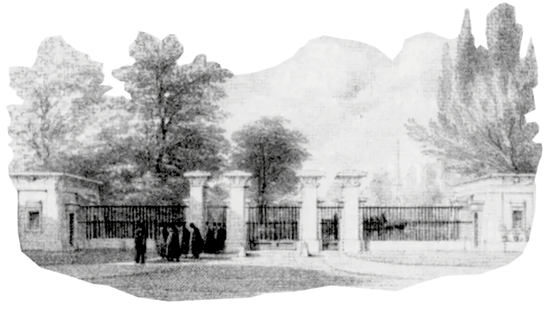
By the seventeenth century, Stoke Newington had become a place where dissenters, and freethinkers settled. One result was Abney Park Cemetery, on your left as you head north along the A10. It was opened by Congregationalists in 1840, and remains one of the few unconsecrated cemeteries in the country. Today, the chapel in the centre has been beautifully restored and is used for weddings; yes, weddings in a cemetery.
For about seven hundred and fifty yards, running up to the gates of Abney Park, the A10 becomes one-way. Coming south, you have to take a triangle of roads, rejoining the A10 along Evering Road, which has its own sinister history.
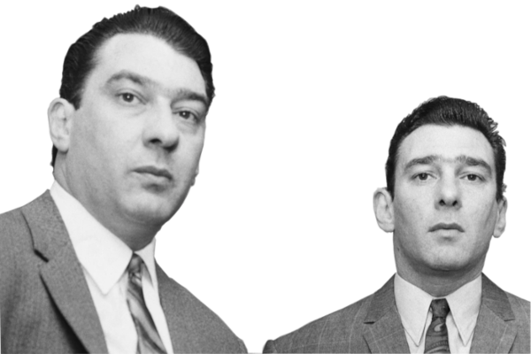
In the 1960s, the notorious and much-feared Kray Twins regarded the area as their ‘manor’, and the centre for their criminal activities. In October 1967, Reggie Kray shot Jack ‘The Hat’ McVitie, in a flat along Evering Road. Though the twins never lived in Stoke Newington, they spent a good deal of time there, particularly at the Regency Club and Restaurant9 on Amhurst Road, which runs east from the A10. Through the ‘the sixties’ The Regency became a place to be seen, with rumours that even Princess Margaret, Queen Elizabeth II’s sister, had been seen there.
Stamford Hill
The road now takes us up Stamford Hill, known as Sanford or Saundfordhill in the 13th century. The ‘Ford‘ part of the name probably referred to where Ermine Street crossed the, now buried, Hackney Brook.
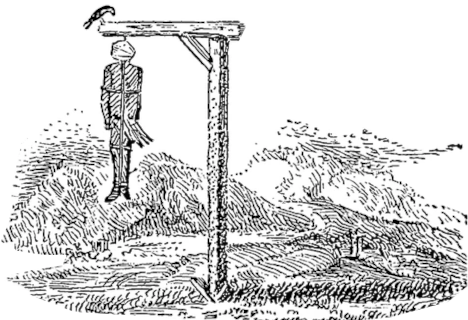
Until the nineteenth century, Stamford Hill was little more than a hamlet, with a reputation for highwaymen. Indeed, there was a well-known gibbet which stood at the junction of the A10 with Clapton Common (A107), from 1684. Criminals hanged at Tyburn were displayed there, in the hope of deterring others. It was finally taken down in 1752 following complaints from local inhabitants.
As with other places along the road, the community grew rapidly after the coming of the railway in the 1870s. Then, in the early twentieth century, people fleeing Nazism moved into the area. As a result, it is now home to the largest Hasidic community in Europe.
Tottenham
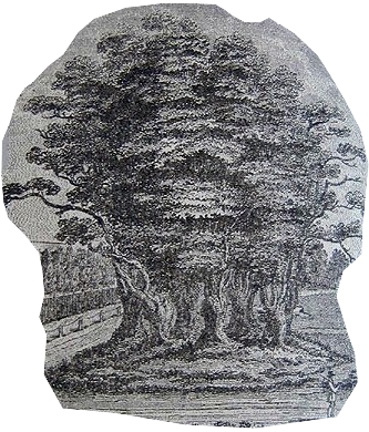
By the time you reach the A503 turning signed for Manor House, you are at the Seven Sisters in South Tottenham. The Sisters were originally seven elms planted round a walnut tree, possibly back in the mid fourteenth century. Tottenham, itself, probably goes back to the seventh century, when it was part of the kingdom of Essex.
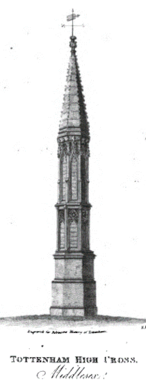
Half a mile after Seven Sisters Station, you pass the Tottenham High Cross. There is mention of the ‘hie crosse’ at Tottenham in a court roll of 1456, though it is believed to have been there long before that. Early in the seventeenth century it was replaced by a brick column, which, in 1809, was decorated in a mock-gothic fashion.10

By 1254, the Scottish Bruce Family owned the manor of Tottenham, or at least, land in the area, It was duly forfeited when Robert the Bruce took the throne of Scotland in 1306. The family is still remembered, though. For a while, the A10 is called Bruce Grove, and just off the road you can find Bruce Castle Park, and Museum.
Perhaps even more significant for the folk round about, the Earls of Northumberland had holdings in the area from before the conquest. At the end of the fourteenth century, Sir Henry Percy, known as “Hotspur”, owned a house on the Tottenham Marshes. He is the same Henry Percy we met on the A53. It was his ‘Hotspur’ sobriquet that gave the famous Tottenham Football Club its name and badge.
The Parting of the Ways
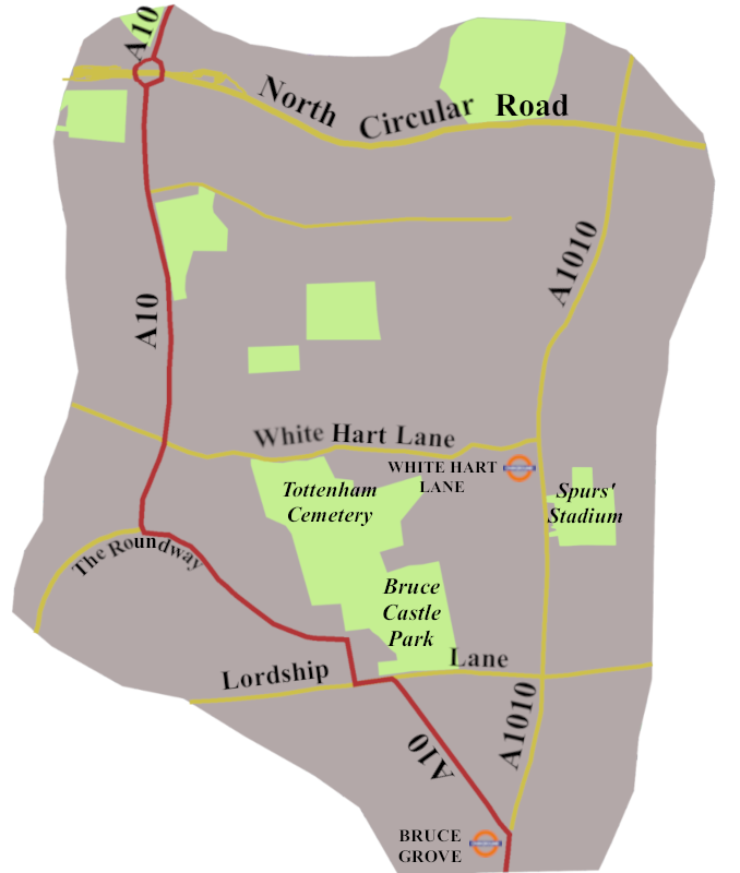
Going on from the High Cross, as you approach Bruce Grove Station, there is a sign marking the parting of the ways‘. Straight on for Edmonton on the A1010, which was once the A10, but left for Hertford, Enfield, and Wood Green, the A10 as from the 1950s. At the traffic lights by the station, turn left under the railway bridge into Bruce Grove, a nod to the Scottish royal ancestry’s connection.
After going on and off Lordship Lane via two mini-roundabouts, you come to The Roundway, which skirts the north-east edge of the Tower Garden Estate. Built between 1904 and 1928, it was one of the first Cottage Estates, with a strong ‘Arts and Crafts’ feel. Halfway round, there’s a tricky right turn to stay on the A10, signed for Hertford, Enfield, and Edmonton.
You are now on the Great Cambridge Road, built as the A108 in 1923-4, it became the A10 sometime in the early 1950s. During the following decade it was widened so we now have about six and a half miles of suburban dual carriageway, which carries us across the North Circular, through Enfield, to the M25.
Enfield and Enfield Chase
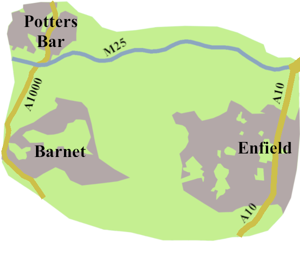
Enfield is another old settlement recorded in Domesday. For much of its existence, it was a small community on the edge of the Middlesex Forest. The Manor of Enfield was granted to Elizabeth Tudor, by her half-brother, Edward VI, in 1551. He, or she, had the existing manor house remodelled to become Enfield Palace. It survived, in various guises until 1927. Today, the only clue to its existence is the Palace Gardens shopping centre about a mile west of the A10.
A large area of forest, called Enfield Chase, lay west of our road, its northern edge defined by the Middlesex/Hertfordshire border. Its western boundary followed a line between Potters Bar and the outskirts of Barnet, which looks very like the A1000. Remember, the A1000 was once the Great North Road, and, until the early 1950s, the A1. Thus, Enfield Chase filled an area between the two North Roads, Old and Great
The Chase was held by the Duchy of Lancaster, which was not always scrupulous about maintaining the Commoners’ rights. What had been rumblings of discontent over the year, came to a head in the seventeenth century. Between the death of Oliver Cromwell and the restoration of Charles II, Parliament, always short of money, began selling off parcels of the Enfield Chase, often to retired senior army officers. The result was open conflict between those wishing to preserve their common rights and new owners’ plans to enclose the woodland. Surprisingly, the locals drove off the soldiers hired by the landowners, and asserted their right to pannage for another hundred years.
The A10 of today, still the Great Cambridge Road, keeps you away from the town centre, as you drive past retail parks and industrial units towards the M25 and over the M25.
The Original A10
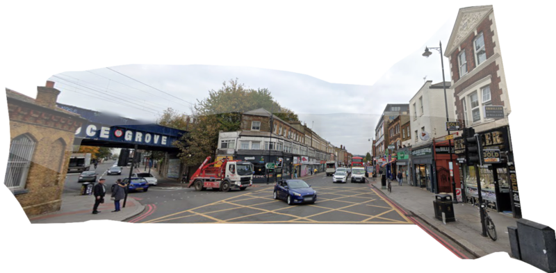
None of the road from Bruce Grove was the A10 from 1923 to the 1950s. To follow that, we have to go back to the ‘The Parting of the Ways’, and keep on along Tottenham High Road, the A1010. It is the line of Ermine Street, the Old North Road, and once the A10.
You can understand why the road was rerouted. Tottenham High Road, and the road through Edmonton are mature centres, making it difficult to find ways to make them wider, but the original A10 does, pretty much, follow Ermine Street.
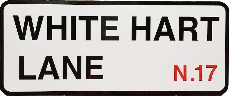
It’s very much a classic North London high street, not to mention it carries you past Tottenham Hotspur’s impressive new stadium, and the famous White Hart Lane, which is what we all called the Spur’s ground until 2017.
The road crosses the North Circular to reach Edmonton, yet another town from Saxon times, recorded in Domesday. Like other places along the road, it grew when the railway arrived, to become a part of the London conurbation. The traditional road went on through Enfield Wash, where, until 1821, coaches had to use a ford to cross the Turkey Brook.
The Royal Small Arms Factory, Enfield
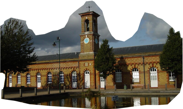
To the east of Enfield Wash the Royal Small Arms Factory stood beside the river Lea, from 1816, until 1988. When it was first built, it was technically in Essex. Then, around 1910, during the scheme to create the George V Reservoir, the River Lea was moved east, with the result the factory found itself in Middlesex.11
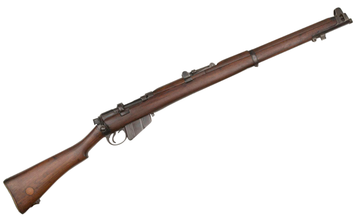
Though it started life working on improving muskets, it famously gave the British Army the Lee-Enfield .303. First developed in 1895, through a series of modifications it continued to be the standard British Service rifle until 1958. The factory also produced two other weapons associated with World War II, both with ‘En’ as part of their name: the Bren Gun and the Sten Gun
Beyond Enfield Wash, you go through the charmingly named Freezywater to reach the M25. The northern section of the London Orbital Motorway opened in 1985, so my decision to end this post there is somewhat arbitrary, but for us now, the M25 does mark the outer reach of London
In the next post we will follow the A10 through Royston, to Cambridge, on to Ely, and across the fen to Kings Lynn.
- London Wall, English Heritage Website, https://www.english-heritage.org.uk/visit/places/london-wall/history/ ↩︎
- Bishopgate, History of London Website, https://www.thehistoryoflondon.co.uk/bishopsgate/ ↩︎
- Whatley E.Gordon, (Ed.), 1905. The Saint of London: The Life and Miracles of St. Erkenwald, State University of New York at Binghamton, Medieval & Renaissance Texts & Studies ↩︎
- The Gentle Author, 2013.The Relics of Norton Folgate, Spitalfields Life Website, https://spitalfieldslife.com/2013/04/12/the-relics-of-norton-folgate/ ↩︎
- Spitalfields, 2025. 10 atmospheric ruins in London – 4. Spitalfields Charnel House…, Exploring London Website, https://exploring-london.com/tag/spitalfields/ ↩︎
- Bird, James, 1922. The Augustinian Priory of St. John the Baptist, Holywell’, Survey of London: Volume 8, Shoreditch, British History Online https://www.british-history.ac.uk/survey-london/vol8/pp153-187 ↩︎
- Edmond, Mary, 2004, Burbage, James (c 1531 – 1597), Oxford Dictionary of National Biography, Oxford University Press. ↩︎
- Walford, Edward, 1878, The northern suburbs: Hoxton, Kingsland and Dalston’, in Old and New London: Volume 5 British History Online, https://www.british-history.ac.uk/old-new-london/vol5/pp524-530 ↩︎
- Horrid Hackney, 2026, The Kray Twins at the Reglency Club,Stoke Newington (1960s) https://horridhackney.com/f/the-kray-twins-at-the-regency-club-stoke-newington ↩︎
- Hornby, Paul, 2020, High Cross, Tottenham, Greater London, The Northern Antiquarian Website, https://www.thenorthernantiquarian.org/2020/12/07/high-cross-tottenham/ ↩︎
- de Moor, Des, 2016. London Loop 18/19: Enfield Lock – Chingford – Chigwell, London Underfoot Website, https://desdemoor.blogspot.com/2016/10/ ↩︎